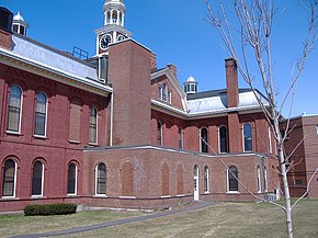
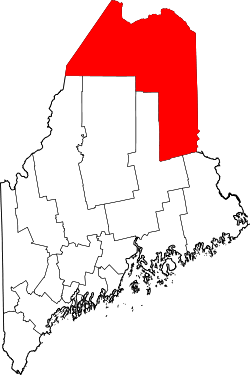
Aroostook County, Maine

| Vawoitung | |
|---|---|
| US-Bundesstoot: | Maine |
| Sitz vo da Vawoitung: | Houlton |
| Grindung: | 1839 |
| Demographie | |
| Eihwohna: | 71.870 (2010) |
| Dichtn: | 4,2 Eihwohna/km² |
| Eadkund | |
| Flächn gesamt: | 17.686 km² |
| Wossaflächn: | 407 km² |
| Koartn | |
 | |
| Hoamseitn: www.aroostook.me.us | |
Aroostook County[1] is a County im Bundesstoot Louisiana in da USA. As County hod 71.870 Eihwohna. Da Sitz vo da Vawoitung is Houlton.
As County hod a Flächn vo 17.686 Quadratkilometa, dovo san 407 Quadratkilometa Wossaflächn.
Gmoana
- Allagash
- Amity
- Ashland
- Bancroft
- Blaine
- Bridgewater
- Caribou
- |Cary
- Castle Hill
- Caswell
- Chapman
- Crystal
- Cyr
- Dyer Brook
- Eagle Lake
- Easton
- Fort Fairfield
- Fort Kent
- Frenchville
- Garfield
- Glenwood
- Grand Isle
- Hamlin
- Hammond
- Haynesville
- Hersey
- Hodgdon
- Houlton
- Island Falls
- Limestone
- Linneus
- Littleton
- Ludlow
- Macwahoc
- Madawaska
- Mapleton
- Mars Hill
- Masardis
- Merrill
- Monticello
- Moro
- Nashville
- New Canada
- New Limerick
- New Sweden
- Oakfield
- Orient
- Oxbow
- Perham
- Portage Lake
- Presque Isle
- Reed
- St. Agatha
- St. Francis
- St. John
- Sherman
- Smyrna
- Stockholm
- Van Buren
- Wade
- Wallagrass
- Washburn
- Westfield
- Westmanland
- Weston
- Winterville
- Woodland
- Territorien
- Central Aroostook
- Connor
- Northwest Aroostook
- South Aroostook
- Square Lake
- Indianareservat
- Penobscot Indian Island Preservation (unbewohnt)
Beleg
- ↑ GNIS-ID: 581287. Abgerufen am 22. Februar 2011 (englisch).
Im Netz
Countys im Bundesstoot Maine
|
Countys in Maine
|