के2
| K2 | |
|---|---|
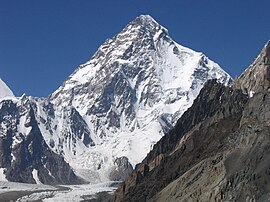 K2 as viewed from Baltistan, August 2006 | |
| Highest point | |
| ऊँचाई | 8,611 मीटर (28,251 फीट) Ranked 2nd |
| टोपो प्रामिनेंस | 4,020 मी (13,190 फीट) [1] Ranked 22nd |
| टोपोग्राफिक बिलगाव | 1,316 किलोमीटर (818 मील) |
| लिस्टिंग |
|
| लोकेशन (भूगोलीय) | 35°52′57″N 76°30′48″E / 35.88250°N 76.51333°Eनिर्देशांक: 35°52′57″N 76°30′48″E / 35.88250°N 76.51333°E [2] |
| Naming | |
| भाषा | Balti |
| भूगोल | |
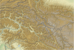 K2 China–Pakistan border:
 K2 Location of K2 relative to Gilgit−Baltistan  K2 Location of K2 relative to Xinjiang  K2 Location of K2 relative to Pakistan 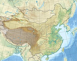 K2 Location of K2 relative to China | |
| Countries | Pakistan-administered Kashmir and China-administered Kashmir |
| मूल परबत श्रेणी | Karakoram |
| चढ़ाई | |
| पहिली चढ़ाई | 31 जुलाई 1954 Achille Compagnoni & Lino Lacedelli |
| सहज रूट | Abruzzi Spur |
के2 या गॉडविन ऑस्टिन या छोगोरी, माउंट एवरेस्ट के बाद दुनिया के दुसरा सभसे ऊँच पहाड़ बाटे। ई पाकिस्तान आ चीन के सीमा पर मौजूद परबत कठिन चढ़ाई खातिर जानल जाला आ अन्नपूर्णा के बाद दुसरा सभसे खतरनाक पहाड़ बाटे। एह पहाड़ पर जाड़ा के सीजन में अभिन ले केहू नइखे चढ़ल।
एह इलाका के सर्वे के समय ऊँचाई अनुसार रफ स्केच बना के दू गो परबत चोटी के K1 आ K2 नाँव दिहल गइल। बाद में के1 के लोकल नाँव मशेरब्रम पता चलल लेकिन के2 खातिर कौनो लोकल नाँव ना मिलल आ एकर नाँव इहे रह गइल।