Baggao
Baggao | |
|---|---|
Municipality | |
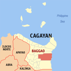 Mapa de Cagayan con Baggao resaltado | |
| Coordinates: 17°56'5"N, 121°46'24"E | |
| Nación | Filipinas |
| Región | Valle de Cagayán (Región II) |
| Provincia | Cagayan |
| Número de barangay | 48 |
| Gobierno | |
| • Type | Sangguniang Bayan |
| • Electorado | 48 060 votantes (9 Mayo 2022) |
| Area | |
• Total | 920,60 kilómetro cuadrado km2 (Formatting error: invalid input when rounding sq mi) |
| Elevation | 51 metro m (Bad rounding hereFormatting error: invalid input when rounding ft) |
| Population (1 Mayo 2020) | |
• Total | 87 753 |
| • Hogares | 21 486 |
| Economía | |
| • Clase de ingresos | es un primera clase de municipalidad |
| • Incidencia de la pobreza | 13,46 |
| • Ingresos | ₱ 395,3 million (2020) |
| • Activos | ₱ 860 million (2020) |
| • Pasivos | ₱ 166,3 million (2020) |
| • Gastos | ₱ 302,8 million (2020) |
| Time zone | UTC+8 (PST) |
| Código postal | 3506 |
| PSGC | |
| Código telefonico | 78 |
| Clima | clima monzónico |
| Lenguaje nativo | Ibanag ilocano Cagayan Agta Dupaningan Agta Tagalog |
Baggao es un primera clase de municipalidad na provincia de Cagayan, [[Filipinas]]. Tiene este zona de 920.60 kilómetro cuadrado kilometro cuadrado. Comporme del 1 Mayo 2020 censo este tiene papulidad de 87,753 personas y 21,486 hogares. El designada codigo postal 3506 y PSGC 021506000.
Barangay
|
|
|
Demografía
| Año | Populación | ±% p.a. |
|---|---|---|
| 1903 | 3857 | — |
| 1918 | 6727 | +3.78% |
| 1939 | 11 602 | +2.63% |
| 1948 | 11 232 | −0.36% |
| 1960 | 21 597 | +5.60% |
| 1970 | 36 471 | +5.37% |
| 1975 | 41 011 | +2.38% |
| 1980 | 44 081 | +1.45% |
| 1990 | 55 264 | +2.29% |
| 1995 | 60 060 | +1.57% |
| 2000 | 66 264 | +2.13% |
| 2007 | 73 048 | +1.35% |
| 2010 | 78 188 | +2.51% |
| 2015 | 82 782 | +1.09% |
| 2020 | 87 753 | +1.15% |
| Ref: Autoridad de Estadísticas de Filipinas[3][4][5][6] | ||
Referencias
- ↑
"Province: Cagayan". PSGC Interactive. Quezon City, Philippines: Philippine Statistics Authority. Retrieved Diciembre 17, 2016.
{cite web}: Check date values in:|accessdate=(help) - ↑ "PSA Releases the 2021 City and Municipal Level Poverty Estimates". Autoridad de Estadística de Filipinas. 2 Abril 2024. Retrieved 28 Abril 2024.
- ↑
Census of Population (2015). "Region II (Cagayan Valley)". Total Population by Province, City, Municipality and Barangay. Philippine Statistics Authority.
{cite encyclopedia}: External link in|chapterurl=|chapterurl=ignored (|chapter-url=suggested) (help)CS1 maint: numeric names: authors list (link) - ↑
Census of Population and Housing (2010). "Region II (Cagayan Valley)". Total Population by Province, City, Municipality and Barangay. NSO.
{cite encyclopedia}: External link in|chapterurl=|chapterurl=ignored (|chapter-url=suggested) (help)CS1 maint: numeric names: authors list (link) - ↑
Censuses of Population (1903–2007). "Region II (Cagayan Valley)". Table 1. Population Enumerated in Various Censuses by Province/Highly Urbanized City: 1903 to 2007. NSO.
{cite encyclopedia}: External link in|chapterurl=|chapterurl=ignored (|chapter-url=suggested) (help)CS1 maint: numeric names: authors list (link) CS1 maint: url-status (link) - ↑
"Province of Cagayan". Municipality Population Data. Local Water Utilities Administration Research Division. Retrieved Diciembre 17, 2016.
{cite web}: Check date values in:|accessdate=(help)
Enlaces externos
| Tuguegarao (cabecera) | |
| Municipalidad: | Abulug ▪ Alcala ▪ Allacapan ▪ Amulung ▪ Aparri ▪ Baggao ▪ Ballesteros ▪ Buguey ▪ Calayan ▪ Camalaniugan ▪ Claveria ▪ Enrile ▪ Gattaran ▪ Gonzaga ▪ Iguig ▪ Lal-lo ▪ Lasam ▪ Pamplona ▪ Peñablanca ▪ Piat ▪ Rizal ▪ Sanchez Mira ▪ Santa Ana ▪ Santa Praxedes ▪ Santa Teresita ▪ Santo Niño ▪ Solana ▪ Tuao |
| Ciudad: | Tuguegarao |