Batanes
Batanes | |
|---|---|
Provincia | |
 | |
 Flag  Seal | |
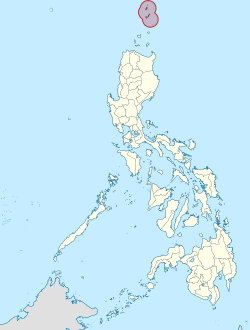 Mapa de Filipinas con Batanes resaltado | |
| Coordinates: 20°35'N, 121°54'E | |
| Nación | Filipinas |
| Región | Valle de Cagayán |
| Cabecera | Basco |
| Fundación | 1909 |
| Gobierno | |
| • Type | Sangguniang Panlalawigan |
| • Cabeza | Marilou Cayco |
| • Electorado | 13 820 votantes (9 Mayo 2022) |
| Area | |
• Total | 219,01 kilómetro cuadrado km2 (Formatting error: invalid input when rounding sq mi) |
| Population (1 Mayo 2020) | |
• Total | 18 831 |
| • Hogares | 4709 |
| Economía | |
| • Clase de ingresos | el ika cinco clase de provincia |
| • Incidencia de la pobreza | 2,60 |
| • Ingresos | ₱ 748,9 million (2022) |
| • Activos | ₱ 1769 million (2022) |
| • Pasivos | ₱ 359,2 million (2022) |
| • Gastos | ₱ 460,5 million (2022) |
| Time zone | UTC+8 (PST) |
| PSGC | |
| Código telefonico | 78 |
| ISO 3166 code | PH-BTN |
| Clima | clima monzónico |
| Lenguaje nativo | idioma batán |
Batanes el ika cinco clase de provincia na región de Valle de Cagayán, [[Filipinas]]. Tiene este zona de 219.01 kilómetro cuadrado kilometro cuadrado. Comporme del 1 Mayo 2020 censo este tiene papulidad de 18,831 personas y 4,709 hogares. El designada codigo telefonico 78 y PSGC 020900000. Su capital es Basco.
Demografía
| Año | Populación | ±% p.a. |
|---|---|---|
| 1903 | 8293 | — |
| 1918 | 8214 | −0.06% |
| 1939 | 9512 | +0.70% |
| 1948 | 10 705 | +1.32% |
| 1960 | 10 309 | −0.31% |
| 1970 | 11 398 | +1.01% |
| 1975 | 11 870 | +0.82% |
| 1980 | 12 091 | +0.37% |
| 1990 | 15 026 | +2.20% |
| 1995 | 14 180 | −1.08% |
| 2000 | 16 467 | +3.26% |
| 2007 | 15 974 | −0.42% |
| 2010 | 16 604 | +1.42% |
| 2015 | 17 246 | +0.73% |
| 2020 | 18 831 | +1.74% |
| Ref: Autoridad de Estadísticas de Filipinas[3][4][5][6] | ||
Subdivisión política


Referencias
- ↑
"Province: Batanes". PSGC Interactive. Quezon City, Philippines: Philippine Statistics Authority. Retrieved Diciembre 17, 2016.
{cite web}: Check date values in:|accessdate=(help) - ↑ "2021 Full Year Official Poverty Statistics of the Philippines" (PDF). Autoridad de Estadística de Filipinas. 15 Agosto 2022. Retrieved 28 Abril 2024.
- ↑
Census of Population (2015). "Region II (Cagayan Valley)". Total Population by Province, City, Municipality and Barangay. Philippine Statistics Authority.
{cite encyclopedia}: External link in|chapterurl=|chapterurl=ignored (|chapter-url=suggested) (help)CS1 maint: numeric names: authors list (link) - ↑
Census of Population and Housing (2010). "Region II (Cagayan Valley)". Total Population by Province, City, Municipality and Barangay. NSO.
{cite encyclopedia}: External link in|chapterurl=|chapterurl=ignored (|chapter-url=suggested) (help)CS1 maint: numeric names: authors list (link) - ↑
Censuses of Population (1903–2007). "Region II (Cagayan Valley)". Table 1. Population Enumerated in Various Censuses by Province/Highly Urbanized City: 1903 to 2007. NSO.
{cite encyclopedia}: External link in|chapterurl=|chapterurl=ignored (|chapter-url=suggested) (help)CS1 maint: numeric names: authors list (link) CS1 maint: url-status (link) - ↑
"Province of Batanes". Municipality Population Data. Local Water Utilities Administration Research Division. Retrieved Diciembre 17, 2016.
{cite web}: Check date values in:|accessdate=(help)