Bauan
Bauan | |
|---|---|
Municipality | |
 | |
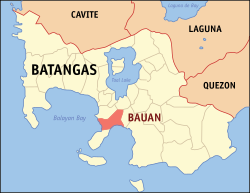 Mapa de Batangas con Bauan resaltado | |
| Coordinates: 13°47'30.12"N, 121°0'30.60"E | |
| Nación | Filipinas |
| Región | Calabarzon (Región IV-A) |
| Provincia | Batangas |
| Número de barangay | 40 |
| Gobierno | |
| • Type | Sangguniang Bayan |
| • Electorado | 58 725 votantes (9 Mayo 2022) |
| Area | |
• Total | 53,31 kilómetro cuadrado km2 (Formatting error: invalid input when rounding sq mi) |
| Elevation | 58 metro m (Bad rounding hereFormatting error: invalid input when rounding ft) |
| Population (1 Mayo 2020) | |
• Total | 90 819 |
| • Hogares | 22 420 |
| Economía | |
| • Clase de ingresos | es un primera clase de municipalidad |
| • Incidencia de la pobreza | 10,65 |
| • Ingresos | ₱ 501 million (2022) |
| • Activos | ₱ 1512 million (2022) |
| • Pasivos | ₱ 512,3 million (2022) |
| • Gastos | ₱ 442,6 million (2022) |
| Time zone | UTC+8 (PST) |
| Código postal | 4201 |
| PSGC | |
| Código telefonico | 43 |
| Clima | clima monzónico |
| Lenguaje nativo | Tagalog |
| Website | http://www.bauan.gov.ph/ |
Bauan es un primera clase de municipalidad na provincia de Batangas, [[Filipinas]]. Tiene este zona de 53.31 kilómetro cuadrado kilometro cuadrado. Comporme del 1 Mayo 2020 censo este tiene papulidad de 90,819 personas y 22,420 hogares. El designada codigo postal 4201 y PSGC 041006000.
Barangay
|
|
|
Demografía
| Año | Populación | ±% p.a. |
|---|---|---|
| 1903 | 39 094 | — |
| 1918 | 27 729 | −2.26% |
| 1939 | 37 043 | +1.39% |
| 1948 | 40 168 | +0.90% |
| 1960 | 41 147 | +0.20% |
| 1970 | 36 862 | −1.09% |
| 1975 | 38 200 | +0.72% |
| 1980 | 43 560 | +2.66% |
| 1990 | 59 258 | +3.13% |
| 1995 | 64 190 | +1.51% |
| 2000 | 72 604 | +2.68% |
| 2007 | 79 831 | +1.32% |
| 2010 | 81 351 | +0.69% |
| 2015 | 91 297 | +2.22% |
| 2020 | 90 819 | −0.10% |
| Ref: Autoridad de Estadísticas de Filipinas[3][4][5][6] | ||
Referencias
- ↑
"Province: Batangas". PSGC Interactive. Quezon City, Philippines: Philippine Statistics Authority. Retrieved Diciembre 17, 2016.
{cite web}: Check date values in:|accessdate=(help) - ↑ "PSA Releases the 2021 City and Municipal Level Poverty Estimates". Autoridad de Estadística de Filipinas. 2 Abril 2024. Retrieved 28 Abril 2024.
- ↑
Census of Population (2015). "Region IV-A (Calabarzon)". Total Population by Province, City, Municipality and Barangay. Philippine Statistics Authority.
{cite encyclopedia}: External link in|chapterurl=|chapterurl=ignored (|chapter-url=suggested) (help)CS1 maint: numeric names: authors list (link) - ↑
Census of Population and Housing (2010). "Region IV-A (Calabarzon)". Total Population by Province, City, Municipality and Barangay. NSO.
{cite encyclopedia}: External link in|chapterurl=|chapterurl=ignored (|chapter-url=suggested) (help)CS1 maint: numeric names: authors list (link) - ↑
Censuses of Population (1903–2007). "Region IV-A (Calabarzon)". Table 1. Population Enumerated in Various Censuses by Province/Highly Urbanized City: 1903 to 2007. NSO.
{cite encyclopedia}: External link in|chapterurl=|chapterurl=ignored (|chapter-url=suggested) (help)CS1 maint: numeric names: authors list (link) CS1 maint: url-status (link) - ↑
"Province of Batangas". Municipality Population Data. Local Water Utilities Administration Research Division. Retrieved Diciembre 17, 2016.
{cite web}: Check date values in:|accessdate=(help)
Enlaces externos
- PhilAtlas.com
- Philippine Standard Geographic Code
- Local Governance Performance Management System
- www
.bauan .gov .ph
| Ciudad de Batangas (cabecera) | |
| Municipalidad: | Agoncillo ▪ Alitagtag ▪ Balayan ▪ Balete ▪ Bauan ▪ Calaca ▪ Calatagan ▪ Cuenca ▪ Ibaan ▪ Laurel ▪ Lemery ▪ Lian ▪ Lobo ▪ Mabini ▪ Malvar ▪ Mataasnakahoy ▪ Nasugbu ▪ Padre Garcia ▪ Rosario ▪ San Jose ▪ San Juan ▪ San Luis ▪ San Nicolas ▪ San Pascual ▪ Santa Teresita ▪ Taal ▪ Talisay ▪ Taysan ▪ Tingloy ▪ Tuy |
| Ciudad: | Ciudad de Batangas ▪ Lipá ▪ Santo Tomas ▪ Tanauan |