Pandan, Catanduanes
Pandan | |
|---|---|
Municipality | |
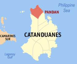 Mapa de Catanduanes con Pandan resaltado | |
| Coordinates: 14°3'N, 124°10'E | |
| Nación | Filipinas |
| Región | Región de Bicol (Región V) |
| Provincia | Catanduanes |
| Número de barangay | 26 |
| Gobierno | |
| • Type | Sangguniang Bayan |
| • Electorado | 16 223 votantes (9 Mayo 2022) |
| Area | |
• Total | 119,90 kilómetro cuadrado km2 (Formatting error: invalid input when rounding sq mi) |
| Elevation | 63 metro m (Bad rounding hereFormatting error: invalid input when rounding ft) |
| Population (1 Mayo 2020) | |
• Total | 21 473 |
| • Hogares | 4694 |
| Economía | |
| • Clase de ingresos | es un aca cuatro clase de municipalidad |
| • Incidencia de la pobreza | 32,66 |
| • Ingresos | ₱ 109,2 million (2020) |
| • Activos | ₱ 170,8 million (2020) |
| • Pasivos | ₱ 44,34 million (2020) |
| • Gastos | ₱ 99,91 million (2020) |
| Time zone | UTC+8 (PST) |
| Código postal | 4809 |
| PSGC | |
| Código telefonico | 52 |
| Clima | clima monzónico |
| Lenguaje nativo | Pandan Bikol Tagalog |
| Website | http://www.pandan-catanduanes.gov.ph/ |
Pandan es un aca cuatro clase de municipalidad na provincia de Catanduanes, [[Filipinas]]. Tiene este zona de 119.90 kilómetro cuadrado kilometro cuadrado. Comporme del 1 Mayo 2020 censo este tiene papulidad de 21,473 personas y 4,694 hogares. El designada codigo postal 4809 y PSGC 052006000.
Barangay
|
|
Demografía
| Año | Populación | ±% p.a. |
|---|---|---|
| 1903 | 3281 | — |
| 1918 | 8408 | +6.47% |
| 1939 | 15 460 | +2.94% |
| 1948 | 10 253 | −4.46% |
| 1960 | 12 764 | +1.84% |
| 1970 | 14 612 | +1.36% |
| 1975 | 14 862 | +0.34% |
| 1980 | 15 156 | +0.39% |
| 1990 | 15 784 | +0.41% |
| 1995 | 15 725 | −0.07% |
| 2000 | 17 696 | +2.56% |
| 2007 | 19 005 | +0.99% |
| 2010 | 19 393 | +0.74% |
| 2015 | 20 516 | +1.08% |
| 2020 | 21 473 | +0.90% |
| Ref: Autoridad de Estadísticas de Filipinas[3][4][5][6] | ||
Referencias
- ↑
"Province: Catanduanes". PSGC Interactive. Quezon City, Philippines: Philippine Statistics Authority. Retrieved Diciembre 17, 2016.
{cite web}: Check date values in:|accessdate=(help) - ↑ "PSA Releases the 2021 City and Municipal Level Poverty Estimates". Autoridad de Estadística de Filipinas. 2 Abril 2024. Retrieved 28 Abril 2024.
- ↑
Census of Population (2015). "Region V (Bicol Region)". Total Population by Province, City, Municipality and Barangay. Philippine Statistics Authority.
{cite encyclopedia}: External link in|chapterurl=|chapterurl=ignored (|chapter-url=suggested) (help)CS1 maint: numeric names: authors list (link) - ↑
Census of Population and Housing (2010). "Region V (Bicol Region)". Total Population by Province, City, Municipality and Barangay. NSO.
{cite encyclopedia}: External link in|chapterurl=|chapterurl=ignored (|chapter-url=suggested) (help)CS1 maint: numeric names: authors list (link) - ↑
Censuses of Population (1903–2007). "Region V (Bicol Region)". Table 1. Population Enumerated in Various Censuses by Province/Highly Urbanized City: 1903 to 2007. NSO.
{cite encyclopedia}: External link in|chapterurl=|chapterurl=ignored (|chapter-url=suggested) (help)CS1 maint: numeric names: authors list (link) CS1 maint: url-status (link) - ↑
"Province of Catanduanes". Municipality Population Data. Local Water Utilities Administration Research Division. Retrieved Diciembre 17, 2016.
{cite web}: Check date values in:|accessdate=(help)
Enlaces externos
- PhilAtlas.com
- Philippine Standard Geographic Code
- Local Governance Performance Management System
- www
.pandan-catanduanes .gov .ph
| Virac (cabecera) | |
| Municipalidad: | Bagamanoc ▪ Baras ▪ Bato ▪ Caramoran ▪ Gigmoto ▪ Pandan ▪ Panganiban ▪ San Andres ▪ San Miguel ▪ Viga ▪ Virac |