Santo Niño, South Cotabato
Santo Niño | |
|---|---|
Municipality | |
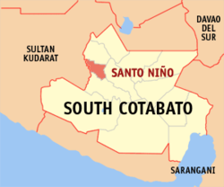 Mapa de South Cotabato con Santo Niño resaltado | |
| Coordinates: 6°26'N, 124°41'E | |
| Nación | Filipinas |
| Región | Soccsksargen (Región XII) |
| Provincia | South Cotabato |
| Número de barangay | 10 |
| Fundación | 7 Abril 1981 |
| Gobierno | |
| • Type | Sangguniang Bayan |
| • Electorado | 25 071 votantes (9 Mayo 2022) |
| Area | |
• Total | 86,20 kilómetro cuadrado km2 (Formatting error: invalid input when rounding sq mi) |
| Elevation | 160 metro m (Bad rounding hereFormatting error: invalid input when rounding ft) |
| Population (1 Mayo 2020) | |
• Total | 39 796 |
| • Hogares | 9892 |
| Economía | |
| • Clase de ingresos | es un tercera clase de municipalidad |
| • Incidencia de la pobreza | 17,73 |
| • Ingresos | ₱ 159,9 million (2020) |
| • Activos | ₱ 374,5 million (2020) |
| • Pasivos | ₱ 88,12 million (2020) |
| • Gastos | ₱ 131,5 million (2020) |
| Time zone | UTC+8 (PST) |
| Código postal | 9509 |
| PSGC | |
| Código telefonico | 83 |
| Clima | clima ecuatorial |
| Lenguaje nativo | hiligaíno Cebuano idioma maguindánao Idioma B'laan Tagalog |
| Website | http://stoninoscot.gov.ph/ |
Santo Niño es un tercera clase de municipalidad na provincia de South Cotabato, [[Filipinas]]. Tiene este zona de 86.20 kilómetro cuadrado kilometro cuadrado. Comporme del 1 Mayo 2020 censo este tiene papulidad de 39,796 personas y 9,892 hogares. El designada codigo postal 9509 y PSGC 126318000.
Barangay
- Ambalgan
- Guinsang-an
- Katipunan
- Manuel Roxas
- Panay
- Poblacion
- San Isidro
- San Vicente
- Teresita
- Sajaneba
Demografía
| Año | Populación | ±% p.a. |
|---|---|---|
| 1990 | 30 076 | — |
| 1995 | 32 103 | +1.23% |
| 2000 | 36 228 | +2.63% |
| 2007 | 38 400 | +0.81% |
| 2010 | 39 738 | +1.25% |
| 2015 | 40 947 | +0.57% |
| 2020 | 39 796 | −0.56% |
| Ref: Autoridad de Estadísticas de Filipinas[3][4][5][6] | ||
Referencias
- ↑
"Province: South Cotabato". PSGC Interactive. Quezon City, Philippines: Philippine Statistics Authority. Retrieved Diciembre 17, 2016.
{cite web}: Check date values in:|accessdate=(help) - ↑ "PSA Releases the 2021 City and Municipal Level Poverty Estimates". Autoridad de Estadística de Filipinas. 2 Abril 2024. Retrieved 28 Abril 2024.
- ↑
Census of Population (2015). "Region XII (Soccsksargen)". Total Population by Province, City, Municipality and Barangay. Philippine Statistics Authority.
{cite encyclopedia}: External link in|chapterurl=|chapterurl=ignored (|chapter-url=suggested) (help)CS1 maint: numeric names: authors list (link) - ↑
Census of Population and Housing (2010). "Region XII (Soccsksargen)". Total Population by Province, City, Municipality and Barangay. NSO.
{cite encyclopedia}: External link in|chapterurl=|chapterurl=ignored (|chapter-url=suggested) (help)CS1 maint: numeric names: authors list (link) - ↑
Censuses of Population (1903–2007). "Region XII (Soccsksargen)". Table 1. Population Enumerated in Various Censuses by Province/Highly Urbanized City: 1903 to 2007. NSO.
{cite encyclopedia}: External link in|chapterurl=|chapterurl=ignored (|chapter-url=suggested) (help)CS1 maint: numeric names: authors list (link) CS1 maint: url-status (link) - ↑
"Province of South Cotabato". Municipality Population Data. Local Water Utilities Administration Research Division. Retrieved Diciembre 17, 2016.
{cite web}: Check date values in:|accessdate=(help)
Enlaces externos
- PhilAtlas.com
- Philippine Standard Geographic Code
- Local Governance Performance Management System
- stoninoscot
.gov .ph
| Koronadal (cabecera) | |
| Municipalidad: | Bangá ▪ Lake Sebu ▪ Norala ▪ Polomolok ▪ Santo Niño ▪ Surallah ▪ Tampakan ▪ Tantangan ▪ T'boli ▪ Tupi |
| Ciudad: | General Santos ▪ Koronadal |