Éteignières
Éteignières | |
|---|---|
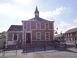 School | |
 Coat of arms | |
 Éteignières  Éteignières | |
| Coordinates: 49°53′13″N 4°23′27″E / 49.8869°N 4.3908°E | |
| Country | France |
| Region | Grand Est |
| Department | Ardennes |
| Arrondissement | Charleville-Mézières |
| Canton | Rocroi |
| Government | |
| • Mayor (2020–2026) | Jean-Pierre Jarlot[1] |
Area 1 | 11.79 km2 (4.55 sq mi) |
| Population (2022)[2] | 469 |
| • Density | 40/km2 (100/sq mi) |
| Time zone | UTC+01:00 (CET) |
| • Summer (DST) | UTC+02:00 (CEST) |
| INSEE/Postal code | 08156 /08260 |
| Elevation | 261 m (856 ft) |
| 1 French Land Register data, which excludes lakes, ponds, glaciers > 1 km2 (0.386 sq mi or 247 acres) and river estuaries. | |
Éteignières (French pronunciation: [etɛɲɛʁ]) is a commune in the Ardennes department in the Grand Est region in northern France.
Geography
The river Sormonne forms most of the commune's northern border.
Population
| Year | Pop. | ±% |
|---|---|---|
| 1962 | 411 | — |
| 1968 | 454 | +10.5% |
| 1975 | 409 | −9.9% |
| 1982 | 385 | −5.9% |
| 1990 | 355 | −7.8% |
| 1999 | 406 | +14.4% |
| 2008 | 456 | +12.3% |
See also
References
- ^ "Répertoire national des élus: les maires". data.gouv.fr, Plateforme ouverte des données publiques françaises (in French). 2 December 2020.
- ^ "Populations de référence 2022" (in French). The National Institute of Statistics and Economic Studies. 19 December 2024.
Wikimedia Commons has media related to Éteignières.