Arin, Armenia
39°43′38″N 45°29′38″E / 39.72722°N 45.49389°E
Arin
Արին | |
|---|---|
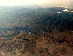 Aerial view of Vayots Dzor, Arin in the foreground | |
 Arin  Arin | |
| Coordinates: 39°43′38″N 45°29′38″E / 39.72722°N 45.49389°E | |
| Country | Armenia |
| Province | Vayots Dzor |
| Municipality | Vayk |
| Elevation | 1,630 m (5,350 ft) |
| Population | |
| • Total | 309 |
| Time zone | UTC+4 (AMT) |
| Arin, Armenia at GEOnet Names Server | |
Arin (Armenian: Արին) is a village in the Vayk Municipality of the Vayots Dzor Province of Armenia.[2] It is situated 22 km southeast of the Province center, at an elevation of 1630 m above sea level. The village shares its borders with Herher to the northeast, Malishka to the northwest, and Azatek to the south. 3 km northeast of the village is the volcanic center Dali Tapa, which destroyed the city of Moz in 735.
The village was renamed to Arin in 1978.[3]
History
Until 1978, the village was known as Daylakhlu. According to a tale passed down from ancestors, an esteemed Armenian individual once passed through the village and was captivated by the sight of a herd of horses, accompanied by playful foals trailing the carts. Impressed, the person exclaimed, "What a delightful foal game!" As horses held special reverence during that era, the locals subsequently referred to that area as Kurkakhaghats places (Armenian: Քուռկախաղաց տեղեր, "places where foals play").
Later, probably in 1604, foreigners resettled the Arin community and changed Kurkakhaghats to Daylakhlu in their language.
One of the ancient landmarks in the region is the Sultan's cave, characterized by two walls with a round shape, standing at a height of 3–4 arshins. The remains of polished stones and artifacts dating back to the Stone Age were found. Besides, remnants of a ruined chapel from the 19th century and a Stone Age "Petak" (Beehive) cave have been preserved, which provide further evidence of Arin's settlement history, tracing back to the Stone Age.
Climate
Autumn in Arin is long, and winter is cold and windy, lasting 3.5–4 months.
Population
Some of the residents came from the village of Azatek.
The population dynamics of Arin over the years:[4]
| Year | 1873 | 1897 | 1926 | 1939 | 1970 | 1989 | 2001 | 2011 |
|---|---|---|---|---|---|---|---|---|
| Population | 87 | 126 | 143 | 201 | 241[5] | 254[6] | 264 | 309[1] |
Occupation
The villagers are primarily involved in arable farming, animal husbandry, tobacco growing, and cultivation. Wheat is predominantly sown in the fall, while barley is planted in the spring.
The village comprises 73 households and covers a total area of 3669.2 hectares. This includes 337 hectares of arable land, 845 hectares of pasture, 2249 hectares of operational lands, 34 hectares of residential area, 41.1 hectares of lands with historical significance, 102.1 hectares of Herher reservoir area, and 274 hectares of privatized lands. The arable lands in the village are predominantly arid and consist of black soil.
Historical and cultural sites
The ruined chapel of the 19th century and the "Petak" (Beehive) cave of the Stone Age have been preserved.
Public facilities
The community benefits from a centralized network providing gas and electricity supply, supported by two transformers.
Besides, the community possesses the HerHer reservoir, which has a depth of 74 meters. The residential area consists of 73 buildings, predominantly 1–2-storey stone houses with attached plots.
References
- ^ a b Statistical Committee of Armenia. "The results of the 2011 Population Census of Armenia" (PDF).
- ^ "RA Vayots Dzor Marz" (PDF). Marzes of the Republic of Armenia in Figures. 2009. pp. 264–270. Retrieved 27 June 2023.
- ^ "ԱՐԻՆ" (PDF). vdzor.mtad.am. Retrieved 14 January 2020.
- ^ "Centre of Geodesy and Cartography" SNCO under Cadastre Committee of the Republic of Armenia (2008). Dictionary of settlements of the Republic of Armenia (PDF). Yerevan. p. 184. Archived from the original (PDF) on 9 February 2020. Retrieved 25 July 2023.
{cite book}: CS1 maint: location missing publisher (link) - ^ H. Barseghyan, S. Melik-Bakhshyan, E. Aghayan (1986). Dictionary of the toponymy of Armenia and adjacent territories, vol. 1. Yerevan: YSU Publishing House. p. 992.
{cite book}: CS1 maint: multiple names: authors list (link) - ^ H. Barseghyan, S. Melik-Bakhshyan, E. Aghayan (2001). Dictionary of the toponymy of Armenia and adjacent territories, vol. 5. Yerevan: YSU Publishing House. p. 916.
{cite book}: CS1 maint: multiple names: authors list (link)
External links
- Report of the results of the 2001 Armenian Census, Statistical Committee of Armenia
- Kiesling, Brady (2005), Rediscovering Armenia: Guide, Yerevan, Armenia: Matit Graphic Design Studio
- Kiesling, Brady (June 2000). Rediscovering Armenia: An Archaeological/Touristic Gazetteer and Map Set for the Historical Monuments of Armenia (PDF). Archived (PDF) from the original on 6 November 2021.
