Baghran
Baghran
بغران | |
|---|---|
 Baghran's main street is being resurfaced as part of a foreign reconstruction project. | |
 | |
| Coordinates: 33°4′1″N 65°5′30″E / 33.06694°N 65.09167°E | |
| Country | |
| Province | Helmand |
| District | Baghran |
| Elevation | 5,131 ft (1,564 m) |
| Population | |
| • Total | 26,724 |
| Time zone | + 4.30 |
Baghrān (Pashto: بغران) is a village and the district center of Baghran District in Helmand province, Afghanistan. It is located at 33°04′01″N 65°05′30″E / 33.0669°N 65.0917°E and at an altitude of 1,564 m. The population of Baghran and the nearest settlements is 26,724.
In 2005 the United States was funding a $2 million project to pave 700 meters of the Baghran's main road.[1]
It is controlled by the Taliban, and has been called their "most secure stronghold".[2]
Climate
Baghran features a humid continental climate (Köppen: Dsa) with hot summers and moderately cold winters.
| Climate data for Baghran | |||||||||||||
|---|---|---|---|---|---|---|---|---|---|---|---|---|---|
| Month | Jan | Feb | Mar | Apr | May | Jun | Jul | Aug | Sep | Oct | Nov | Dec | Year |
| Daily mean °C (°F) | −2.5 (27.5) |
−0.3 (31.5) |
6.4 (43.5) |
13.7 (56.7) |
17.8 (64.0) |
22.3 (72.1) |
24.0 (75.2) |
22.6 (72.7) |
17.7 (63.9) |
12.2 (54.0) |
5.8 (42.4) |
0.8 (33.4) |
11.7 (53.1) |
| Average precipitation mm (inches) | 46.1 (1.81) |
90.4 (3.56) |
67.0 (2.64) |
40.0 (1.57) |
14.9 (0.59) |
1.2 (0.05) |
0.7 (0.03) |
0.8 (0.03) |
0.7 (0.03) |
6.6 (0.26) |
30.1 (1.19) |
11.4 (0.45) |
309.9 (12.21) |
| Average relative humidity (%) | 41 | 43 | 34 | 25 | 17 | 10 | 11 | 12 | 11 | 19 | 32 | 34 | 24 |
| Source 1: ClimateCharts[3] | |||||||||||||
| Source 2: World Weather Online (precipitation & humidity)[4] | |||||||||||||
See also
Taliban captured Area,
References
- ^ "Afghan Valley to Receive $2.4 Million for Reconstruction". American Forces Press Service. 16 August 2005. Retrieved 18 July 2009.
- ^ "Taliban Present Gentler Face but Wield Iron Fist in Afghan District". The New York Times. 5 August 2015. Retrieved 20 May 2016.
- ^ "Climate: Baghran - ClimateCharts, Laura Zepner, Pierre Karrasch, Felix Wiemann & Lars Bernard (2020) ClimateCharts.net – an interactive climate analysis web platform, International Journal of Digital Earth, DOI: 10.1080/17538947.2020.1829112". Retrieved 20 September 2022.
- ^ "Humidity: Baghran - World Weather Online". Retrieved 20 September 2022.
| Districts | 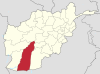 | |
|---|---|---|
| Populated places | ||
| Landmarks | ||
| Other | ||