Ballinabranna
Ballinabranna
Baile na mBreatnach | |
|---|---|
Village | |
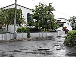
 Ballinabranna National School | |
| Coordinates: 52°47′08″N 6°59′06″W / 52.785608°N 6.984882°W | |
| Country | Ireland |
| Province | Leinster |
| County | County Carlow |
| Elevation | 90 m (300 ft) |
| Population | 557 |
| Time zone | UTC+0 (WET) |
| • Summer (DST) | UTC-1 (IST (WEST)) |
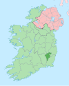
Ballinabranna or Ballinabrannagh (Irish: Baile na mBreatnach)[2] is a small village in County Carlow, Ireland. It is located approximately 8 kilometres south of Carlow and 5 kilometres from Junction 6 of the M9 motorway. It is within the townland of Ballinabrannagh, and is in the barony of Idrone West. As of the 2022 census, the population of the village was 557.[3]
History
Traditionally a rural townland, it developed into a nucleated village due to its proximity to the M9 motorway. The Milford Park and Gort na Gréine housing developments, built in the late-2000s and 2010s respectively, significantly expanded the population of the area. It was first included (as Ballinabrannagh) as a census town for the 2011 census, at which time it had a population of 389 people.[1]
The village has a church (St. Fintan's), a child daycare, a GAA club/gym, and a national (primary) school. As of 2014, the school (Ballinabranna National School) had an enrollment of approximately 170 pupils.[4]
See also
References
- ^ a b "Ballinabrannagh (Ireland) Census Town". City Population. Retrieved 26 May 2021.
- ^ "Baile na mBreatnach / Ballinabranagh". logainm.ie. Placenames Database of Ireland. Retrieved 26 May 2021.
- ^ "Census Interactive Map – Towns: Ballinabrannagh". Census 2022. Central Statistics Office. Retrieved 28 November 2024.
- ^ "Whole School Evaluation Management, Leadership and Learning Report - Ballinabranna National School" (PDF). Department of Education and Skills. Department of Education. 17 January 2014. Archived from the original (PDF) on 26 May 2021.

