Brookville Township, Franklin County, Indiana
Brookville Township | |
|---|---|
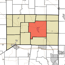 Location of Brookville Township in Franklin County | |
| Coordinates: 39°25′16″N 85°00′25″W / 39.42111°N 85.00694°W | |
| Country | United States |
| State | Indiana |
| County | Franklin |
| Government | |
| • Type | Indiana township |
| Area | |
| • Total | 67.09 sq mi (173.8 km2) |
| • Land | 64.25 sq mi (166.4 km2) |
| • Water | 2.83 sq mi (7.3 km2) |
| Elevation | 630 ft (192 m) |
| Population (2010) | |
| • Total | 5,773 |
| • Density | 89.8/sq mi (34.7/km2) |
| FIPS code | 18-08200[2] |
| GNIS feature ID | 453136 |
Brookville Township is one of thirteen townships in Franklin County, Indiana. As of the 2010 census, its population was 5,773.[3]
Geography
According to the 2010 census, the township has a total area of 67.09 square miles (173.8 km2), of which 64.25 square miles (166.4 km2) (or 95.77%) is land and 2.83 square miles (7.3 km2) (or 4.22%) is water.[3]
Cities and towns
- Brookville (the county seat)
Unincorporated towns
(This list is based on USGS data and may include former settlements.)
Adjacent townships
- Fairfield Township (north)
- Bath Township (northeast)
- Springfield Township (east)
- Whitewater Township (southeast)
- Highland Township (south)
- Butler Township (southwest)
- Metamora Township (west)
- Blooming Grove Township (northwest)
Major highways
Cemeteries
The township contains three cemeteries: Maple Grove, Saint Michaels and Usher.
Education
Brookville Township residents may obtain a free library card from the Franklin County Public Library District in Brookville.[4]
References
- "Brookville Township, Franklin County, Indiana". Geographic Names Information System. United States Geological Survey, United States Department of the Interior. Retrieved September 24, 2009.
- United States Census Bureau cartographic boundary files
- ^ "US Board on Geographic Names". United States Geological Survey. October 25, 2007. Retrieved January 31, 2008.
- ^ "U.S. Census website". United States Census Bureau. Retrieved January 31, 2008.
- ^ a b "Population, Housing Units, Area, and Density: 2010 - County -- County Subdivision and Place -- 2010 Census Summary File 1". United States Census. Archived from the original on February 12, 2020. Retrieved May 10, 2013.
- ^ "Policies". Franklin County Public Library District. Retrieved March 7, 2018.
External links
Municipalities and communities of Franklin County, Indiana, United States | ||
|---|---|---|
| City |  | |
| Towns | ||
| Townships | ||
| CDPs | ||
| Other communities |
| |
| Footnotes | ‡This populated place also has portions in an adjacent county or counties | |