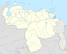
Canaima Airport
Canaima Airport Aeropuerto de Canaima | |||||||||||
|---|---|---|---|---|---|---|---|---|---|---|---|
 | |||||||||||
| Summary | |||||||||||
| Airport type | Public | ||||||||||
| Serves | Canaima National Park | ||||||||||
| Location | Canaima, Venezuela | ||||||||||
| Elevation AMSL | 1,339 ft / 408 m | ||||||||||
| Coordinates | 6°13′55″N 62°51′15″W / 6.23194°N 62.85417°W | ||||||||||
| Map | |||||||||||
| Runways | |||||||||||
| |||||||||||
Canaima Airport (Spanish: Aeropuerto de Canaima; IATA: CAJ, ICAO: SVCN) is an airport in Canaima, a town in Canaima National Park in the state of Bolívar in Venezuela. The airport and town are next to the Carrao Rapids on the Carrao River, and 46 kilometres (29 mi) downstream of Angel Falls.
The Canaima VOR-DME (Ident: CMA) is located 0.52 nautical miles (960 m) off the Runway 18 threshold.[4]
Airlines and destinations
| Airlines | Destinations |
|---|---|
| Conviasa | Caracas |
Accidents and incidents
- On 27 August 1972, Douglas C-47 YV-C-AKE of LAV suffered a failure of the port engine shortly after take-off on a domestic scheduled passenger flight to Tomás de Heres Airport, Ciudad Bolivar. The aircraft crashed while attempting to return to Canaima, killing all 34 people on board.[5]
- On 2 October 1998, Douglas DC-3C YV-611C of Servivensa crashed on approach to Canaima Airport. The aircraft had been on a local sightseeing flight to view the Angel Falls. One of the 25 people on board was killed.[6]
See also
References
- ^ Airport information for SVCN[usurped] from DAFIF (effective October 2006)
- ^ Airport information for CAJ at Great Circle Mapper. Source: DAFIF (effective October 2006).
- ^ Google Maps - Canaima
- ^ CMA VOR
- ^ "Accident description". Aviation Safety Network. Retrieved 7 September 2010.
- ^ "YV-611C Accident description". Aviation Safety Network. Retrieved 25 June 2010.
External links
- OurAirports - Canaima
- SkyVector - Canaima
- OpenStreetMap - Canaima
- Accident history for CAJ at Aviation Safety Network
- Video from aircraft landing at Canaima Airport
 Media related to Canaima Airport at Wikimedia Commons
