Castle Wildland Provincial Park
| Castle Wildland Provincial Park | |
|---|---|
 Location of Castle Wildland Provincial Park  Castle Wildland Provincial Park (Canada) 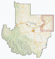 Castle Wildland Provincial Park (M.D. of Pincher Creek) | |
| Location | |
| Nearest city | Crowsnest Pass, Pincher Creek |
| Coordinates | 49°15′N 114°15′W / 49.25°N 114.25°W |
| Area | 79,678 ha (307.64 sq mi)[2] |
| Established | 16 February 2017[3] |
| Governing body | Alberta Parks[4] |
Castle Wildland Provincial Park is a wildland provincial park in southern Alberta, Canada. The designation of the park was established on 20 January 2017, with an effective date of 16 February 2017.[3] The designation involved the protection of 79,678 hectares (196,890 acres) of land.[2] The park is included in the South Saskatchewan Region Land Use Framework.[5] The park, along with Castle Provincial Park, is managed under the Castle Management Plan.[6] The park takes its name from the region including the Castle River and Castle peak of Windsor Mountain. Despite the name, it is not associated with Castle Mountain which is in Banff National Park.[7]
Location
The park is located within the Municipal District of Pincher Creek west of the town of Pincher Creek. It shares a northern boundary with the Municipality of Crowsnest Pass, a southwestern boundary with the province of British Columbia, a southeastern boundary with Waterton Lakes National Park and a northeastern boundary with Castle Provincial Park.[2][8]
Ecology
The park's natural history themes are in the Alpine, Subalpine, and Montane subregions of the Rocky Mountain region in the Alberta classification system.[5] In the National Ecological Framework for Canada used by Environment and Climate Change Canada, the park is in the Crowsnest Mountains, Blairmore Foothills, and Waterton Mountains ecodistricts of the Northern Continental Divide ecoregion in the Columbia Montane Cordillera ecoprovince of the Montane Cordillera ecozone.[9][10] Under the OneEarth classification (previously World Wildlife Fund), the park is in the Northern Rockies conifer forests ecoregion of the Greater Rockies & Mountain Forests bioregion.[11]
Climate

The Köppen climate classification of the park is Continental, Subarctic (Dfc) characterized by long, cold, dry winters, and short, cool, summers.[12] Using the data from nearby weather station, Castle Auto, for 1991 to 2020, the average daily temperatures exceeds 10 °C (50 °F) only for June, July, August, and September while average daily temperatures are less than 0 °C (32 °F) for November through March. At Castle Auto station, the long-run average precipitation from 1991 to 2020 is variable throughout the year from 40 to 100 mm (1.6 to 3.9 in) per month.[13]
Activities
Front country and back country hiking are available in the park. There are no developed facilities so only back country camping is available. Hunting is permitted with proper authorization and licensing.[4]
References
- ^ UNEP-WCMC (2015). "Protected Area Profile for Castle Wildland Provincial Park from the World Database on Protected Areas". ProtectedPlanet.net. Retrieved 1 February 2024.
- ^ a b c Plan Showing Castle Wildland Provincial Park (PDF) (Map). 1:275,000. Alberta Environment and Parks. 17 January 2017.
- ^ a b "O.C. 23/2017". Government of Alberta. 20 January 2017. Retrieved 21 January 2017.
- ^ a b "Castle Wildland Provincial Park". Alberta Parks.
- ^ a b "Castle Wildland Provincial Park: Parks Research and Management". Alberta Parks. 7 August 2020.
- ^ Castle Management Plan (PDF). Alberta Environment and Parks. May 2018.
- ^ "Exploring Alberta's Wildland Provincial Parks: Castle". Wild Albertan. Retrieved 3 February 2024.
- ^ "Castle – Provincial Park and Wildland". Alberta Parks. 11 January 2017. Archived from the original on 2 February 2017. Retrieved 21 January 2017.
- ^ "Terrestrial Ecodistricts of Canada". Government of Canada.
- ^ Ecological Land Classification, 2017 (PDF). Statistics Canada. 1 March 2018. pp. 4–5, 38. ISBN 978-0-660-24501-0. Catalogue no. 12-607-X.
- ^ Noss, Reed. "Northern Rockies Conifer Forests". OneEarth.org.
- ^ Atlas of Canada: Climatic Regions (PDF) (Map). Government of Canada. Archived (PDF) from the original on 15 March 2023. Retrieved 3 February 2024.
- ^ "Climate Normals for Alberta". Government of Alberta. 2020.
