Changbai Korean Autonomous County
Changbai County
长白县 · 장백현 | |
|---|---|
| Changbai Korean Autonomous County 长白朝鲜族自治县 · 장백조선족자치현 | |
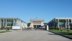
 China–North Korea border crossing in Changbai | |
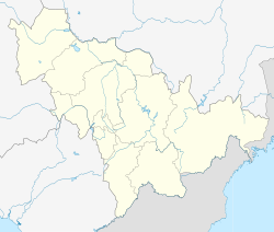
 Location within Baishan City | |
| Coordinates: 41°25′N 128°12′E / 41.417°N 128.200°E | |
| Country | China |
| Province | Jilin |
| Prefecture-level city | Baishan |
| County seat | Changbai |
| Area | |
• Total | 2,497.6 km2 (964.3 sq mi) |
| Elevation | 730 m (2,400 ft) |
| Population (2020 census)[1] | |
• Total | 58,266 |
| • Density | 23/km2 (60/sq mi) |
| Time zone | UTC+8 (China Standard) |
| Postal code | 134400 |
| Website | www |
| Changbai Korean Autonomous County | |||||||||||||||||||||
|---|---|---|---|---|---|---|---|---|---|---|---|---|---|---|---|---|---|---|---|---|---|
| Simplified Chinese | 长白朝鲜族自治县 | ||||||||||||||||||||
| Traditional Chinese | 長白朝鮮族自治縣 | ||||||||||||||||||||
| Hanyu Pinyin | Chángbái Cháoxiǎnzú Zìzhìxiàn | ||||||||||||||||||||
| |||||||||||||||||||||
| Chinese Korean name | |||||||||||||||||||||
| Chosŏn'gŭl | 장백조선족자치현 | ||||||||||||||||||||
| Hancha | 長白朝鮮族自治縣 | ||||||||||||||||||||
| |||||||||||||||||||||
| South Korean name | |||||||||||||||||||||
| Hangul | 창바이 조선족 자치현 | ||||||||||||||||||||
| |||||||||||||||||||||
Changbai Korean Autonomous County[a], or simply Changbai County[b], is a county in southern Jilin province, China, facing Hyesan, North Korea. It is under the administration of the city of Baishan, 160 kilometres (99 mi) to the west-northwest, and has an area of 2,497.6 km2 (964.3 sq mi). The county has a total population of 85,000 people, 14,000 of which are ethnic Koreans (16.9% of the county's population).
Changbai is one of only two Korean autonomous areas of China, the other being Yanbian Korean Autonomous Prefecture.
Administrative divisions
There are seven towns and one township.[2]
| Name | Simplified Chinese | Hanyu Pinyin | Korean | McCune–Reischauer | Administrative division code | |
|---|---|---|---|---|---|---|
| Towns | ||||||
| Changbai Town | 长白镇 | Chángbái zhèn | 장백진 | changbaek chin | 220623100 | |
| Badaogou Town | 八道沟镇 | Bādàogōu zhèn | 팔도구진 | p'altoku chin | 220623101 | |
| Shisidaogou Town | 十四道沟镇 | Shísìdàogōu zhèn | 십사도구진 | sipsatoku chin | 220623102 | |
| Malugou Town | 马鹿沟镇 | Mǎlùgōu zhèn | 마록구진 | marokku chin | 220623103 | |
| Baoquanshan Town | 宝泉山镇 | Bǎoquánshān zhèn | 보천산진 | poch'ŏnsan chin | 220623104 | |
| Xinfangzi Town | 新房子镇 | Xīnfángzi zhèn | 신방자진 | sinpangcha chin | 220623105 | |
| Shi'erdaogou Town | 十二道沟镇 | Shí'èrdàogōu zhèn | 십이도구진 | sipitoku chin | 220623106 | |
| Township | ||||||
| Jinhua Township | 金华乡 | Jīnhuá xiāng | 금화향 | kŭmhwa hyang | 220623200 | |
Climate
| Climate data for Changbai, elevation 775 m (2,543 ft), (1991–2020 normals, extremes 1981–2010) | |||||||||||||
|---|---|---|---|---|---|---|---|---|---|---|---|---|---|
| Month | Jan | Feb | Mar | Apr | May | Jun | Jul | Aug | Sep | Oct | Nov | Dec | Year |
| Record high °C (°F) | 3.4 (38.1) |
10.9 (51.6) |
19.4 (66.9) |
29.0 (84.2) |
32.2 (90.0) |
33.6 (92.5) |
34.8 (94.6) |
34.4 (93.9) |
29.7 (85.5) |
23.9 (75.0) |
17.0 (62.6) |
6.4 (43.5) |
34.8 (94.6) |
| Mean daily maximum °C (°F) | −9.2 (15.4) |
−4.0 (24.8) |
3.7 (38.7) |
13.0 (55.4) |
20.5 (68.9) |
24.4 (75.9) |
26.9 (80.4) |
26.1 (79.0) |
21.2 (70.2) |
13.5 (56.3) |
2.2 (36.0) |
−7.7 (18.1) |
10.9 (51.6) |
| Daily mean °C (°F) | −16.8 (1.8) |
−12.1 (10.2) |
−3.6 (25.5) |
5.2 (41.4) |
12.3 (54.1) |
16.8 (62.2) |
20.2 (68.4) |
19.4 (66.9) |
13.0 (55.4) |
5.2 (41.4) |
−4.6 (23.7) |
−14.6 (5.7) |
3.4 (38.1) |
| Mean daily minimum °C (°F) | −22.9 (−9.2) |
−19.1 (−2.4) |
−10.1 (13.8) |
−1.6 (29.1) |
5.0 (41.0) |
10.5 (50.9) |
15.2 (59.4) |
14.5 (58.1) |
6.9 (44.4) |
−1.3 (29.7) |
−10.0 (14.0) |
−20.1 (−4.2) |
−2.7 (27.1) |
| Record low °C (°F) | −36.4 (−33.5) |
−33.1 (−27.6) |
−25.8 (−14.4) |
−12.0 (10.4) |
−3.3 (26.1) |
1.4 (34.5) |
6.1 (43.0) |
0.9 (33.6) |
−5.2 (22.6) |
−13.7 (7.3) |
−24.7 (−12.5) |
−31.9 (−25.4) |
−36.4 (−33.5) |
| Average precipitation mm (inches) | 7.1 (0.28) |
13.1 (0.52) |
16.8 (0.66) |
33.3 (1.31) |
66.9 (2.63) |
90.6 (3.57) |
147.4 (5.80) |
122.7 (4.83) |
58.1 (2.29) |
29.7 (1.17) |
24.8 (0.98) |
11.9 (0.47) |
622.4 (24.51) |
| Average precipitation days (≥ 0.1 mm) | 7.8 | 7.4 | 9.7 | 10.8 | 15.0 | 16.2 | 17.5 | 15.9 | 8.7 | 8.4 | 10.2 | 9.3 | 136.9 |
| Average snowy days | 10.8 | 10.0 | 11.6 | 6.8 | 0.5 | 0 | 0 | 0 | 0 | 2.5 | 10.5 | 12.8 | 65.5 |
| Average relative humidity (%) | 66 | 62 | 58 | 56 | 60 | 70 | 77 | 78 | 74 | 63 | 68 | 69 | 67 |
| Mean monthly sunshine hours | 194.9 | 196.1 | 225.6 | 219.9 | 232.5 | 214.8 | 203.3 | 203.5 | 212.9 | 213.1 | 169.0 | 170.1 | 2,455.7 |
| Percent possible sunshine | 66 | 65 | 61 | 55 | 52 | 47 | 45 | 48 | 58 | 63 | 58 | 60 | 57 |
| Source: China Meteorological Administration[3][4] | |||||||||||||
See also
Notes
References
- ^ "白山市第七次全国人口普查公报(第一号)——全市人口情况" (in Chinese). Baishan Bureau of Statistics. 2021-06-15.
- ^ 2022年统计用区划代码:长白朝鲜族自治县 (in Chinese). National Bureau of Statistics of the People's Republic of China.
- ^ 中国气象数据网 – WeatherBk Data (in Simplified Chinese). China Meteorological Administration. Retrieved 7 July 2023.
- ^ 中国气象数据网 (in Simplified Chinese). China Meteorological Administration. Retrieved 7 July 2023.
