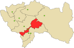
Comas District, Concepción
Comas District | |
|---|---|
 | |
| Country | |
| Region | Junín |
| Province | Concepción |
| Capital | Comas |
| Government | |
| • Mayor | Jorge Luis Garcia Porras |
| Area | |
• Total | 825.29 km2 (318.65 sq mi) |
| Elevation | 3,335 m (10,942 ft) |
| Population | |
• Total | 7,952 |
| • Density | 9.6/km2 (25/sq mi) |
| Time zone | UTC-5 (PET) |
| UBIGEO | 120206 |
Comas District is one of fifteen districts of the Concepción Province in Peru.[1]
Geography
The Waytapallana mountain range traverses the province. One of the highest peaks of the district is Putkaqucha at 5,236 m (17,178 ft). Other mountains are listed below:[2]
- Anchhi
- Anta K'uchu
- Ch'uspi
- Hatun Pata
- Kima Qucha
- Kimsa Uchku
- Kiswar
- Lipa Q'asa
- Luychu Kancha
- Llaksa Qucha
- Llant'a Pallaku
- Mach'ayniyuq
- Mamallayniyuq
- Marayrasu
- Mina Pata
- Mina Q'asa
- Muratayuq
- Pakaku
- Para K'uchu
- Pitita
- Puywan
- Qillqay
- Quchayuq
- Q'ara Chuku
- Saywa
- Silla Pata
- Tinki Qucha
- Tuku Mach'ay
- Tunsu
- T'asta Pata
- T'illu
- Utkhu Warqu
- Wamanripayuq
- Wari Pampa
- Warmi Sinqa
- Wayta Pallaku
- Waytapallana
- Yana Qucha
- Yanaqa
- Yawar Qucha
Climate
| Climate data for Comas, elevation 3,603 m (11,821 ft), (1991–2020) | |||||||||||||
|---|---|---|---|---|---|---|---|---|---|---|---|---|---|
| Month | Jan | Feb | Mar | Apr | May | Jun | Jul | Aug | Sep | Oct | Nov | Dec | Year |
| Mean daily maximum °C (°F) | 13.8 (56.8) |
13.5 (56.3) |
13.7 (56.7) |
14.3 (57.7) |
14.7 (58.5) |
14.7 (58.5) |
14.4 (57.9) |
14.6 (58.3) |
14.5 (58.1) |
14.4 (57.9) |
14.8 (58.6) |
14.0 (57.2) |
14.3 (57.7) |
| Mean daily minimum °C (°F) | 5.2 (41.4) |
5.5 (41.9) |
5.3 (41.5) |
4.5 (40.1) |
3.5 (38.3) |
2.4 (36.3) |
2.0 (35.6) |
2.4 (36.3) |
3.4 (38.1) |
4.4 (39.9) |
4.4 (39.9) |
4.9 (40.8) |
4.0 (39.2) |
| Average precipitation mm (inches) | 143.6 (5.65) |
146.3 (5.76) |
141.6 (5.57) |
65.7 (2.59) |
28.6 (1.13) |
15.9 (0.63) |
22.4 (0.88) |
27.7 (1.09) |
49.9 (1.96) |
94.1 (3.70) |
79.1 (3.11) |
122.4 (4.82) |
937.3 (36.89) |
| Source: National Meteorology and Hydrology Service of Peru[3] | |||||||||||||
| Climate data for Runatullo, Comas, elevation 3,473 m (11,394 ft), (1991–2020) | |||||||||||||
|---|---|---|---|---|---|---|---|---|---|---|---|---|---|
| Month | Jan | Feb | Mar | Apr | May | Jun | Jul | Aug | Sep | Oct | Nov | Dec | Year |
| Mean daily maximum °C (°F) | 13.3 (55.9) |
13.1 (55.6) |
13.3 (55.9) |
13.3 (55.9) |
13.5 (56.3) |
13.0 (55.4) |
12.8 (55.0) |
13.2 (55.8) |
13.2 (55.8) |
13.5 (56.3) |
14.0 (57.2) |
13.4 (56.1) |
13.3 (55.9) |
| Mean daily minimum °C (°F) | 6.2 (43.2) |
6.4 (43.5) |
6.1 (43.0) |
5.3 (41.5) |
3.9 (39.0) |
2.4 (36.3) |
2.0 (35.6) |
2.4 (36.3) |
4.0 (39.2) |
5.2 (41.4) |
5.8 (42.4) |
6.2 (43.2) |
4.7 (40.4) |
| Average precipitation mm (inches) | 166.7 (6.56) |
187.6 (7.39) |
155.8 (6.13) |
75.8 (2.98) |
42.2 (1.66) |
21.2 (0.83) |
40.5 (1.59) |
35.2 (1.39) |
59.8 (2.35) |
102.8 (4.05) |
97.5 (3.84) |
163.8 (6.45) |
1,148.9 (45.22) |
| Source: National Meteorology and Hydrology Service of Peru[3] | |||||||||||||
References
- ^ (in Spanish) Instituto Nacional de Estadística e Informática. Banco de Información Distrital Archived April 23, 2008, at the Wayback Machine. Retrieved April 11, 2008.
- ^ escale.minedu.gob.pe/ UGEL map of the Concepción Province (Junín Region)
- ^ a b "Normales Climáticas Estándares y Medias 1991-2020". National Meteorology and Hydrology Service of Peru. Archived from the original on 21 August 2023. Retrieved 17 June 2024.