Eagle City, Oklahoma
Eagle City | |
|---|---|
 Eagle City Location within the state of Oklahoma  Eagle City Eagle City (the United States) | |
| Coordinates: 35°56′02″N 98°35′24″W / 35.93389°N 98.59000°W | |
| Country | United States |
| State | Oklahoma |
| County | Blaine |
| Area | |
| • Total | 0.67 sq mi (1.74 km2) |
| • Land | 0.67 sq mi (1.74 km2) |
| • Water | 0.00 sq mi (0.00 km2) |
| Elevation | 1,706 ft (520 m) |
| Population (2020) | |
| • Total | 40 |
| • Density | 59.44/sq mi (22.94/km2) |
| Time zone | UTC-6 (Central (CST)) |
| • Summer (DST) | UTC-5 (CDT) |
| ZIP codes | 73658 |
| FIPS code | 40-22300 |
| GNIS feature ID | 2805314[2] |
| Website | www |
Eagle City is a small rural community located along and west of State Highway 58 in western Blaine County, Oklahoma, United States.[2] Established on the Frisco Line before statehood, the post office was named Dillon. The Dillon Post Office opened July 26, 1902. The name was changed to Eagle City September 4, 1909.[3] The ZIP Code is 73658.
Demographics
| Census | Pop. | Note | %± |
|---|---|---|---|
| 2020 | 40 | — | |
| U.S. Decennial Census[4] | |||
References
- ^ "ArcGIS REST Services Directory". United States Census Bureau. Retrieved September 20, 2022.
- ^ a b c U.S. Geological Survey Geographic Names Information System: Eagle City, Oklahoma
- ^ Shirk, George H. Oklahoma Place Names, Norman, Oklahoma: University of Oklahoma Press, 1965, p.68.
- ^ "Census of Population and Housing". Census.gov. Retrieved June 4, 2016.
External links
- Eagle City at GhostTowns.com
Municipalities and communities of Blaine County, Oklahoma, United States | ||
|---|---|---|
| Cities | 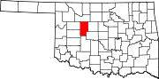 | |
| Towns | ||
| CDPs | ||
| Other community | ||
| Ghost towns | ||
| Footnotes | ‡This populated place also has portions in an adjacent county or counties | |