El Papiol
El Papiol | |
|---|---|
 | |
| Coordinates: 41°26′21″N 2°0′38″E / 41.43917°N 2.01056°E | |
| Country | |
| Community | |
| Province | Barcelona |
| Comarca | Baix Llobregat |
| Government | |
| • Mayor | Joan Borràs Alborch (2015)[1] |
| Area | |
• Total | 9.0 km2 (3.5 sq mi) |
| Elevation | 135 m (443 ft) |
| Population (2018)[3] | |
• Total | 4,103 |
| • Density | 460/km2 (1,200/sq mi) |
| Website | elpapiol |

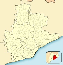
El Papiol (Catalan pronunciation: [əl pəpiˈɔl]) is a municipality in the comarca of the Baix Llobregat in Catalonia, Spain. It is situated on the left bank of the Llobregat river, on the A-7 autopista from Valencia to La Jonquera and the C-1413 road from Sabadell to Molins de Rei. At West it borders on Castellbisbal and Pallejà, at North on Valldoreix (Sant Cugat del Vallès) and at East on Molins de Rei. It is served by the Renfe railway line R4 from Barcelona to Martorell, Vilafranca del Penedès and Sant Vicenç de Calders, which is connected to the village center by a minibus service (6.30 am to 10.31 pm). It is also served by a bus service (L67) and a night bus service (N51) from Barcelona to Esparreguera.
Demography
| 1900 | 1930 | 1950 | 1970 | 1986 | 2018 |
|---|---|---|---|---|---|
| 912 | 1027 | 1159 | 2620 | 3080 | 4103 |
References
- ^ "Ajuntament del Papiol". Generalitat of Catalonia. Retrieved 2015-11-13.
- ^ "El municipi en xifres: El Papiol". Statistical Institute of Catalonia. Retrieved 2015-11-23.
- ^ Municipal Register of Spain 2018. National Statistics Institute.
- Panareda Clopés, Josep Maria; Rios Calvet, Jaume; Rabella Vives, Josep Maria (1989). Guia de Catalunya, Barcelona: Caixa de Catalunya. ISBN 84-87135-01-3 (Spanish). ISBN 84-87135-02-1 (Catalan).
- Moran i Ocerinjauregui, Josep; Pladevall, Antoni; Riera i Viader, Sebastià; Alier, Roger; Codina, Jaume; Pagès i Paretas, Montserrat, et al. (1982). Gran Geografia Comarcal de Catalunya. Vol. 8: Barcelonès i Baix Llobregat, Barcelona: Fundació Enciclopèdia Catalana. ISBN 84-85194-13-6.
External links
- Government data pages (in Catalan)


