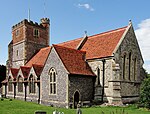
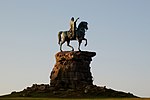
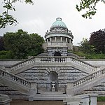
Grade I listed buildings in Berkshire

There are approximately 372,905 listed buildings in England and 2.5% of these are Grade I.[1] This page is a list of these buildings in the county of Berkshire, ordered by building name within place name within district.
Bracknell Forest
| Name | Location | Type | Completed [note 1] | Date designated | Grid ref.[note 2] Geo-coordinates |
Entry number [note 3] | Image |
|---|---|---|---|---|---|---|---|
| Grotto in the Grounds of Ascot Place to South of House at West end of lake | Winkfield | Grotto | c. 1750 | 20 December 1972 | SU9131171181 51°25′56″N 0°41′16″W / 51.432284°N 0.687869°W |
1390475 |  |
Reading
Slough
| Name | Location | Type | Completed [note 1] | Date designated | Grid ref.[note 2] Geo-coordinates |
Entry number [note 3] | Image |
|---|---|---|---|---|---|---|---|
| Baylis House, including forecourt walls and pavilions adjoining to North East | Stoke Poges Lane | House | c. 1695 | 29 September 1950 | SU9694780868 51°31′06″N 0°36′15″W / 51.518423°N 0.604165°W |
1113389 |  |
| Church of St Laurence | Upton Court Road, Upton-cum-Chalvey | Church | Early 12th century | 29 September 1950 | SU9807479094 51°30′08″N 0°35′18″W / 51.502283°N 0.58842°W |
1251379 |  |
| Church of St Mary, Langley | St Mary's Road | Church | 1623 | 29 September 1950 | TQ0048379533 51°30′21″N 0°33′13″W / 51.505806°N 0.5536°W |
1135750 |  |
| Former Service Block Adjoining Baylis House to North East | Stoke Poges Lane | Training College | 1984 | 29 September 1950 | SU9697280892 51°31′07″N 0°36′14″W / 51.518635°N 0.603798°W |
1251374 |  Upload Photo |
| Stable approximately 40 Metres to North of Baylis House | Godolphin Court, Stoke Poges Lane | Stable | Mid to Late 18th century | 29 September 1950 | SU9697280918 51°31′08″N 0°36′14″W / 51.518868°N 0.603791°W |
1313126 |  Upload Photo |
West Berkshire
| Name | Location | Type | Completed [note 1] | Date designated | Grid ref.[note 2] Geo-coordinates |
Entry number [note 3] | Image |
|---|---|---|---|---|---|---|---|
| Church of St Mary | Church Road, Aldermaston | Church | 12th century | 14 April 1967 | SU5965564975 51°22′51″N 1°08′39″W / 51.380699°N 1.144218°W |
1117319 |  |
| Church of St Mary | Parsonage Green, Aldworth | Church | 12th century | 24 November 1966 | SU5540379381 51°30′38″N 1°12′11″W / 51.510649°N 1.203056°W |
1313119 |  |
| Church of St Clement | Church Lane, Ashampstead | Church | Early 13th century | 14 April 1967 | SU5641876793 51°29′14″N 1°11′20″W / 51.487281°N 1.188845°W |
1212118 |  |
| Basildon Park | Basildon | Country House | 1776–83 | 14 April 1967 | SU6107778160 51°29′57″N 1°07′17″W / 51.499088°N 1.121517°W |
1221097 |  |
| Church of St Bartholemew | Basildon | Church | Late 13th century | 14 April 1967 | SU6116679270 51°30′33″N 1°07′12″W / 51.509058°N 1.120043°W |
1221092 |  |
| Church of St Nicholas | Beedon | Church | Early 13th century | 24 November 1966 | SU4823678125 51°30′00″N 1°18′23″W / 51.500012°N 1.306493°W |
1136040 | 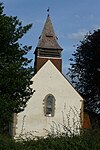 |
| Church of St Mary | Bucklebury | Church | c. 1450 | 14 April 1967 | SU5530470867 51°26′03″N 1°12′21″W / 51.434112°N 1.205813°W |
1212695 |  |
| Church of St Margaret | Catmore | Church | 12th century | 24 November 1966 | SU4539080164 51°31′07″N 1°20′50″W / 51.51858°N 1.347228°W |
1210997 | 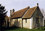 |
| Church of St Andrew | Mount Lane, Chaddleworth | Church | 1742 | 24 November 1966 | SU4115277924 51°29′56″N 1°24′31″W / 51.498764°N 1.408564°W |
1210713 |  |
| Church of St Swithin | Church Lane, Combe, Berkshire | Church | 12th century | 6 February 1962 | SU3681360741 51°20′40″N 1°28′22″W / 51.344566°N 1.472847°W |
1221122 |  |
| Church of St Mary | Church Hill, East Ilsley | Church | 13th century | 24 November 1966 | SU4933080918 51°31′30″N 1°17′25″W / 51.525029°N 1.290344°W |
1136120 |  |
| Parish Church of St Michael, Enborne | Enborne | Church | 12th century | 6 April 1967 | SU4358565773 51°23′22″N 1°22′30″W / 51.389332°N 1.375009°W |
1220252 |  |
| Church of St Mark | Englefield | Church | 13th century | 14 April 1967 | SU6238571995 51°26′37″N 1°06′14″W / 51.443519°N 1.103763°W |
1213321 |  |
| Church of All Saints | Farnborough Village, Farnborough | Church | 11th century | 24 November 1966 | SU4351581936 51°32′05″N 1°22′27″W / 51.534659°N 1.374031°W |
1117199 |  |
| St Thomas' Church, East Shefford | East Shefford, Great Shefford | Church | Norman | 11 July 1983 | SU3905874679 51°28′11″N 1°26′21″W / 51.469736°N 1.439086°W |
1321841 |  |
| Sandleford Priory | Newton Road, Greenham | Country House | c. 1800 | 6 June 1952 | SU4768164440 51°22′37″N 1°18′59″W / 51.377019°N 1.316326°W |
1220371 |  |
| Pair of Gate Piers 103 Metres South of East End of Church | Park Lane, Hampstead Marshall | Gate Pier | Early C18, before 1718 | 6 March 1985 | SU4203466605 51°23′49″N 1°23′50″W / 51.39693°N 1.397199°W |
1136047 |  |
| Pair of Gate Piers 204 Metres East of Entrance to Home Farm | Park Lane, Hampstead Marshall | Gate Pier | Early C18, before 1718 | 6 March 1985 | SU4191866685 51°23′52″N 1°23′56″W / 51.397657°N 1.398857°W |
1136042 |  |
| Pair of Gate Piers 210 Metres Due South of Church Tower | Park Lane, Hampstead Marshall | Gate Pier | Late 17th century | 6 March 1985 | SU4198066538 51°23′47″N 1°23′53″W / 51.396331°N 1.397983°W |
1117219 |  |
| Pair of Gate Piers 30 Metres South of East End of Church | Park Lane, Hampstead Marshall | Gate Pier | Early C18, before 1718 | 6 March 1985 | SU4200566711 51°23′52″N 1°23′51″W / 51.397885°N 1.397604°W |
1117218 |  |
| Three Pairs of Gate Piers and Walls Around Gardens and Terrace at Home Farm | Park Lane, Hampstead Marshall | Gate pier | Late 17th century | 6 March 1985 | SU4188866608 51°23′49″N 1°23′57″W / 51.396967°N 1.399298°W |
1136034 |  |
| Church of St Mary | Church Street, Hampstead Norreys | Church | 12th century | 24 November 1966 | SU5293276259 51°28′58″N 1°14′21″W / 51.482816°N 1.239127°W |
1135735 | 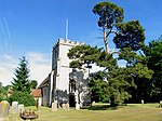 |
| Church of St Mark and St Luke | Kintbury | Church | 11th century | 6 February 1962 | SU3727667964 51°24′34″N 1°27′56″W / 51.40948°N 1.465444°W |
1319539 |  |
| Church of St Michael and All Angels | Market Place, Lambourn | Church | Late Norman | 6 February 1962 | SU3260678957 51°30′31″N 1°31′54″W / 51.508608°N 1.531576°W |
1113695 |  |
| West Berkshire Museum | Wharf Street, Newbury | Museum | 1626–7 | 29 September 1950 | SU4724367135 51°24′05″N 1°19′20″W / 51.401286°N 1.322261°W |
1289770 | 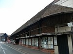 |
| St Nicolas Church, Newbury | Bartholomew Street, Newbury | Parish Church | 1509–1532 | 29 September 1950 | SU4706167101 51°24′04″N 1°19′30″W / 51.400995°N 1.324882°W |
1219556 |  |
| Church of St John the Baptist | Padworth | Church | c. 1130 | 14 April 1967 | SU6132966158 51°23′28″N 1°07′12″W / 51.391157°N 1.119963°W |
1155386 |  |
| Bere Court and Bere House | Bere Court Road, Pangbourne | House | Circa 13th century | 25 October 1951 | SU6163075016 51°28′15″N 1°06′51″W / 51.470762°N 1.114099°W |
1213565 |  |
| Donnington Castle | Castle Lane, Shaw cum Donnington | Castle | 1386 | 9 September 1969 | SU4611869170 51°25′11″N 1°20′17″W / 51.419675°N 1.338168°W |
1291031 |  |
| Shaw House | Church Road, Shaw cum Donnington | House | 1581 | 6 June 1952 | SU4756168369 51°24′44″N 1°19′03″W / 51.412354°N 1.317525°W |
1220445 |  |
| Gate Piers and Gates at Benham Park, West Lodge | Bath Road, Speen | Gate | Late 19th century | 6 June 1952 | SU4320968195 51°24′40″N 1°22′48″W / 51.411137°N 1.380118°W |
1220645 |  |
| Church of St Denys | Stanford Dingley | Church | 12th century | 29 November 1983 | SU5755471703 51°26′29″N 1°10′24″W / 51.441405°N 1.173313°W |
1213251 |  |
| Church of St Mary | Sulhamstead | Church | 13th century | 28 January 1987 | SU6450667949 51°24′25″N 1°04′26″W / 51.406907°N 1.073985°W |
1117112 |  |
| Folly Farmhouse and Entrance Court to East | Sulhamstead Hill, Sulhamstead | Country House | c. 1912 | 25 October 1951 | SU6308168917 51°24′57″N 1°05′39″W / 51.41577°N 1.094297°W |
1135848 |  |
| Old Bluecoat School | Chapel Street, Thatcham | Chapel | 1304 | 10 November 1983 | SU5217967466 51°24′14″N 1°15′05″W / 51.40383°N 1.251263°W |
1303195 |  |
| Church of the Holy Trinity | Church Street, Theale | Church | 1820–1832 | 14 April 1967 | SU6402771290 51°26′13″N 1°04′49″W / 51.436998°N 1.080268°W |
1288225 |  |
| Church of St Laurence | A340 at Tidmarsh | Church | 12th century | 14 April 1967 | SU6348274552 51°27′59″N 1°05′15″W / 51.466386°N 1.087523°W |
1287940 |  |
| Ufton Court | Ufton Nervet | House | c. 1568 | 25 October 1951 | SU6258866730 51°23′46″N 1°06′06″W / 51.396162°N 1.101771°W |
1135879 |  |
| Church of St Nicholas | Wasing Park, Wasing | Church | 13th century | 6 April 1967 | SU5759964271 51°22′28″N 1°10′26″W / 51.374582°N 1.17387°W |
1117257 |  |
| Welford Park and walls to east and west | Welford | Country House | Late 17th century | 6 June 1952 | SU4084273168 51°27′22″N 1°24′49″W / 51.456025°N 1.413578°W |
1264078 | 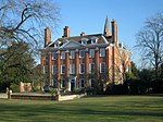 |
| West Woodhay House | West Woodhay | Country House | 1635 | 29 October 1984 | SU3850663253 51°22′01″N 1°26′54″W / 51.367041°N 1.44827°W |
1290600 |  |
| Church of St Peter and St Paul | Yattendon Lane, Yattendon | Church | c. 1450 | 14 April 1967 | SU5541874545 51°28′02″N 1°12′13″W / 51.467169°N 1.203598°W |
1288822 | 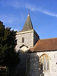 |
Windsor and Maidenhead
Wokingham
| Name | Location | Type | Completed [note 1] | Date designated | Grid ref.[note 2] Geo-coordinates |
Entry number [note 3] | Image |
|---|---|---|---|---|---|---|---|
| Church of St James | Church Lane, Finchampstead | Parish Church | From 12th century | 26 January 1967 | SU7928263810 51°22′04″N 0°51′45″W / 51.367828°N 0.862513°W |
1118084 |  |
| Henley Bridge | Hart Street, Remenham | Bridge | 18th century | 23 December 1983 | SU7637582642 51°32′15″N 0°54′01″W / 51.537523°N 0.900204°W |
1117419 |  |
| Church of St James | Church Lane, Ruscombe | Parish Church | 12th century | 26 January 1967 | SU7980676295 51°28′48″N 0°51′08″W / 51.479992°N 0.85218°W |
1154605 |  |
| Church of St Mary the Virgin | Church Lane, Shinfield | Parish Church | Late 12th century | 26 January 1967 | SU7297368198 51°24′29″N 0°57′08″W / 51.408121°N 0.952224°W |
1118131 |  |
| The Deanery | Thames Street, Sonning | Courtyard House | 1901 | 1 August 1952 | SU7570575617 51°28′28″N 0°54′41″W / 51.47446°N 0.911368°W |
1319459 |  |
| Church of St Nicholas | Church Hill, Hurst | Parish Church | Early 13th century | 26 January 1967 | SU7948672972 51°27′01″N 0°51′27″W / 51.450164°N 0.857533°W |
1117400 |  |
| Church of All Saints | Church Road, Swallowfield | Church | 19th century | 26 January 1967 | SU7317464788 51°22′39″N 0°57′00″W / 51.377439°N 0.950036°W |
1118061 |  |
| Farley Hall | Farley Hill Road, Swallowfield | Country House | c. 1730 | 1 August 1952 | SU7501464627 51°22′33″N 0°55′25″W / 51.375752°N 0.923638°W |
1118066 |  |
| Henry Lucas Hospital and attached water pumps | Chapel Green, Wokingham | Hospital | 1663–1665 | 12 November 1951 | SU8125167394 51°23′59″N 0°50′00″W / 51.399769°N 0.833416°W |
1303641 | 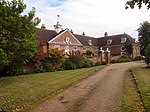 |
See also
Notes
- ^ a b c d e f The date given is the date used by Historic England as significant for the initial building or that of an important part in the structure's description.
- ^ a b c d e f Sometimes known as OSGB36, the grid reference is based on the British national grid reference system used by the Ordnance Survey.
- ^ a b c d e f The "List Entry Number" is a unique number assigned to each listed building and scheduled monument by Historic England.
References
- ^ "Listed Buildings". English Heritage. 2010. Archived from the original on 26 January 2013. Retrieved 23 August 2011.
External links
![]() Media related to Grade I listed buildings in Berkshire at Wikimedia Commons
Media related to Grade I listed buildings in Berkshire at Wikimedia Commons


