Hacienda Demiñho
Hacienda Demiñho | |
|---|---|
Abandoned Spanish plantation | |
| Hacienda San José Demiñho | |
 Elephant Hill, part of Hacienda Demiñho | |
| Etymology: Of the Coyote Pass of the Coyote | |
 | |
 Hacienda Demiñho  Hacienda Demiñho | |
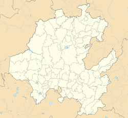
| Coordinates (Hacienda's manor): 20°14′34″N 99°14′34″W / 20.24278°N 99.24278°W | |
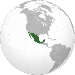
| Country | Mexico |
| Mexican States | Hidalgo |
| Municipalities | Chilcuautla |
| Royal appropriation | 1580 |
| Royal property grant (merced) | November 1581 |
| "Estancia" (Spanish ranching estate) | 1603 |
| Hacienda (Spanish plantation) | 1611 |
| Destroyed during Mexican Revolution | 1919 |
| Founded by | Juan González Soto |
| Elevation | 1,991 m (6,532 ft) |
| Time zone | UTC−6 (CST) |
| • Summer (DST) | UTC−5 (CDT) |
Hacienda Demiñho (also known as Deminyo) is located near Tunititlán in the Chilcuautla municipality in the state of Hidalgo in central Mexico. Spanish plantation with vast lands which made its livelihood with cattle activity, agriculture production, and property rental. It became one of the most important haciendas in the Mezquital Valley region. After its destruction during the Mexican Revolution, it is no longer in use. Today, farmers use the manor's abandoned ruins to store their agricultural items and local municipal authorities use it as a makeshift site for cultural events.
Toponymy
The name Demiñho is a term in Otomi language. Demiñho means "of the Coyote" or "pass of the Coyote". It comes from the word min'yō which means coyote.[1] It refers to the mountain which is the main geographical feature in the site. Another translation of Demiñho is "In the middle of spiny small reeds", derived from the Otomi words nde (center or half), 'mini (spine), and 'yo (small reed).[2]
In different colonial documents the hacienda's name appears as "De minyo", "de Minyo", "Deminyo", or "Demiño".[3]
History
Land appropriation
After the Spanish conquest of the Aztec Empire, in 1580 began a series of appropriations of lands in the region by the Spanish Crown in order to be given to Spanish people in the form of merced (Royal property grant). In November 1581 the first merced intended for equestrian facilities was given to Nicolás de Covarrubias, a Spanish man, by order of Lorenzo Suárez de Mendoza, 5th Count of Coruña, viceroy of New Spain. In 1589 another merced was granted, this time by Álvaro Manrique de Zúñiga, 1st Marquess of Villamanrique, viceroy of New Spain, to Juan Martín Murillo, a Spanish man, to be used for cattle ranching. Nicolás de Covarrubias sold his merced to Juan Martín Murillo, merging both properties. When Juan Martín Murillo died, the Murillo family sold their property to Gonzalo Pérez de Ajacuba, a Spanish man, in 1593. Luis de Velasco, 1st Marquess of Salinas del Río Pisuerga, viceroy of New Spain granted a merced to Juan Baptista Michel, chief constable of Zimapan mines, for the purpose of ranching 2,000 head cattle, effectively taking the lands of the towns of Tunititlán and Texcatepec. This new land was officially possessed in 1594 by lieutenant mayor of Chilcuautla Pedro de Vargas. A month later to Juan Baptista Michel sells his land to Gonzalo Pérez, a Spanish man. In October 1603 Gaspar de Zúñiga, 5th Count of Monterrey, viceroy of New Spain, grants a merced of the lands between Chilcuautla and Texcatepec to Gaspar López to be intended for cattle ranching and equestrian facilities. A month later, Gaspar López sells his land to Gonzalo Pérez.[4]
Estancia
With the merging of properties bought by Gonzalo Pérez and additional land bought in 1603 near the Atengo-Mixquiahuala corregimiento, Pérez builds houses, corrals, and barns, officially founding the Estancia of Demiñho, royal assent given in representation by Diego de las Ruelas, mayor of Ixmiquilpan, and Luis de Hurtado, lieutenant mayor of Chilcuautla. European seeds are introduced to Demiñho during this time for agricultural purposes and a wider variety of European cattle. In 1611, Gonzalo Pérez sells the property to his son-in-law Juan González Soto.[4]
Hacienda
With this newly acquired property and lands, and during the same year, Juan González Soto officially established the Hacienda Demiñho, a Spanish plantation. In 1620, Pablo Vargas Verdugo sells to Juan González Soto the Estancia Tenayahualco located in Chilcuautla. In 1629, Juan González Soto buys a vast territory known as Ayutlan from Alonso Pérez Bocanegra. Given the great revenue generated from Hacienda Demiñho, Juan González Soto establishes two sister haciendas of Demiñho: Hacienda Doica-Xidoo (also known just as Xido) and Hacienda La Viña. In 1645, Juan González Soto dies, his eldest son, Miguel Gonzáles Soto, inherits the power to retain or distribute the property and its earnings. In 1654, Miguel Gonzáles Soto sells Hacienda Demiñho to his sister, Martha Gonzáles Soto.[4]
On April 23, 1673, Martha Gonzáles Soto and her husband Juan López de las Ruelas get a loan of 1575 pesos from Juan Chavarria Valera, owner of Hacienda Ulapa. As the credit mounts and unable to fulfill payment in full in a 10-year term, and as established in the loan contract, Hacienda Demiñho becomes property of Juan Chavarria Valera. When Juan Chavarria Valera dies, the estate is put on sale.[4]
In April 1688, Pedro de Lugo, a Spanish man, buys Hacienda Demiñho paying 13 thousand pesos. Pedro de Lugo renamed the hacienda San José (Saint Joseph) during a solemn ceremony. In 1689, Pedro de Lugo built a bullpen, two corrals, a chicken coop, two warehouses, one barn, a cemetery, a brand-new office, and a niche made of Cantera (stone) where a statue of Saint Joseph was adored and catholic masses celebrated. By 1690, Hacienda Demiñho was considered the most important hacienda in all the region.[4]
By 1782, the owner of Hacienda Demiñho was Nicolás de la Puente García, who got a loan of 20,000 pesos, pledging the hacienda as collateral. On October 26, 1783, Nicolás de la Puente García died, this prompted the lender, Fondo Piadoso de las Californias, to seize the property. The lender's administrator, Francisco de Sales Carrillo, ordered Hacienda Demiñho's administrator, Bernardo Mendoza, to audit valuation of the property. Thus, in 1791 Juan Vicente de Güemes, 2nd Count of Revillagigedo, viceroy of New Spain, sold and delivered the hacienda to Manuel Mier de Terán, who was also owner of Hacienda Endoó, diminishing the independence of Hacienda Demiñho as a stand-alone hacienda.[citation needed]
Destruction
In 1919, as the Mexican Revolution ideals reached the region, Hacienda Demiñho suffered an uprise from its peasants which ended in a violent attack and destruction on the hacienda premises along with massacre of its owners. This marked the end of Hacienda Demiñho. The ruins of the main manor and church were used by peasants to store their agricultural items and the vast land that once belonged to Demiñho was taken by local inhabitants.[5]
Since the early 21st century, the local governments have used the grounds where the ruins remain as a place of gathering for makeshift cultural events. The hacienda buildings remain in ruins.[6]
Architecture
The Hacienda Demiñho is built in Spanish colonial style. Although only ruins remain, there are features who still stand: the main manor, where the owner and his or her family lived, a church with a tower, a threshing floor, a water reservoir, a sweat bath, and horse housing. Some walls of the manor still show traces of colonial-style painting and designs.[7]
Demographics

Over the centuries, the hacienda Demiñho had a great number of people working the main manor as well as the hacienda's land. Additionally, there were those who rented land for agricultural or cattling purposes, living within the domain of the hacienda.[citation needed]
Hacendados
The owner of the Hacienda Demiñho, which at times was a hacendado (male owner) and at times a hacendada (female owner), lived in the plantation's manor with his/her direct family. The owner's extended family could also live there, as well as a floating population of the family's friends and guests. Income generated by the hacienda was for the hacendado.[citation needed]
Servants
In 1783, there were 15 servants who worked for the hacienda's manor. They were registered by the hacienda's administration between June 1, 1782 and November 16, 1783, dates corresponding to a work period in Hacienda Demiñho. Although the number of servants reached a maximum of 25 servants during other work periods.[8]
These servants were people who routinely maintained the hacienda's functioning as well as it security vigilance. The job position for Hacienda Demiñho's servants varied, which included: cooks, millers, cowboys, foremen, loaders, farmers, grooms, helpers, pasturemen, drivers, water boys, drovers, masons, muleteers and vigilants.[8]
Farm laborers
During the 18th century there could be up to 309 farm laborers working for Hacienda Demiñho in a work period year.[8]
Agricultural workers for the Hacienda Demiñho, known by the hacienda as gañanes, peones or operarios during the 18th century, worked the land and also did maintenance needed for such work. Hacienda Demiñho farm laborers came from nearby villages such as Tunititlan, Tesca, and Santa Maria.[8]
These farm workers' job positions included: farm laborers (of maize, chili, barley, and beans), mason workers (to build or maintain barbecue pits, fences, and other farming structures), and barbecue-pit cooks.[8]
Tenants
In the 1780's there were up to 131 tenants renting land from Hacienda Demiñho.[8]
Tenants used the leased properties for various purposes, including: farming, ranching, farm animal husbandry, extraction of maguey sap, collecting wood, and in some cases to build a place to live.[8]
The cost of the land was fixed but varied according to social and economic status. For example, one of the smallest payments made by Hacienda Demiñho's tenants was by Francisco Martín, and indigenous man from the village of Tesca, who paid 4 reales per year for land for his ox. In contrast, the highest payment recorded for Hacienda Demiñho was by Don Nicolás Pérez, governor of Chilcuautla, who paid 1,120 reales (140 pesos) for land he worked.[8]
References
- ^ Cruz, Luis Hernández; Torquemada, Moisés Victoria (2004). Diccionario del hñähñu (otomí) del Valle del Mezquital, estado de Hidalgo (in Spanish). Instituto Lingüístico de Verano. ISBN 978-968-31-0313-0.
- ^ Mendez Gomez, David (2022). El Mapa de Atenco-Mixquiahuala: Analisis Toponimico y Cartografico [Map of Atenco-Mixquiahuala: Toponymic and Cartographic Analysis] (in Spanish). Instituto Nacional de Antropología e HistoriaInstituto Nacional de Estudios Históricos de la Revolución Mexicana. p. 131.
- ^ Velázquez, María del Carmen (1988). La hacienda de señor San José Deminyo, 1780-1784. El Colegio de México. pp. 7–20. ISBN 978-607-628-729-3.
- ^ a b c d e "Museo virtual de Tunititlán - Hacienda Demiñho" [Tunititlan Virtual Museum - Hacienda Demiñho]. sites.google.com (in Spanish). Museo Virtual de Tunititlan. Retrieved 2024-01-07.
{cite web}: CS1 maint: others (link) - ^ "Tunititlan Hgo". tunititlan2013.blogspot.com. Retrieved 2024-01-07.
- ^ Redacción (2023-05-16). "¿A dónde ir? Este fin de semana Festival del Pulque de Tunititlán". Grupo Milenio (in Mexican Spanish). Retrieved 2024-01-07.
- ^ "Museo virtual de Tunititlán - Hacienda Demiñho". sites.google.com. Retrieved 2024-01-07.
- ^ a b c d e f g h DEL CARMEN VELÁZQUEZ, MARÍA (1988-01-01). La hacienda de señor San José Deminyo, 1780-1784 [The hacienda of lord Saint Joseph Deminyo, 1780-1784] (in Spanish). El Colegio de México. pp. 37–88. doi:10.2307/j.ctv6mtcrm. ISBN 978-607-628-729-3.
Bibliography
- Velázquez, María del Carmen. La hacienda de señor San José Deminyo, 1780–1784. El Colegio de México, 1988.
- Mazo y Avilés, José del. Plano ignográfico de la hacienda de San José Deminyo, Mixquiahuala, Hidalgo. Created 1786. Published online 2009. Archivo General de la Nación, AGN. Fondo Mapas, Planos e Ilustraciones (MAPILU), Ramo Tierras, Volumen 2413, Expediente 2, Foja 82bis. Plano ignográfico de la hacienda de San José Deminyo. Mixquiahuala. Hidalgo (atribuido)