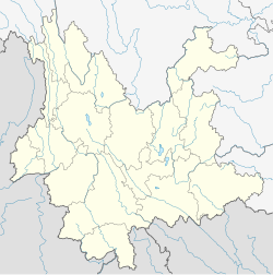
Heqing County
Heqing County
鹤庆县 · Hhop•kait xiainb | |
|---|---|
 Central Heqing | |
 Location of Heqing County (pink) and Dali Prefecture (yellow) within Yunnan province | |
| Coordinates: 26°33′34″N 100°10′36″E / 26.55944°N 100.17667°E | |
| Country | China |
| Province | Yunnan |
| Autonomous prefecture | Dali |
| County seat | Yunhe |
| Area | |
| • Total | 2,395 km2 (925 sq mi) |
| Population (2020 census)[1] | |
| • Total | 243,031 |
| • Density | 100/km2 (260/sq mi) |
| Time zone | UTC+8 (CST) |
| Postal code | 671500 |
| Area code | 0872 |
| Climate | Cwb |
| Website | www |
Heqing County (simplified Chinese: 鹤庆县; traditional Chinese: 鶴慶縣; pinyin: Hèqìng Xiàn; Bai: Hhop•kait[2]) is a county in the Dali Bai Autonomous Prefecture located in the northwest of Yunnan Province, China.
Administrative divisions
Heqing County has 7 towns, 1 township and 1 ethnic township.[3]
- 7 towns
|
|
- 1 township
- Jindun Township (金墩乡)
- 1 ethnic township
- Liuhe Yi Ethnic Township (六合彝族乡)
Ethnic groups
Zhuang
There are 855 Zhuang in Heqing County, most of whom reside in Luolang Village 洛崀村, Duomei Township 朵美乡 (Dali Ethnic Gazetteer 2009:224). Yunnan (1979)[4] lists the name Qing 青; their autonym is Buyi 布依, while the Han Chinese refer to them as the Zhongjiazi 仲家子. They believe that their ancestors had migrated from the Langdai 郎岱 area of Guizhou.[4] They had a population of 161 as of 1960.
Climate
| Climate data for Heqing (1991–2020 normals, extremes 1981–2010) | |||||||||||||
|---|---|---|---|---|---|---|---|---|---|---|---|---|---|
| Month | Jan | Feb | Mar | Apr | May | Jun | Jul | Aug | Sep | Oct | Nov | Dec | Year |
| Record high °C (°F) | 25.7 (78.3) |
24.4 (75.9) |
28.0 (82.4) |
30.0 (86.0) |
32.1 (89.8) |
32.7 (90.9) |
31.7 (89.1) |
28.0 (82.4) |
27.9 (82.2) |
27.1 (80.8) |
24.6 (76.3) |
24.0 (75.2) |
32.7 (90.9) |
| Mean daily maximum °C (°F) | 15.7 (60.3) |
17.7 (63.9) |
20.2 (68.4) |
22.7 (72.9) |
24.5 (76.1) |
25.1 (77.2) |
23.8 (74.8) |
23.6 (74.5) |
22.6 (72.7) |
21.2 (70.2) |
18.4 (65.1) |
16.0 (60.8) |
21.0 (69.7) |
| Daily mean °C (°F) | 7.1 (44.8) |
9.3 (48.7) |
12.1 (53.8) |
15.1 (59.2) |
18.2 (64.8) |
20.1 (68.2) |
19.2 (66.6) |
18.6 (65.5) |
17.2 (63.0) |
14.5 (58.1) |
10.3 (50.5) |
7.2 (45.0) |
14.1 (57.4) |
| Mean daily minimum °C (°F) | −0.5 (31.1) |
1.7 (35.1) |
4.9 (40.8) |
8.1 (46.6) |
12.2 (54.0) |
15.8 (60.4) |
15.9 (60.6) |
15.2 (59.4) |
13.7 (56.7) |
9.6 (49.3) |
3.7 (38.7) |
−0.3 (31.5) |
8.3 (47.0) |
| Record low °C (°F) | −8.5 (16.7) |
−6.7 (19.9) |
−4.9 (23.2) |
0.8 (33.4) |
2.8 (37.0) |
6.7 (44.1) |
10.7 (51.3) |
8.2 (46.8) |
5.4 (41.7) |
2.1 (35.8) |
−2.9 (26.8) |
−11.4 (11.5) |
−11.4 (11.5) |
| Average precipitation mm (inches) | 5.4 (0.21) |
3.8 (0.15) |
8.9 (0.35) |
15.7 (0.62) |
59.8 (2.35) |
140.9 (5.55) |
258.8 (10.19) |
256.6 (10.10) |
172.2 (6.78) |
61.4 (2.42) |
12.6 (0.50) |
2.1 (0.08) |
998.2 (39.3) |
| Average precipitation days (≥ 0.1 mm) | 1.6 | 1.6 | 2.3 | 3.7 | 8.9 | 14.1 | 19.9 | 17.7 | 16.4 | 10.2 | 3.2 | 1.0 | 100.6 |
| Average snowy days | 0.7 | 0.2 | 0.2 | 0 | 0 | 0 | 0 | 0 | 0 | 0 | 0.1 | 0.1 | 1.3 |
| Average relative humidity (%) | 51 | 46 | 48 | 52 | 59 | 71 | 83 | 85 | 84 | 76 | 66 | 60 | 65 |
| Mean monthly sunshine hours | 243.5 | 239.9 | 271.3 | 263.9 | 238.9 | 178.7 | 148.7 | 164.1 | 135.8 | 181.3 | 214.9 | 230.3 | 2,511.3 |
| Percent possible sunshine | 73 | 75 | 73 | 69 | 57 | 43 | 35 | 41 | 37 | 51 | 67 | 71 | 58 |
| Source: China Meteorological Administration[5][6] | |||||||||||||
References
- ^ "大理州第七次全国人口普查主要数据公报" (PDF) (in Chinese). Dali Daily. 2021-06-01.
- ^ 白汉词典(现行白文第一版2022) [Bai–Chinese Dictionary] (PDF) (in Chinese). Government of Dali Prefecture. p. 113.
- ^ "国家统计局" (in Chinese). National Bureau of Statistics of the People's Republic of China. Retrieved 2021-12-07.
- ^ a b Yunnan minzu shibie zonghe diaocha zubian 云南民族识别综合调查组编 (1979). Yunnan minzu shibie zonghe diaocha baogao (1960 nian) Archived 2021-04-23 at the Wayback Machine 云南民族识别综合调查报告(1960年). Kunming: Yunnan minzuxue yanjiu suoyin 云南民族学研究所印.
- ^ 中国气象数据网 – WeatherBk Data (in Simplified Chinese). China Meteorological Administration. Retrieved 9 April 2023.
- ^ "Experience Template" 中国气象数据网 (in Simplified Chinese). China Meteorological Administration. Retrieved 9 April 2023.

