Horní Dvořiště
Horní Dvořiště | |
|---|---|
 Centre of Horní Dvořiště | |
 Flag  Coat of arms | |
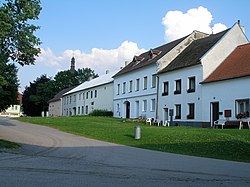
 Horní Dvořiště Location in the Czech Republic | |
| Coordinates: 48°36′14″N 14°24′21″E / 48.60389°N 14.40583°E | |
| Country | |
| Region | South Bohemian |
| District | Český Krumlov |
| First mentioned | 1278 |
| Area | |
• Total | 13.59 km2 (5.25 sq mi) |
| Elevation | 651 m (2,136 ft) |
| Population (2024-01-01)[1] | |
• Total | 461 |
| • Density | 34/km2 (88/sq mi) |
| Time zone | UTC+1 (CET) |
| • Summer (DST) | UTC+2 (CEST) |
| Postal code | 382 93 |
| Website | www |
Horní Dvořiště (German: Oberhaid) is a municipality and village in Český Krumlov District in the South Bohemian Region of the Czech Republic. It has about 500 inhabitants.
Administrative division
Horní Dvořiště consists of two municipal parts (in brackets population according to the 2021 census):[2]
- Horní Dvořiště (304)
- Český Heršlák (120)
Demographics
| Year | Pop. | ±% |
|---|---|---|
| 1869 | 1,038 | — |
| 1880 | 1,144 | +10.2% |
| 1890 | 1,151 | +0.6% |
| 1900 | 1,117 | −3.0% |
| 1910 | 1,113 | −0.4% |
| 1921 | 1,187 | +6.6% |
| 1930 | 1,400 | +17.9% |
| 1950 | 796 | −43.1% |
| 1961 | 630 | −20.9% |
| 1970 | 572 | −9.2% |
| 1980 | 612 | +7.0% |
| 1991 | 499 | −18.5% |
| 2001 | 505 | +1.2% |
| 2011 | 467 | −7.5% |
| 2021 | 424 | −9.2% |
| Source: Censuses[3][4] | ||
References
- ^ "Population of Municipalities – 1 January 2024". Czech Statistical Office. 2024-05-17.
- ^ "Public Census 2021 – basic data". Public Database (in Czech). Czech Statistical Office. 2022.
- ^ "Historický lexikon obcí České republiky 1869–2011" (in Czech). Czech Statistical Office. 2015-12-21.
- ^ "Population Census 2021: Population by sex". Public Database. Czech Statistical Office. 2021-03-27.
External links
Wikimedia Commons has media related to Horní Dvořiště.
| Authority control databases: National |
|---|