Kae Dam district
Kae Dam
แกดำ | |
|---|---|
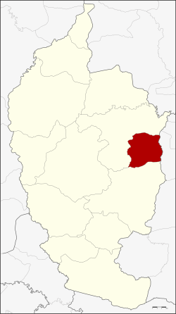 District location in Maha Sarakham province | |
| Coordinates: 16°1′30″N 103°23′6″E / 16.02500°N 103.38500°E | |
| Country | Thailand |
| Province | Maha Sarakham |
| Seat | Kae Dam |
| Area | |
| • Total | 149.5 km2 (57.7 sq mi) |
| Population (2005) | |
| • Total | 29,218 |
| • Density | 195.4/km2 (506/sq mi) |
| Time zone | UTC+7 (ICT) |
| Postal code | 44190 |
| Geocode | 4402 |
Kae Dam (Thai: แกดำ, pronounced [kɛ̄ː dām]) is a district (amphoe) in the east of Maha Sarakham province, northeastern Thailand.
Geography
Neighboring districts are (from the south clockwise): Wapi Pathum and Mueang Maha Sarakham of Maha Sarakham Province, and Si Somdet of Roi Et province.
History
The minor district (king amphoe) was created on 3 January 1977, when the three tambons, Kae Dam, Nong Kung, and Mittraphap were split off from Mueang Maha Sarakham district.[1] It was upgraded to a full district on 1 January 1988.[2]
Administration
The district is divided into five sub-districts (tambons), which are further subdivided into 89 villages (mubans). Kae Dam is a township (thesaban tambon) which covers parts of tambon Kae Dam. There are a further five tambon administrative organizations (TAO).
| No. | Name | Thai name | Villages | Pop. | |
|---|---|---|---|---|---|
| 1. | Kae Dam | แกดำ | 18 | 8,708 | |
| 2. | Wang Saeng | วังแสง | 20 | 5,703 | |
| 3. | Mittraphap | มิตรภาพ | 21 | 6,781 | |
| 4. | Nong Kung | หนองกุง | 16 | 4,181 | |
| 5. | Non Phi Ban | โนนภิบาล | 14 | 3,845 |
References
- ^ ประกาศกระทรวงมหาดไทย เรื่อง แบ่งท้องที่อำเภอเมืองมหาสารคาม จังหวัดมหาสารคาม ตั้งเป็นกิ่งอำเภอแกดำ (PDF). Royal Gazette (in Thai). 94 (4 ง): 118. January 11, 1977. Archived from the original (PDF) on April 27, 2012.
- ^ พระราชกฤษฎีกาตั้งอำเภอนามน อำเภอพระยืน อำเภอหนองบัวระเหว อำเภอบ้านเหลื่อม อำเภอจะแนะ อำเภอหนองหงส์ อำเภอนาโพธิ์ อำเภอเกาะยาว อำเภอแกดำ อำเภอสระโบสถ์ อำเภอโนนคูณ อำเภอควนโดน อำเภอไชยวาน อำเภอหนองแสง และอำเภอตาลสุม พ.ศ. ๒๕๓๐ (PDF). Royal Gazette (in Thai). 104 (278 ก special): 33–37. December 31, 1987. Archived from the original (PDF) on February 14, 2012.
External links