Karkaraly District
Karkaraly | |
|---|---|
District | |
| Қарқаралы ауданы | |
 | |
| Country | Kazakhstan |
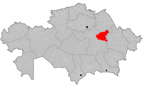
| Region | Karaganda Region |
| Administrative center | Karkaraly |
| Founded | 1930 |
| Government | |
| • Akim | Adilzhan Argynov[1] |
| Area | |
| • Total | 53,600 km2 (20,700 sq mi) |
| Population (2019)[2] | |
| • Total | 36,025 |
| Time zone | UTC+6 (East) |
Karkaraly District (Kazakh: Қарқаралы ауданы, Qarqaraly audany) is a district of Karaganda Region in central Kazakhstan. The administrative center of the district is the town of Karkaraly.[3] As of 2019, the district is home to a population of 36,025 people.[2]
Geography
Karasor, an endorheic salt lake, is located in the district, north of the Karkaraly and Kent mountain ranges.[4][5]
History
The Karkaraly District is home to the Kent Settlement, located in the village of Kent, an archeological digsite which dates back to the Bronze Age.[6][7] Discovered in 1985,[6] the site includes a proto-city which spans 30 hectares,[6][7] complementary farmland which exceeds 100 hectares in area,[7] a religious building,[7] and furnaces used to make bronze and possibly iron.[6][7]
During the times of the Russian Empire, the town of Karkaraly was home to the Koyandy Fair, one of the largest economic and cultural gatherings in the Kazakh Steppes.[8] Major figures who visited the town during the time of the Russian Empire included Abai Kunanbaev, Shoqan Walikhanov, Mikhail Prishvin, Grigory Potanin, Aleksandr Zatayevich, and Mukhtar Auezov.[8]
Demographics
The district reported 36,025 inhabitants as of 2019, of which most were ethnic Kazakhs.[2]
| Ethnic Group | Population (2019) | Percent of Total |
|---|---|---|
| Kazakhs | 34,604 | 96.06% |
| Russians | 1,074 | 2.98% |
| Tatars | 115 | 0.32% |
| Germans | 86 | 0.24% |
| Ukrainians | 41 | 0.11% |
| Belarusians | 17 | 0.05% |
| Bashkirs | 13 | 0.04% |
| Chechens | 13 | 0.04% |
| Moldovans | 9 | 0.02% |
| Uzbeks | 6 | 0.02% |
| Chuvash | 5 | 0.01% |
| Azeris | 4 | 0.01% |
| Lithuanians | 4 | 0.01% |
| Koreans | 4 | 0.01% |
| Poles | 3 | <0.01% |
| Mordvins | 1 | <0.01% |
| Others | 26 | 0.07% |
| Total | 36,025 | 100.00% |
References
- ^ "Адильжан Аргынов назначен акимом Каркаралинского района Карагандинской области". www.inform.kz. 2023-11-22.
- ^ a b c d Численность населения Республики Казахстан по отдельным этносам на начало 2019 года. Комитет по статистике Министерства национальной экономики Республики Казахстан (in Kazakh). Retrieved 2020-05-17.
- ^ "www.geonames.de Subdivisions of Kazakhstan in local languages". Archived from the original on 2017-06-09. Retrieved 2008-04-22.
- ^ Google Earth
- ^ "M-43 Topographic Chart (in Russian)". Retrieved 18 September 2022.
- ^ a b c d Baigunakov, Dosbol; Sabdenova, Gulmira (2014-05-15). "Some Results of Studying the Ancient History of Kazakhstan". Procedia - Social and Behavioral Sciences. 3rd World Conference on Educational Technology Researches 2013, WCETR 2013, 7–9 November 2013, Antalya, Turkey. 131: 304–308. doi:10.1016/j.sbspro.2014.04.121. ISSN 1877-0428.
- ^ a b c d e "ARCHEOLOGICAL ROUTES OF SARY-ARKA". www.discovery-kazakhstan.com. Retrieved 2020-05-17.
- ^ a b "ОЧЕРКИ ПО ИСТОРИИ РАЙОНА". АППАРАТ АКИМА КАРКАРАЛИНСКОГО РАЙОНА. 2019-10-24. Archived from the original on 2019-10-24. Retrieved 2020-05-17.
Capital: Karaganda | ||
| Districts |  | |
| Major cities | ||
| International | |
|---|---|
| National | |
49°28′12″N 75°30′36″E / 49.47000°N 75.51000°E