List of districts of Tamilnadu
| Districts of Tamil Nadu | |
|---|---|
 Districts of Tamil Nadu | |
| Category | Districts |
| Location | Tamil Nadu |
| Number | 38 districts |
| Populations | Perambalur – 565,223 (lowest); Chennai – 7,139,630 (highest) |
| Areas | Chennai – 426 km2 (164 sq mi) (smallest); Dindigul – 6,266.64 km2 (2,419.56 sq mi) (largest) |
| Government | |
| Subdivisions | |
The Indian state of Tamil Nadu has 38 districts after several splits of the original 13 districts at the formation of the state on 1 November 1956. The districts are further divided into taluks and smaller administrative units.
History
Pre-independence

At the time of Independence, Madras Presidency in India was made up of 26 districts, of which 12 districts were found in the present-day Tamil Nadu, namely, Chingleput, Coimbatore, Nilgiris, North Arcot, Madras, Madura, Ramnad, Salem, South Arcot, Tanjore, Tinnevely, and Trichinopoly.
1947–1956
After Indian Independence, the Madras Presidency under British rule became the Madras Province on 15 August 1947. After Indian independence in 1947, the Pudukkottai Princely State was amalgamated with Indian Union on 4 March 1948 and became a division in Trichinopoly district. The new Constitution of India, which came into force on 26 January 1950, made India a sovereign democratic republic. According to this act, on 26 January 1950, Madras Province was formed as Madras State by the Government of India.

At the time of formation of Madras State in 1950, it included the whole of present-day Tamil Nadu, Coastal Andhra, Rayalaseema, the Malabar region of North Kerala, Bellary and South Canara. Coastal Andhra and Rayalaseema were separated to form Andhra State in 1953, while South Canara and Bellary districts were merged with Mysore State to form Karnataka state, and Malabar District with the State of Travancore-Cochin to form Kerala in 1956.
1956

As a result of the 1956 States Reorganisation Act, the state's boundaries were re-organized following linguistic lines. The Tamil speaking region of Kanyakumari was merged to Madras state which was earlier a part of Travancore-Cochin. Madras state was formed on 1 November 1956, with 13 southern districts of Madras Presidency.
They are as follow : Chingleput, Coimbatore, Kanyakumari, Madras, Madurai, Nilgiris, North Arcot, Ramanathapuram, Salem, South Arcot, Thanjavur, Tiruchirappalli and Tirunelveli.
1960–1989

- On 2 October 1966, Dharmapuri district was bifurcated from the erstwhile Salem district comprising Dharmapuri, Harur, Hosur and Krishnagiri taluks.[1]
- In 1969, Madras State was renamed as Tamil Nadu.
- On 14 January 1974, Pudukkottai district was formed from the parts of Tiruchirappalli and Thanjavur districts comprising Kulathur, Thirumayam, Alangudi and Aranthangi taluks.[2]
- On 31 August 1979, Erode district was bifurcated from the erstwhile Coimbatore district comprising Bhavani, Erode and Sathyamangalam taluks.[3]
- On 8 March 1985, Sivaganga and Virudhunagar districts were trifurcated from the erstwhile Ramanathapuram district[4] with Sivaganga district comprising Tirupattur, Karaikudi, Devakottai, Sivaganga, Manamadurai and Ilaiyangudi taluks[5] and Virudhunagar district comprising Srivilliputhur, Virudhunagar, Tiruchuli, Aruppukottai, Sattur and Rajapalayam taluks.[6]
- On 15 September 1985, Dindigul district was bifurcated from the erstwhile Madurai district comprising Dindigul, Palani and Kodaikanal taluks.[7]
- On 20 October 1986, Thoothukudi district was bifurcated from the erstwhile Tirunelveli district comprising Thoothukudi, Ottapidaram and Tiruvaikuntam taluks.[8]
- On 30 September 1989, Tiruvannamalai and Vellore districts were bifurcated from the erstwhile North Arcot district (District ceased to exist) with Tiruvannamalai district comprising Tiruvannamalai, Arni, Vandavasi, Cheyyar, Polur and Chengam taluks[9] and Vellore district comprising Arakkonam, Arcot, Gudiyatham, Tirupattur, Vellore, Vaniyambadi and Walaja taluks.[10]
1990–1999
- On 18 October 1991, Nagapattinam was bifurcated from the erstwhile Thanjavur district comprising Tiruvarur, Mayiladuthurai, Manargudi, Nagapattinam divisions and Valangaiman taluk from Kumbakonam division.[11]
- On 30 September 1993, Cuddalore and Viluppuram districts were bifurcated from the erstwhile South Arcot district (District ceased to exist) with Cuddalore district comprising Cuddalore, Chidambaram and Vriddhachalam taluks[12] and Villupuram district comprising Kallakuruchi, Villupuram, Tirukkoyilur and Tindivanam.[13]
- On 30 September 1995, Karur and Perambalur districts were trifurcated from the erstwhile Tiruchirappalli district[14] with Karur district comprising Karur, Kulithalai and Manapparai taluks[15] and Perambalur district comprising Perambalur and Kunnam taluks.[16]
- On 25 July 1996, Theni district was bifurcated from the erstwhile from Madurai district comprising Theni, Bodinayakanur, Periyakulam, Uthamapalayam and Andipatti taluks.[17]
- On 1 January 1997 Tiruvarur was formed from the parts of erstwhile Nagapattinam and Thanjavur districts comprising Tiruvarur, Nannilam, Kudavasal, Needamangalam, Mannargudi, Thiruthuraipoondi taluks from Nagappatinam district and Valangaiman taluk from Thanjavur district.[18]
- On 1 January 1997, Namakkal district was bifurcated from the erstwhile Salem district comprising Namakkal, Tiruchengode, Rasipuram and Paramathi-Velur taluks.[19]
- On 1 July 1997, Kanchipuram and Tiruvallur districts were bifurcated from the erstwhile Chengalpattu district (District ceased to exist) with Kanchipuram district comprising Kanchipuram, Sriperumbudur, Uthiramerur, Chengalpattu, Tambaram, Tirukalukundram, Maduranthakam and Cheyyur taluks[20] and Tiruvallur district comprising Tiruvallur, Tiruttani taluks and Uthukkottai and Pallipattu sub-taluks separated from Chengalpattu District along with Ponneri and Gummidipoondi taluks of Saidapet revenue division.[21]
2000–Present
- On 9 February 2004, Krishnagiri district was bifurcated from the erstwhile Dharmapuri district comprising Krishnagiri, Hosur, Pochampalli, Uthangarai and Denkanikottai taluks.[22]
- On 19 November 2007, Ariyalur district was bifurcated from the erstwhile Perambalur district comprising Ariyalur, Udayarpalayam and Sendurai taluks.[23]
- On 24 October 2009, Tiruppur district was formed from the parts of Coimbatore and Erode districts[24] with Tiruppur, Udumalpet, Palladam and parts of Avinashi taluks of Coimbatore districts[25] and Dharapuram, Kangeyam and parts of Perundurai taluks of Erode district.[26]
- On 5 January 2018, the area of Chennai district was increased by the addition of Madhavaram, Maduravoyal, Ambattur, Tiruvottriyur taluks and parts of Ponneri taluk of Tiruvallur and Alandur and Sholinganallur taluks of Kanchipuram (present day Chengalpattu) districts.[27]
- On 22 November 2019, Tenkasi district was bifurcated from the erstwhile Tirunelveli district comprising Tenkasi, Sengottai, Kadayanallur, Sivagiri, Veerakeralampudur, Sankarankovil, Thiruvenkatam and Alangulam taluks.[28]
- On 26 November 2019, Kallakurichi district was bifurcated from the erstwhile Viluppuram district comprising Kallakurichi, Sankarapuram, Chinnasalem, Ulundurpet, Thirukovilur and Kalvarayanmalai taluks.[29]
- On 29 November 2019, Tirupattur and Ranipet districts were trifurcated from the erstwhile Vellore district with Tirupattur district comprising Tirupattur, Vaniyambadi, Natrampalli and Ambur taluks and Ranipet district comprising Walajah, Arcot, Nemili and Arakkonam taluks.[30]
- On 30 November 2019, Chengalpattu district was bifurcated from the erstwhile Kanchipuram district comprising Tirukalukundram, Chengalpattu, Madurantakam, Cheyyar, Tiruporur, Tambaram, Pallavaram, and Vandalur taluks.[31]
- On 24 March 2020, Mayiladuthurai district was bifurcated from the erstwhile Nagapattinam district comprising Mayiladuthurai, Sirkazhi, Tharangambadi and Kuthalam taluks.[32]
List
| No. | District | Code | Capital | Estd. | Predecessor | Area (km2) | Population[33] | Population density (/km2) |
Taluks[34] | Assembly constituencies | Lok sabha constituencies | Map |
|---|---|---|---|---|---|---|---|---|---|---|---|---|
| 1 | Ariyalur | AR | Ariyalur | 23 November 2007 | Perambalur | 1949.31 | 754,894 | 390 |
|

| ||
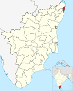
| 2 | Chengalpattu | CGL | Chengalpattu | 29 November 2019 | Kanchipuram | 2,944.96 | 2,556,244 | 868 | 
| |||
| 3 | Chennai (formerly Madras) |
CH | Chennai | 1 November 1956 | None (Part of the original 13 districts) | 426 | 7,139,630 | 17,000 | 
| |||
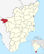
| 4 | Coimbatore | CO | Coimbatore | 1 November 1956 | None (Part of the original 13 districts) | 4,723[35] | 3,458,045 | 732 | 
| |||
| 5 | Cuddalore | CU | Cuddalore | 30 September 1993 | South Arcot District | 3,703 | 2,605,914 | 709 | 
| |||
| 6 | Dharmapuri | DH | Dharmapuri | 2 October 1965 | Salem | 4,497.77 | 1,506,843 | 335 | 
| |||
| 7 | Dindigul | DI | Dindigul | 15 September 1985 | Madurai | 6,266.64 | 2,159,775 | 345 |
|

| ||
| 8 | Erode | ER | Erode | 31 August 1979 | Coimbatore | 5,722[36] | 2,251,744 | 394 | 
| |||
| 9 | Kallakurichi | KL | Kallakurichi | 26 November 2019 | Viluppuram | 3,520.37 | 1,370,281 | 389 | 
| |||
| 10 | Kanchipuram | KC | Kanchipuram | 1 July 1997 | Chingleput | 1,655.94 | 1,166,401 | 704 | 
| |||
| 11 | Kanniyakumari | KK | Nagercoil | 1 November 1956 | None (Part of the original 13 districts) (transferred from Travancore-Cochin) | 1,672 | 1,870,374 | 1,119 |
|

| ||
| 12 | Karur | KR | Karur | 30 September 1995 | Tiruchirappalli | 2,895.57 | 1,064,493 | 357 |
|

| ||
| 13 | Krishnagiri | KR | Krishnagiri | 9 February 2004 | Dharmapuri | 5,143 | 1,879,809 | 366 |
|

| ||
| 14 | Madurai | MDU | Madurai | 1 November 1956 | None (Part of the original 13 districts) | 3,741.73 | 3,038,252 | 812 |
|

| ||
| 15 | Mayiladuthurai | MYD | Mayiladuthurai | 28 December 2020 | Nagapattinam | 1,172 | 918,356 | 784 | 
| |||
| 16 | Nagapattinam | NG | Nagapattinam | 18 October 1991 | Thanjavur | 1,397 | 697,069 | 498 | 
| |||
| 17 | Namakkal | NM | Namakkal | 1 January 1997 | Salem | 3,368.21 | 1,726,601 | 513 |
|

| ||
| 18 | Nilgiris | NI | Ooty | 1 November 1956 | None (Part of the original 13 districts) | 2,545 | 735,394 | 300 | 
| |||
| 19 | Perambalur | PE | Perambalur | 30 September 1995 | Tiruchirappalli | 1,757 | 565,223 | 320 | 
| |||
| 20 | Pudukkottai | PU | Pudukkottai | 14 January 1974 | Thanjavur and Tiruchirappalli | 4,663 | 1,618,345 | 347 | 
| |||
| 21 | Ramanathapuram | RA | Ramanathapuram | 1 November 1956 | None (Part of the original 13 districts) | 4,068.31 | 1,353,445 | 331 |
|

| ||
| 22 | Ranipet | RN | Ranipet | 28 November 2019 | Vellore | 2,234.32 | 1,210,277 | 542 | 
| |||
| 23 | Salem | SA | Salem | 1 November 1956 | None (Part of the original 13 districts) | 5,245 | 3,482,056 | 669 | 
| |||
| 24 | Sivaganga | SI | Sivaganga | 15 March 1985 | Ramanathapuram | 4,189 | 1,339,101 | 328 |
|

| ||
| 25 | Tenkasi | TS | Tenkasi | 22 November 2019 | Tirunelveli | 2916.13 | 1,407,627 | 483 |
|

| ||
| 26 | Thanjavur | TJ | Thanjavur | 1 November 1956 | None (Part of the original 13 districts) | 3,396.57 | 2,405,890 | 708 | 
| |||
| 27 | Theni | TN | Theni | 25 July 1996 | Madurai | 3,242.3 | 1,245,899 | 406 | 
| |||
| 28 | Thoothukudi | TK | Thoothukudi | 20 October 1986 | Tirunelveli | 4,707 | 1,750,176 | 372 | 
| |||
| 29 | Tiruchirappalli | TC | Tiruchirappalli | 1 November 1956 | None (Part of the original 13 districts) | 4,403.83 | 2,722,290 | 618 | 
| |||
| 30 | Tirunelveli | TI | Tirunelveli | 1 November 1956 | None (Part of the original 13 districts) | 3842.37 | 1,665,253 | 433 |
|

| ||
| 31 | Tirupathur | TU | Tirupattur | 28 November 2019 | Vellore | 1,797.92 | 1,111,812 | 618 |
|

| ||
| 32 | Tiruppur | TP | Tiruppur | 22 February 2009 | Coimbatore and Erode | 5,186.34 | 2,479,052 | 478 |
|

| ||
| 33 | Tiruvallur | TL | Tiruvallur | 1 July 1997 | Chingleput | 3,422.43 | 3,728,104 | 1,089 |
|

| ||
| 34 | Tiruvannamalai | TV | Tiruvannamalai | 30 September 1989 | North Arcot | 6,188 | 2,464,875 | 398 |
|

| ||
| 35 | Tiruvarur | TR | Thiruvarur | 18 October 1991 | Thanjavur | 2,161 | 1,264,277 | 585 |
|

| ||
| 36 | Vellore | VE | Vellore | 30 September 1989 | North Arcot | 2030.11 | 1,614,242 | 795 |
|

| ||
| 37 | Viluppuram | VL | Viluppuram | 30 September 1993 | South Arcot | 3725.54 | 2,093,003 | 562 |
|

| ||
| 38 | Virudhunagar | VR | Virudhunagar | 15 March 1985 | Ramanathapuram | 4,241.0 | 1,942,288 | 453 |
|

|
Location map
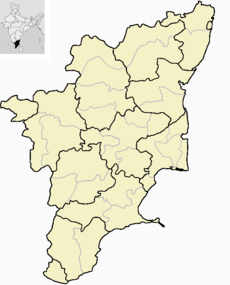
The following is a location map of Tamil Nadu state (in India), with all the 38 districts it consisted, as on 21st December 2023.
Former districts
| Map | District | Years | Successor districts |
|---|---|---|---|

|
Chingleput | 1956–1998 | Kanchipuram, Chengalpattu and Tiruvallur |

|
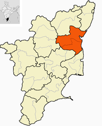
North Arcot | 1956–1989 | Tiruvannamalai, Vellore, Ranipet and Tirupattur |

|
South Arcot | 1956–1993 | Cuddalore, Villupuram and Kallakurichi |
See also
- List of developmental administrative units of Tamil Nadu
- List of revenue divisions of Tamil Nadu
- List of districts in Tamil Nadu by Human Development Index
- List of constituencies of the Tamil Nadu Legislative Assembly
- List of constituencies of the Lok Sabha in Tamil Nadu
References
- ^ "Formation of Dharmapuri district". Government of Tamil Nadu. 2 October 1966. Archived from the original on 12 April 2019. Retrieved 28 April 2020.
- ^ "Formation of Pudukottai district". Government of Tamil Nadu. 14 January 1974. Archived from the original on 10 May 2019. Retrieved 28 April 2020.
- ^ "Formation of Erode district". Government of Tamil Nadu. 31 August 1979. Archived from the original on 10 April 2019. Retrieved 28 April 2020.
- ^ "Formation of Sivgangai and Virudhunagar districts". Government of Tamil Nadu. 8 March 1985. Retrieved 28 April 2020.
- ^ "Formation of Sivgangai and Virudhunagar district". Government of Tamil Nadu. 8 March 1985. Archived from the original on 3 November 2019. Retrieved 28 April 2020.
- ^ "Formation of Sivgangai and Virudhunagar district". Government of Tamil Nadu. 8 March 1985. Archived from the original on 21 April 2020. Retrieved 28 April 2020.
- ^ "Formation of Dindigul district". Government of Tamil Nadu. 15 September 1985. Archived from the original on 29 December 2019. Retrieved 28 April 2020.
- ^ "Formation of Thoothukudi district". Government of Tamil Nadu. 2 October 1966. Archived from the original on 2 May 2019. Retrieved 28 April 2020.
- ^ "Formation of Tiruvannamalai district". Government of Tamil Nadu. 30 September 1989. Archived from the original on 24 April 2019. Retrieved 28 April 2020.
- ^ "Formation of Vellore district". Government of Tamil Nadu. 30 September 1989. Archived from the original on 10 October 2019. Retrieved 28 April 2020.
- ^ "Formation of Nagapattinam district". Government of Tamil Nadu. 18 October 1991. Archived from the original on 21 April 2019. Retrieved 28 April 2020.
- ^ "Formation of Cuddalore district". Government of Tamil Nadu. 30 September 1993. Archived from the original on 25 March 2020. Retrieved 28 April 2020.
- ^ "Formation of Villupuram district". Government of Tamil Nadu. 30 September 1993. Retrieved 28 April 2020.
- ^ "Formation of Karur and Perambalur districts". Government of Tamil Nadu. 30 September 1995. Retrieved 28 April 2020.
- ^ "Formation of Karur and Perambalur districts". Government of Tamil Nadu. 30 September 1995. Archived from the original on 9 May 2019. Retrieved 28 April 2020.
- ^ "Formation of Karur and Perambalur districts". Government of Tamil Nadu. 30 September 1995. Archived from the original on 2 November 2019. Retrieved 28 April 2020.
- ^ "Formation of Theni district". Government of Tamil Nadu. 25 July 1996. Archived from the original on 27 April 2019. Retrieved 28 April 2020.
- ^ "Formation of Tiruvarur district". Government of Tamil Nadu. 1 January 1997. Archived from the original on 29 March 2019. Retrieved 28 April 2020.
- ^ "Formation of Namakkal district". Government of Tamil Nadu. 1 January 1997. Archived from the original on 1 November 2019. Retrieved 28 April 2020.
- ^ "Formation ofKanchipuram district". Government of Tamil Nadu. 1 July 1997. Retrieved 28 April 2020.
- ^ "Formation of Tiruvallur district". Government of Tamil Nadu. 1 July 1997. Archived from the original on 20 April 2019. Retrieved 28 April 2020.
- ^ "Formation of Krishnagiri district". Government of Tamil Nadu. 9 February 2004. Archived from the original on 7 May 2019. Retrieved 28 April 2020.
- ^ "Formation of Ariyalur district". Government of Tamil Nadu. 19 November 2007. Archived from the original on 8 April 2019. Retrieved 28 April 2020.
- ^ "Formation of Tiruppur district". Government of Tamil Nadu. 24 October 2009. Archived from the original on 24 April 2020. Retrieved 28 April 2020.
- ^ "Formation of Tiruppur district". Government of Tamil Nadu. 24 October 2009. Archived from the original on 12 April 2019. Retrieved 28 April 2020.
- ^ "Formation of Tiruppur district". Government of Tamil Nadu. 24 October 2009. Archived from the original on 10 April 2019. Retrieved 28 April 2020.
- ^ "Expansion of Chennai district". Times of India. 5 January 2018. Retrieved 28 April 2020.
- ^ "Formation of Tenkasi district". The Hindu. 22 November 2019. Archived from the original on 14 November 2019. Retrieved 28 April 2020.
- ^ "Formation of Kallakuruchi district". New Indian Express. 26 November 2019. Retrieved 28 April 2020.
- ^ "Formation of Tirupattur and Ranipet districts". New Indian Express. 29 November 2019. Archived from the original on 24 December 2019. Retrieved 28 April 2020.
- ^ "Formation of Chengalpattu district". The Hindu. 30 November 2019. Archived from the original on 21 March 2020. Retrieved 28 April 2020.
- ^ "Formation of Mayiladuthurai district". The Hindu. 24 March 2020. Archived from the original on 25 April 2020. Retrieved 28 April 2020.
- ^ "A – 2: Decadal Variation Population Since 1901" (PDF). Registrar General and Census Commissioner of India. Archived (PDF) from the original on 13 November 2014. Retrieved 30 November 2019.
- ^ "Government of Tamil Nadu – Taluks". Information Technology Department, Government of Tamil Nadu. National Informatics Centre. Archived from the original on 3 October 2019. Retrieved 19 April 2020.
- ^ "Coimbatore District Statistical Handbook". Coimbatore District Administration. Archived from the original on 4 December 2015. Retrieved 21 November 2015.
- ^ "Erode District – District At a Glance". National Informatics Centre. Archived from the original on 11 September 2019. Retrieved 22 November 2019.

