Majagua, Cuba
Majagua | |
|---|---|
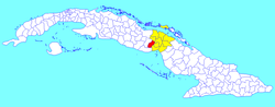 Majagua municipality (red) within Ciego de Ávila Province (yellow) and Cuba | |
| Coordinates: 21°55′28″N 78°59′26″W / 21.92444°N 78.99056°W | |
| Country | Cuba |
| Province | Ciego de Ávila |
| Government | |
| • President | Humberto Fleitas Portal |
| Area | |
| • Total | 544 km2 (210 sq mi) |
| Elevation | 110 m (360 ft) |
| Population (2022)[2] | |
| • Total | 24,987 |
| • Density | 46/km2 (120/sq mi) |
| Time zone | UTC-5 (EST) |
| Area code | +53-43 |
| Website | https://www.majagua.gob.cu/es/ |
Majagua (Spanish pronunciation: [maˈxaɣwa]) is a municipality and town in the Ciego de Ávila Province of Cuba. It is located in the eastern part of the province, and is bisected by the Carretera Central highway.
Geography
In addition to the main town, the municipality includes the villages of Guayacanes, Jicotea, Las Coloradas, and La Calera.
Demographics
In 2022, the municipality of Majagua had a population of 24,987.[2] With a total area of 544 km2 (210 sq mi),[1] it has a population density of 46/km2 (120/sq mi).
See also
References
- ^ a b Statoids (July 2003). "Municipios of Cuba". Retrieved 2007-10-06.
- ^ a b "Cuba: Administrative Division (Provinces and Municipalities) - Population Statistics, Charts and Map". www.citypopulation.de. Retrieved 2024-02-03.
External links
![]() Media related to Majagua at Wikimedia Commons
Media related to Majagua at Wikimedia Commons