Murindó
Murindó | |
|---|---|
Municipality and town | |
 Flag | |
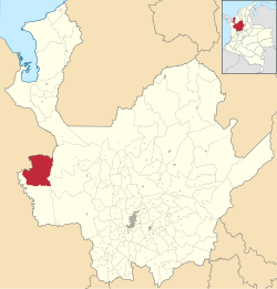 Location of the municipality and town of Murindó in the Antioquia Department of Colombia | |
 Murindó Location in Colombia | |
| Coordinates: 6°48′0″N 76°48′0″W / 6.80000°N 76.80000°W | |
| Country | |
| Department | |
| Subregion | Urabá |
| Time zone | UTC-5 (Colombia Standard Time) |
Murindó is a town and municipality in the Colombian department of Antioquia. It is part of the Urabá Antioquia sub-region.
Climate
Murindó has a tropical rainforest climate (Af) with heavy to very heavy rainfall year-round.
| Climate data for Murindó | |||||||||||||
|---|---|---|---|---|---|---|---|---|---|---|---|---|---|
| Month | Jan | Feb | Mar | Apr | May | Jun | Jul | Aug | Sep | Oct | Nov | Dec | Year |
| Mean daily maximum °C (°F) | 30.7 (87.3) |
31.0 (87.8) |
31.4 (88.5) |
31.4 (88.5) |
30.0 (86.0) |
30.1 (86.2) |
30.3 (86.5) |
30.2 (86.4) |
29.6 (85.3) |
29.4 (84.9) |
29.6 (85.3) |
29.8 (85.6) |
30.3 (86.5) |
| Daily mean °C (°F) | 26.6 (79.9) |
27.0 (80.6) |
27.3 (81.1) |
27.4 (81.3) |
26.7 (80.1) |
26.6 (79.9) |
26.7 (80.1) |
26.6 (79.9) |
26.3 (79.3) |
26.1 (79.0) |
26.2 (79.2) |
26.3 (79.3) |
26.7 (80.0) |
| Mean daily minimum °C (°F) | 22.5 (72.5) |
23.0 (73.4) |
23.3 (73.9) |
23.4 (74.1) |
23.4 (74.1) |
23.1 (73.6) |
23.2 (73.8) |
23.1 (73.6) |
23.1 (73.6) |
22.9 (73.2) |
22.8 (73.0) |
22.9 (73.2) |
23.1 (73.5) |
| Average rainfall mm (inches) | 224 (8.8) |
171 (6.7) |
215 (8.5) |
413 (16.3) |
423 (16.7) |
446 (17.6) |
477 (18.8) |
539 (21.2) |
471 (18.5) |
481 (18.9) |
462 (18.2) |
430 (16.9) |
4,752 (187.1) |
| [citation needed] | |||||||||||||