Ramsgate, KwaZulu-Natal
Ramsgate | |
|---|---|
 Ramsgate Main Beach | |
| Coordinates: 30°52′56″S 30°21′20″E / 30.88222°S 30.35556°E | |
| Country | South Africa |
| Province | KwaZulu-Natal |
| District | Ugu |
| Municipality | Ray Nkonyeni |
| Main Place | Margate |
| Area | |
| • Total | 0.83 km2 (0.32 sq mi) |
| Population (2011)[1] | |
| • Total | 1,080 |
| • Density | 1,300/km2 (3,400/sq mi) |
| Racial makeup (2011) | |
| • Black African | 41.7% |
| • Coloured | 1.9% |
| • Indian/Asian | 2.0% |
| • White | 54.0% |
| • Other | 0.4% |
| First languages (2011) | |
| • English | 46.0% |
| • Afrikaans | 20.6% |
| • Zulu | 16.8% |
| • Xhosa | 13.3% |
| • Other | 3.3% |
| Time zone | UTC+2 (SAST) |
| PO box | 4275 |
| Area code | 039 |
| Website | ramsgatevillage |
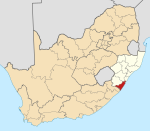
Ramsgate is a village on the south coast of KwaZulu-Natal in South Africa, just southwest of Margate. Ramsgate is located on the mouth of a river known by the Zulu name Bilanhlolo ("the marvellous boiler") for the bubbles caused by strong currents making it look like the water is boiling.[2]: 331 In 1922, there was only one person living there, Paul Buck, a painter and violin maker and he called the place Blue Lagoon.[2]: 332
Infrastructure
Roads
The R61 (future N2 Wild Coast Toll Route) is a toll freeway bypassing Ramsgate from Port Shepstone in the north to Port Edward in the south. The R620 is the main road through Ramsgate, passing through from Margate in the north to Southbroom in the south as Marine Drive. Alford Avenue is an east–west route providing access to the R61 and Izotsha Road (to Izotsha and Gamalakhe).
References
- ^ a b c d "Sub Place Ramsgate". Census 2011.
- ^ a b Illustrated guide to Southern Africa. Internet Archive. Cape Town : Published by Reader's Digest Association South Africa in association with T.V. Bulpin. 1980. ISBN 978-0-620-04650-3.
{cite book}: CS1 maint: others (link)


