Road signs in Belgium

Road signs in Belgium are defined in the Royal Decree of 1 December 1975 on general regulations for the road traffic police and in the use of public highways.[1] They generally conform to the 1968 Vienna Convention on Road Signs and Signals.[2] The official typeface on road signs in Belgium is SNV.[3]
Belgium signed the Vienna Convention on Road Signs and Signals on November 8, 1968, and ratified it on November 16, 1988.[4]
Warning signs
-
 A1a: Curve to the left
 -
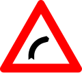 A1b: Curve to the right
 -
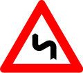 A1c: Double curve, first to the left
 -
 A1d: Double curve, first to the right
 -
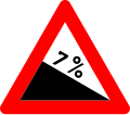 A3: Steep descent
 -
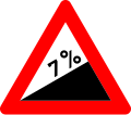 A5: Steep ascent
 -
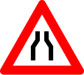 A7a: Road narrows
 -
 A7b: Road narrows on the left
 -
 A7c: Road narrows on the right
 -
 A9: Opening bridge
 -
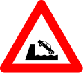 A11: Quay or riverbank
 -
 A13: Uneven road
 -
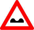
 A14: Road hump
 -
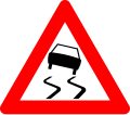 A15: Slippery road
 -
 A17: Loose surface
 -
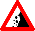 A19: Falling roads
 -
 A21: Pedestrian crossing
 -
 A23: Children
 -
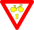
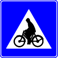
 A25: Cyclists
 -
 A27: Wild animals crossing
 -
 A29: Domestic animals crossing
 -
 A31: Roadworks
 -
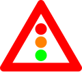 A33: Traffic signals
 -
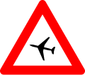 A35: Low-flying aircraft
 -
 A37: Crosswinds
 -
 A39: Two-way traffic
 -
 A41: Railroad crossing ahead with gates or barriers
 -
 A43: Railroad crossing ahead without gates or barriers
 -
 A45: Railroad crossing (single track)
 -
 A47: Railroad crossing (multiple tracks)
 -
 A49: Tramway crossing
 -
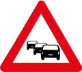 A50: Traffic queues likely
 -
 A51: Other danger


Priority signs
-
 B1: Yield
 -
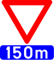 B3: Yield in 150 metres
 -
 B5: Stop
 -
 B7: Stop in 150 metres
 -
 B9: Priority road
 -
 B11: End of priority road
 -
 B13: End of priority road in 250 metres
 -
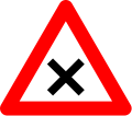
 B15: Intersection with priority
 -
 B17: Intersection with priority to the right
 -
 B19: Yield to oncoming traffic
 -
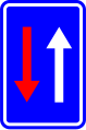 B21: Priority over oncoming traffic
 -
 B22: Bike may pass a yellow or red light to turn right, after yield
 -
 B23: Bike may pass a yellow or red light to go straight, after yield


Prohibitory signs
-
 C1: Do not enter
 -
 C3: No vehicles in both directions
 -
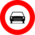 C5: No entry for motor vehicles with more than two wheels and motorcycles with sidecar
 -
 C6: No entry for motor vehicles with four wheels, constructed for off-road use, with an open bodywork, a steering wheel as on a motorcycle and a saddle
 -
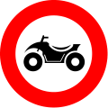
 C7: No entry for motorcycles
 -
 C9: No entry for mopeds
 -
 C11: No entry for bicycles
 -
 C13: No entry for horse-drawn vehicles
 -
 C15: No entry for horse riders
 -
 C17: No entry for hand carts
 -
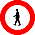 C19: No entry for pedestrians
 -
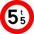 C21: Weight limit
 -
 C22: No entry for buses
 -
 C23: No entry for trucks
 -
 C24a: No entry for vehicles transporting dangerous goods
 -
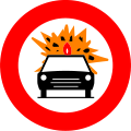 C24b: No entry for vehicles transporting flammable or explosive goods
 -
 C24c: No entry for vehicles transporting water polluting goods
 -
 C25: Length limit
 -
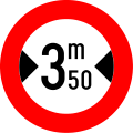 C27: Width limit
 -
 C29: Height limit
 -
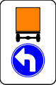
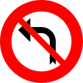 C31a: No left turn
 -
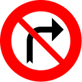 C31b: No right turn
 -
 C33: No U-turn
 -
 C35: No overtaking
 -
 C37: End of the overtaking restriction
 -
 C39: No overtaking for vehicles with a maximum allowed mass of over 3,5 tonnes
 -
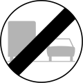 C41: End of the overtaking restriction for vehicles with a maximum allowed mass of over 3,5 tonnes
 -
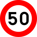 C43: Maximum speed
 -
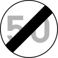 C45: End of the maximum speed restriction
 -
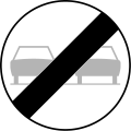
 C46: End of the restrictions imposed on moving vehicles
 -
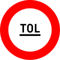 C47: Toll post


Mandatory signs
-
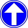 D1a: Ahead only
 -
 D1b: Turn left
 -
 D1b: Turn right
 -
 D1c: Pass on left
 -
 D1d: Pass on right
 -
 D1e: Turn left ahead
 -
 D1f: Turn right
 -
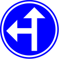 D3a: Turn left or ahead only
 -
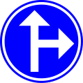 D3b: Turn right or ahead only
 -
 D4: Directon of vehicles transporting dangerous goods (turn left)
 -
 D4: Directon of vehicles transporting dangerous goods (ahead only)
 -
 D4: Directon of vehicles transporting dangerous goods (turn right)
 -
 D5: Roundabout
 -
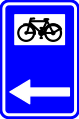
 D7: Cycleway
 -
 D9a: Segregated path for pedestrians and cyclists
 -
 D9b: Segregated path for pedestrians and cyclists
 -
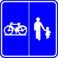
 D10: Shared path for pedestrians and cyclists
 -
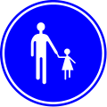 D11: Footpath
 -
 D13: Bridlepath


Parking signs
-
 E1: No parking
 -
 E3: No stopping
 -
 E5: No parking from the 1st till 15th day of the month
 -
 E7: No parking forbidden from the 16th till last day of the month
 -
 E9a: Parking permitted
 -
 E9a: Parking permitted, when using parking disk
 -
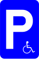 E9a: Parking reserved for the disabled
 -
 E9b: Parking reserved for motorcycles, cars, vans (< 3.5t) and minibusses
 -
 E9c: Parking reserved for trucks
 -
 E9d: Parking reserved for coaches
 -
 E9e: Parking mandatory on the verge or sidewalk
 -
 E9f: Parking mandatory partly on the verge or sidewalk
 -
 E9g: Parking mandatory on the road
 -
 E9h: Parking reserved for campers
 -
 E9i: Parking reserved for motorcycles
 -
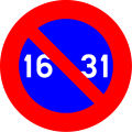
 E11: Half-monthly parking restriction in built-up areas


Indicatory signs

-
 F1a: Start of a built up area
 -
 F1a: Start of a built up area
 -
 F1b: Start of a built up area
 -
 F1b: Start of a built up area
 -
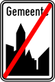
 F3a: End of a built up area
 -
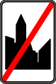
 F3a: End of a built up area
 -
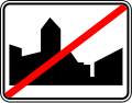 F3b: End of a built up area
 -
 F3b: End of a built up area
 -
 F4a: Start of a 30 km/h speed zone
 -
 F4b: End of a 30 km/h speed zone
 -
 F5: Start of a motorway
 -
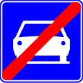
 F7: End of a motorway
 -
 F8: Tunnel
 -
 F9: Start of a motorroad
 -
 F11: End of a motorroad
 -
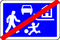
 F12a: Start of a living street
 -
 F12b: End of a living street
 -
 F13: Turn lane(s)
 -
 F14: Advanced stop line for bicycles
 -
 F15: Indication of the choice of direction
 -
 F17: Bus lane
 -
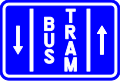 F18: Bus and tram lane
 -
 F19: One-way road
 -
 F21: Pass on either side
 -
 F23a: Number of a national road
 -
 F23b: Number of a motorway
 -
 F23c: Number of an international road
 -
 F23d: Number of a ringroad
 -
 F25: Direction sign
 -
 F27: Direction sign
 -
 F29: Direction sign
 -
 F31: Direction sign (over motorways)
 -
 F33a: Direction sign
 -
 F33b: Direction sign (valley or stream)
 -
 F33c: Direction sign (touristic destination)
 -
 F34a: Direction sign (important public destinations)
 -
 F34b1: Direction sign (for cyclists, horse riders and pedestrians)
 -
 F34b2: Direction sign (for cyclists, horse riders and pedestrians)
 -
 F34c1: Direction sign (touristic destinations for cyclists, horse riders and pedestrians)
 -
 F34c2: Direction sign (touristic destinations for cyclists, horse riders and pedestrians)
 -
 F35: Direction sign (touristic destinations)
 -
 F37: Direction sign (hotels, hostels, restaurants ...)
 -
 F39: Direction sign (detours)
 -
 F41: Direction sign (detours)
 -
 F43: Municipal boundary
 -
 F45: Dead end
 -
 F45b: Dead end, except for pedestrians and cyclists
 -
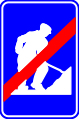 F47: End of roadworks
 -
 F49: Pedestrian crossing
 -
 F50: Cyclist and moped crossing
 -
 F50bis: Warning for cyclists and/or pedestrians when turning in
 -
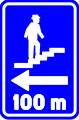
 F51a: Crossing for pedestrians below ground
 -
 F51b: Crossing for pedestrians above ground
 -
 F52: Emergency exit in tunnel
 -
 F52bis: Emergency exit route
 -
 F53: Healthcare facility (hospital, nursing home ...)
 -
 F55: First aid post
 -
 F56: Fire extinguisher
 -
 F57: Stream
 -
 F59: Parking lot
 -
 F60: Parking garage
 -
 F61: Telephone
 -
 F62: Emergency telephone
 -
 F63: Fuel station
 -
 F65: Hotel or motel
 -
 F67: Restaurant
 -
 F69: Bar/café
 -
 F71: Camping area
 -
 F73: Trailer park
 -
 F75: Youth hostel
 -
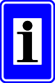 F77: Information point for foreigners or touristic information
 -
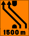
 F79: Reduction of lanes
 -
 F81: Lane displacement
 -
 F83: Cut through median
 -
 F85: Traffic allowed in both directions on a one-way road
 -
 F87: Hump
 -
 F89: Speed limit on certain lanes in ...m
 -
 F91: Speed limit on certain lanes
 -
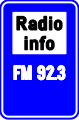 F93: Radio station broadcasting traffic information
 -
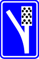 F95: Runaway ramp
 -
 F97: Reduction of lanes
 -
 F98: Emergency bay
 -
 F99a: Start of a road or part of a road reserved for pedestrians, cyclists horse riders and drivers of speed pedelecs
 -
 F99b: Start of a road or part of a road reserved for pedestrians, cyclists horse riders and drivers of speed pedelecs with segregation
 -
 F99c: Start of a road or part of a road reserved for farm vehicles, pedestrians, cyclists horse riders and drivers of speed pedelecs
 -
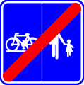
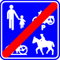 F101a: End of a road or part of a road reserved for pedestrians, cyclists horse riders and drivers of speed pedelecs
 -
 F101b: End of a road or part of a road reserved for pedestrians, cyclists horse riders and drivers of speed pedelecs with segregation
 -
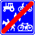 F101c: End of a road or part of a road reserved for farm vehicles, pedestrians, cyclists horse riders and drivers of speed pedelecs
 -
 F103: Start of a pedestrian zone
 -
 F105: End of a pedestrian zone
 -
 F111: Cycle street
 -
 F117: Start of a low emission zone
 -
 F118: End of a low emission zone
 -
 F119: Start of an airport zone
 -
 F120: End of an airport zone


Additional signs
-
 M1: Only for bicyclists
 -
 M2: Except bicyclists
 -
 M3: Except bicyclists and mopeds class A (mofas)
 -
 M3bis: Except bicyclists and mopeds
 -
 M4: Except bicyclists
 -
 M5: Except bicyclists and mopeds class A (mofas)
 -
 M5bis: Except bicyclists and mopeds
 -
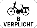 M6: Compulsory for mopeds class B
 -
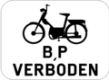
 M7: Forbidden for mopeds class B
 -
 M8: Only for bicyclists and mopeds
 -
 M9: Bicyclists coming from left and right
 -
 M10: Bicyclists and mopeds coming from left and right
 -
 M16: Forbidden for mopeds class B and P (speed pedelecs)
 -
 GXI: Sign above only applies to the exit
 -
 GXa: Start of a parking regulation
 -
 GXb: End of a parking regulation
 -
 GXc: Parking regulation during the following ...m
 -
 GXd: Repeating a parking regulation
 -
 GVIId: Parking reserved for the disabled


Icons
-
 S1: Airport
 -
 S2: Exposition center
 -
 S3: Harbour
 -
 S4: Car ferry
 -
 S5: Business and industrial zone
 -
 S10: Police department
 -
 S11: Fire department
 -
 S12: Civil protection
 -
 S13: Cemetery
 -
 S14: Bus terminal
 -
 S15: Train station
 -
 S16: Goods station
 -
 S17: City hall
 -
 S18: Religious building
 -
 S19: Court building
 -
 S20: Car shuttle train
 -
 S21: Post office
 -
 S30: Sports center
 -
 S31: Castle
 -
 S32: Ruins
 -
 S33: Monastery/abbey
 -
 S34: Cultural, recreational or amusement park
 -
 S35: Image of a monument or important landscape
 -
 S36: Park


Obsolete signs
-
 C48: No use of cruise control
 -
 C49: End of the cruise control restriction
 -
 F113: End of cycle street


New road signs
In June 2024, new and improved road signs are used from 1 September 2026.[5]
-
 A1a: Curve to the left
 -
 A1b: Curve to the right
 -
 A1c: Double curve, first to the left
 -
 A1d: Double curve, first to the right
 -
 A3: Steep descent
 -
 A5: Steep ascent
 -
 A7a: Road narrows
 -
 A8: Soft shoulders
 -
 A9: Opening bridge
 -
 A11: Quay or riverbank
 -
 A13: Uneven road
 -
 A14: Road hump
 -
 A15: Slippery road
 -
 A16: Ice or snow
 -
 A17: Loose surface
 -
 A18: Reduced visibility
 -
 A19: Falling roads
 -
 A21: Pedestrian crossing
 -
 A23: Children
 -
 A25: Cyclists
 -
 A27: Animals crossing (big game)
 -
 A27: Animals crossing (livestock)
 -
 A31: Roadworks
 -
 A32: Traffic queues
 -
 A33: Traffic signals
 -
 A35: Low-flying aircraft
 -
 A37: Crosswinds
 -
 A39: Two-way traffic
 -
 A41: Railroad crossing ahead with barriers
 -
 A43: Railroad crossing ahead without barriers
 -
 A45: Railroad crossing (single track)
 -
 A47: Railroad crossing (multiple tracks)
 -
 A49: Tramway crossing
 -
 A51: Other danger
 -
 B1: Yield
 -
 B5: Stop
 -
 B9: Priority road
 -
 B11: End of priority road
 -
 B15: Intersection with priority
 -
 B17: Intersection with priority to the right
 -
 B19: Yield to oncoming traffic
 -
 B21: Priority over oncoming traffic
 -
 B22: Yield to cyclists
 -
 C1: Do no enter
 -
 C3: No vehicles in both directions
 -
 C5: No entry for motor vehicles with more than two wheels and motorcycles with sidecar
 -
 C7: No entry for motorcycles
 -
 C8: No entry for tractors
 -
 C9: No entry for mopeds
 -
 C11: No entry for bicycles
 -
 C13: No entry for horse-drawn vehicles
 -
 C19: No entry for pedestrians
 -
 C21: Weight limit
 -
 C22: Axle weight limit
 -
 C23: No entry for buses
 -
 C24: No entry for trucks
 -
 C25a: No entry for vehicles transporting dangerous goods
 -
 C25b: No entry for vehicles transporting flammable or explosive goods
 -
 C25c: No entry for vehicles transporting water polluting goods
 -
 C26: Length limit
 -
 C27: Width limit
 -
 C29: Height limit
 -
 C30: No entry for vehicles towing caravans
 -
 C32a: No left turn
 -
 C32b: No right turn
 -
 C33: No U-turn
 -
 C35: No overtaking
 -
 C41: End of the overtaking restriction
 -
 C39: No overtaking for vehicles with a maximum allowed mass of over 3,5 tonnes
 -
 C41: End of the overtaking restriction for vehicles with a maximum allowed mass of over 3,5 tonnes
 -
 C43: Maximum speed
 -
 C45: End of the maximum speed restriction
 -
 C46: End of the restrictions imposed on moving vehicles
 -
 D1a: Ahead only
 -
 D1b: Turn right ahead
 -
 D1c: Turn left ahead
 -
 D1d: Pass on right
 -
 D1e: Pass on left
 -
 D1f: Turn right
 -
 D1g: Turn left
 -
 D3a: Turn right or ahead only
 -
 D3b: Turn left or ahead only
 -
 D3c: Turn left or right
 -
 D4: Directon of vehicles transporting dangerous goods
 -
 D5: Roundabout
 -
 D7: Cycleway
 -
 D8: End of cycleway
 -
 D9: Segregated path for pedestrians and cyclists
 -
 D9: Segregated path for pedestrians and cyclists
 -
 D11: Shared path for pedestrians and cyclists
 -
 D13: Footpath
 -
 D15: Bridlepath
 -
 E1: No parking
 -
 E3: No stopping
 -
 E9: Parking


See also
References
- ^ "Koninklijk besluit van 1 december 1975 houdende algemeen reglement op de politie van het wegverkeer en van het gebruik van de openbare weg" (PDF). static.tijd.be (in Flemish).
- ^ "Convention on Road Signs and Signals Vienna, 8 November 1968". United Nations. Retrieved 1 September 2012.
- ^ "Handleiding verticale signalisatie" (PDF). wegenenverkeer.be (in Flemish).
- ^ "United Nations Treaty Collection". treaties.un.org. Retrieved 2023-12-09.
- ^ "New Belgian road code is now official". Retrieved 2025-01-24.