Rovinka
Rovinka | |
|---|---|
Municipality | |
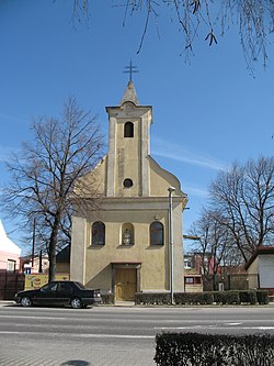 Church of Holy Trinity | |
 Rovinka Location of Rovinka in the Bratislava Region  Rovinka Rovinka (Slovakia) | |
| Coordinates: 48°06′N 17°14′E / 48.100°N 17.233°E | |
| Country | Slovakia |
| Region | Bratislava |
| District | Senec |
| First mentioned | 1274 |
| Area | |
| • Total | 8.85[2] km2 (3.42[2] sq mi) |
| Elevation | 130[3] m (430[3] ft) |
| Population (2021) | |
| • Total | 5,445[1] |
| Postal code | 900 41[3] |
| Area code | +421 20[3] |
| Car plate | SC |
| Website | www.obecrovinka.sk |
Rovinka (Hungarian: Csölle, German: Waltersdorf) is a village and municipality in western Slovakia in Senec District in the Bratislava Region.

History
In historical records the village was first mentioned in 1274. Until their expulsion in 1945 the village was inhabited by Germans.
Geography
The municipality lies at an altitude of 132 metres and covers an area of 8.853 km².
Demographics
According to the 2011 census, the municipality had 2,250 inhabitants. 1,998 of inhabitants were Slovaks, 78 Hungarians, 23 Czechs, 12 Germans, 1 Kazakh and 139 others and unspecified.[5]
References
- ^ "Počet obyvateľov podľa pohlavia - obce (ročne)". www.statistics.sk (in Slovak). Statistical Office of the Slovak Republic. 2022-03-31. Retrieved 2022-03-31.
- ^ a b "Hustota obyvateľstva - obce [om7014rr_ukaz: Rozloha (Štvorcový meter)]". www.statistics.sk (in Slovak). Statistical Office of the Slovak Republic. 2022-03-31. Retrieved 2022-03-31.
- ^ a b c d "Základná charakteristika". www.statistics.sk (in Slovak). Statistical Office of the Slovak Republic. 2015-04-17. Retrieved 2022-03-31.
- ^ a b "Hustota obyvateľstva - obce". www.statistics.sk (in Slovak). Statistical Office of the Slovak Republic. 2022-03-31. Retrieved 2022-03-31.
- ^ http://portal.statistics.sk/files/obce-narodnost.pdf[bare URL PDF]
External links/Sources
![]() Media related to Rovinka at Wikimedia Commons
Media related to Rovinka at Wikimedia Commons
- Official page
- https://web.archive.org/web/20070513023228/http://www.statistics.sk/mosmis/eng/run.html