Rubempré
Rubempré | |
|---|---|
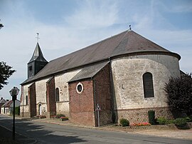 The church in Rubempré | |
 Coat of arms | |
 Rubempré  Rubempré | |
| Coordinates: 50°01′11″N 2°23′12″E / 50.0197°N 2.3867°E | |
| Country | France |
| Region | Hauts-de-France |
| Department | Somme |
| Arrondissement | Amiens |
| Canton | Corbie |
| Intercommunality | CC Territoire Nord Picardie |
| Government | |
| • Mayor (2020–2026) | Anne Loire[1] |
| Area 1 | 10.08 km2 (3.89 sq mi) |
| Population (Jan. 2020)[2] | 729 |
| • Density | 72/km2 (190/sq mi) |
| Time zone | UTC+01:00 (CET) |
| • Summer (DST) | UTC+02:00 (CEST) |
| INSEE/Postal code | 80686 /80260 |
| Elevation | 89–147 m (292–482 ft) (avg. 131 m or 430 ft) |
| 1 French Land Register data, which excludes lakes, ponds, glaciers > 1 km2 (0.386 sq mi or 247 acres) and river estuaries. | |
Rubempré (French pronunciation: [ʁybɑ̃pʁe]; Picard: Rubimpré) is a commune in the Somme department in Hauts-de-France in northern France.
Geography
The commune is situated some 9 miles (14 km) north of Amiens, at the junction of the D11 and D113 roads.
Population
| Year | Pop. | ±% p.a. |
|---|---|---|
| 1968 | 421 | — |
| 1975 | 433 | +0.40% |
| 1982 | 486 | +1.66% |
| 1990 | 634 | +3.38% |
| 1999 | 675 | +0.70% |
| 2007 | 774 | +1.73% |
| 2012 | 720 | −1.44% |
| 2017 | 726 | +0.17% |
| Source: INSEE[3] | ||
See also
References
- ^ "Répertoire national des élus: les maires" (in French). data.gouv.fr, Plateforme ouverte des données publiques françaises. 13 September 2022.
- ^ "Populations légales 2020". The National Institute of Statistics and Economic Studies. 29 December 2022.
- ^ Population en historique depuis 1968, INSEE
Wikimedia Commons has media related to Rubempré.
| Authority control databases: National |
|---|