Sains-lès-Pernes
Sains-lès-Pernes | |
|---|---|
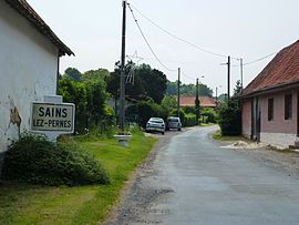 The road into of Sains-lès-Pernes | |
 Coat of arms | |
 Sains-lès-Pernes  Sains-lès-Pernes | |
| Coordinates: 50°28′42″N 2°21′26″E / 50.4783°N 2.3572°E | |
| Country | France |
| Region | Hauts-de-France |
| Department | Pas-de-Calais |
| Arrondissement | Arras |
| Canton | Saint-Pol-sur-Ternoise |
| Intercommunality | CC Ternois |
| Government | |
| • Mayor (2023–2026) | Pauline Boëte[1] |
Area 1 | 4.2 km2 (1.6 sq mi) |
| Population (2022)[2] | 303 |
| • Density | 72/km2 (190/sq mi) |
| Time zone | UTC+01:00 (CET) |
| • Summer (DST) | UTC+02:00 (CEST) |
| INSEE/Postal code | 62740 /62550 |
| Elevation | 111–186 m (364–610 ft) (avg. 165 m or 541 ft) |
| 1 French Land Register data, which excludes lakes, ponds, glaciers > 1 km2 (0.386 sq mi or 247 acres) and river estuaries. | |
Sains-lès-Pernes (French pronunciation: [sɛ̃ lɛ pɛʁn], literally Sains near Pernes) is a commune in the Pas-de-Calais department in the Hauts-de-France region of France[3] about 27 miles (43 km) northwest of Arras, close to the town of Pernes. It is the source of the river Clarence, at a place known as "Le Buich".
Population
| Year | Pop. | ±% p.a. |
|---|---|---|
| 1968 | 271 | — |
| 1975 | 262 | −0.48% |
| 1982 | 250 | −0.67% |
| 1990 | 221 | −1.53% |
| 1999 | 209 | −0.62% |
| 2007 | 251 | +2.32% |
| 2012 | 278 | +2.06% |
| 2017 | 292 | +0.99% |
| Source: INSEE[4] | ||
See also
References
- ^ "Répertoire national des élus: les maires" (in French). data.gouv.fr, Plateforme ouverte des données publiques françaises. 6 June 2023.
- ^ "Populations de référence 2022" (in French). The National Institute of Statistics and Economic Studies. 19 December 2024.
- ^ INSEE commune file
- ^ Population en historique depuis 1968, INSEE
Wikimedia Commons has media related to Sains-lès-Pernes.
| Authority control databases: National |
|---|