Thakurgaon Sadar Upazila
Thakurgaon Sadar
ঠাকুরগাঁও সদর | |
|---|---|
 Thakurgaon Sadar Location in Bangladesh | |
| Coordinates: 26°1.2′N 88°28′E / 26.0200°N 88.467°E | |
| Country | |
| Division | Rangpur Division |
| District | Thakurgaon District |
| Area | |
| • Total | 683.45 km2 (263.88 sq mi) |
| Population (2011) | |
| • Total | 581,227[1] |
| Time zone | UTC+6 (BST) |
| Postal code | 5100 |
| Website | thakurgaonsadar |
Thakurgaon Sadar (Bengali: ঠাকুরগাঁও সদর) is an upazila of Thakurgaon District in the Division of Rangpur, Bangladesh.[2]
Geography
Thakurgaon Sadar is located at 26°01′15″N 88°28′00″E / 26.0208°N 88.4667°E. It has 79823 households and total area 683.46 km2. It is bounded by Atwari and Boda upazilas on the north, Pirganj (Thakurgaon) and Birganj upazilas on the south, Boda, Debiganj and Birganj upazilas on the east, Baliadangi and Ranisankail upazilas on the west.[3]
Demographics
According to the 2001 Bangladesh census, Thakurgaon sadar upazila has a population of 504428; males 260515, females 243913; Muslim 369486, Hindu 129794, Buddhist 3614, Christian 38 and others 1496. Indigenous communities such as santal, oraon, munda, Mushar and rajbanshi belong to this upazila.[3]
As of the 1991 Bangladesh census, the upazila has a population of 422728. Males constitute 51.7% of the population, and females 48.3%. This Upazila's eighteen up population is 214112. Thakurgaon Sadar has an average literacy rate of 30.1% (7+ years), and the national average of 32.4% literate.[4]
Administration
Thakurgaon Sadar Thana formed in 1800 and it was turned into an upazila in 1984.[5]
Thakurgaon Upazila is divided into Thakurgaon Municipality and 19 union parishads: Akhanagar, Akcha, Auliapur, Balia, Baragaon, Begunbari, Chilarang, Debipur, Gareya, Jagannathpur, Jamalpur, Mohammadpur, Nargun, Rahimanpur, Rajagaon, Ruhea, Roypur, Salandar, and Sukhanpukhari. The union parishads are subdivided into 194 mauzas and 198 villages.[6]
Gallery
-
 The Monument of 1971 War beside Tangon River
 -
 Shuk River at Thakurgaon Sadar Upazila
 -
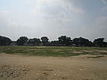 Playground of Thakurgaon
 -
 Tangon River from Tangon Bridge
 -
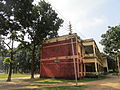 A science building of Thakurgaon Govt.College.


See also
References
- ^ "Thakurgaon (District (Zila), Bangladesh) - Population Statistics and Location in Maps and Charts". citypopulation.de.
- ^ Abu Md. Iqbal Rumi Shah (2012), "Thakurgaon Sadar Upazila", in Sirajul Islam and Ahmed A. Jamal (ed.), Banglapedia: National Encyclopedia of Bangladesh (Second ed.), Asiatic Society of Bangladesh
- ^ a b "Thakurgaon Sadar Upazila - Banglapedia". en.banglapedia.org. Retrieved 2023-02-21.
- ^ "Population Census Wing, BBS". Archived from the original on 2005-03-27. Retrieved November 10, 2006.
- ^ "Thakurgaon Sadar Upazila - Banglapedia". en.banglapedia.org. Retrieved 2023-02-21.
- ^ "District Statistics 2011: Thakurgaon" (PDF). Bangladesh Bureau of Statistics. Archived from the original (PDF) on 13 November 2014. Retrieved 14 July 2014.
| Upazila/Thana: | ||
|---|---|---|
Capital: Rangpur | ||
| Dinajpur District |  | |
| Gaibandha District | ||
| Kurigram District | ||
| Lalmonirhat District | ||
| Nilphamari District | ||
| Panchagarh District | ||
| Rangpur District | ||
| Thakurgaon District | ||