Tipton Township, Cass County, Indiana
Tipton Township | |
|---|---|
 Farmland in Tipton Township | |
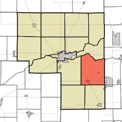 Location of Tipton Township in Cass County | |
| Coordinates: 40°41′54″N 86°13′06″W / 40.69833°N 86.21833°W | |
| Country | United States |
| State | Indiana |
| County | Cass |
| Government | |
| • Type | Indiana township |
| Area | |
| • Total | 40.77 sq mi (105.58 km2) |
| • Land | 40.62 sq mi (105.22 km2) |
| • Water | 0.14 sq mi (0.36 km2) |
| Elevation | 755 ft (230 m) |
| Population (2010) | |
| • Total | 2,490 |
| • Density | 61/sq mi (24/km2) |
| FIPS code | 18-75968[2] |
| GNIS feature ID | 453899 |
Tipton Township is one of fourteen townships in Cass County, Indiana, United States. As of the 2010 census, its population was 2,490.[3]
History
Tipton Township was organized in 1840.[4] It was named for Indiana Senator John Tipton.[5]
Pipe Creek Falls Resort was listed on the National Register of Historic Places in 1995.[6]
Geography
Tipton Township covers an area of 40.77 square miles (105.6 km2); 0.14 square miles (0.36 km2) (0.34 percent) of this is water.
Cities and towns
Adjacent townships
- Miami (north)
- Peru Township, Miami County (northeast)
- Pipe Creek Township, Miami County (east)
- Deer Creek Township, Miami County (southeast)
- Jackson (south)
- Deer Creek (southwest)
- Washington (west)
Major highways
Cemeteries
The township contains five cemeteries: Bowyer, Little Deer Creek, Shaff, Venard and Walton.
References
- ^ "US Board on Geographic Names". United States Geological Survey. October 25, 2007. Retrieved January 31, 2008.
- ^ "U.S. Census website". United States Census Bureau. Retrieved January 31, 2008.
- ^ "Geographic Identifiers: 2010 Demographic Profile Data (G001): Tipton township, Cass County, Indiana". U.S. Census Bureau, American Factfinder. Archived from the original on February 12, 2020. Retrieved January 15, 2013.
- ^ Powell, Jehu Z. (1913). History of Cass County Indiana: From Its Earliest Settlement to the Present Time. Lewis Publishing Company. pp. 678.
- ^ Helm, Thomas B. (1878). History of Cass County, Indiana. Kingman Bros. pp. 42.
- ^ "National Register Information System". National Register of Historic Places. National Park Service. July 9, 2010.
External links
Wikimedia Commons has media related to Tipton Township, Cass County, Indiana.
Municipalities and communities of Cass County, Indiana, United States | ||
|---|---|---|
| City |  | |
| Towns | ||
| Townships | ||
| CDPs | ||
| Other communities | ||
| Footnotes | ‡This populated place also has portions in an adjacent county or counties | |