Velké Tresné
Velké Tresné | |
|---|---|
 Main road | |
 Flag  Coat of arms | |
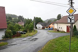
 Velké Tresné Location in the Czech Republic | |
| Coordinates: 49°34′31″N 16°22′50″E / 49.57528°N 16.38056°E | |
| Country | |
| Region | Vysočina |
| District | Žďár nad Sázavou |
| First mentioned | 1351 |
| Area | |
| • Total | 2.77 km2 (1.07 sq mi) |
| Elevation | 564 m (1,850 ft) |
| Population (2023-01-01)[1] | |
| • Total | 102 |
| • Density | 37/km2 (95/sq mi) |
| Time zone | UTC+1 (CET) |
| • Summer (DST) | UTC+2 (CEST) |
| Postal code | 592 65 |
| Website | www |
Velké Tresné is a municipality and village in Žďár nad Sázavou District in the Vysočina Region of the Czech Republic. It has about 100 inhabitants.
Velké Tresné lies approximately 33 kilometres (21 mi) east of Žďár nad Sázavou, 61 km (38 mi) east of Jihlava, and 152 km (94 mi) east of Prague.
Demographics
| Year | Pop. | ±% |
|---|---|---|
| 1869 | 215 | — |
| 1880 | 247 | +14.9% |
| 1890 | 261 | +5.7% |
| 1900 | 248 | −5.0% |
| 1910 | 252 | +1.6% |
| 1921 | 243 | −3.6% |
| 1930 | 216 | −11.1% |
| 1950 | 233 | +7.9% |
| 1961 | 246 | +5.6% |
| 1970 | 237 | −3.7% |
| 1980 | 188 | −20.7% |
| 1991 | 165 | −12.2% |
| 2001 | 126 | −23.6% |
| 2011 | 119 | −5.6% |
| 2021 | 106 | −10.9% |
| Source: Censuses[2][3] | ||
References
- ^ "Population of Municipalities – 1 January 2023". Czech Statistical Office. 2023-05-23.
- ^ "Historický lexikon obcí České republiky 1869–2011 – Okres Žďár nad Sázavou" (in Czech). Czech Statistical Office. 2015-12-21. pp. 19–20.
- ^ "Population Census 2021: Population by sex". Public Database. Czech Statistical Office. 2021-03-27.
Wikimedia Commons has media related to Velké Tresné.
| Authority control databases: National |
|---|