Bocksdorf
| Bocksdorf | ||||

| ||||
| Administration | ||||
|---|---|---|---|---|
| Pays | ||||
| Land | ||||
| District (Bezirk) |
Güssing | |||
| Conseillers municipaux | 6 LB, 5 SPÖ, 2 ÖVP | |||
| Maire | Adolf Schabhüttl (LB) | |||
| Code postal | A-7551 | |||
| Immatriculation | GS | |||
| Code Commune | 1 04 01 | |||
| Démographie | ||||
| Population | 796 hab. () | |||
| Densité | 80 hab./km2 | |||
| Géographie | ||||
| Coordonnées | 47° 09′ 00″ nord, 16° 11′ 00″ est | |||
| Altitude | 244 m |
|||
| Superficie | 998 ha = 9,98 km2 | |||
| Localisation | ||||
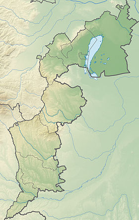
| Géolocalisation sur la carte : Autriche
Géolocalisation sur la carte : Autriche
Géolocalisation sur la carte : Burgenland
| ||||
| Liens | ||||
| Site web | www.bocksdorf.at | |||
| modifier |
||||
Bocksdorf est une commune d'Autriche, dans le Burgenland. Elle fait partie du district de Güssing.
Géographie
La commune de Bocksdorf est située dans la région du sud du Burgenland. Bocksdorf est le seul village de la commune. Autres lieux habités sont Bocksdorfer Berghäuser et Zickenbergen.
Histoire
Démographie
| Année | Pop. | ±% |
|---|---|---|
| 1869 | 1,048 | — |
| 1880 | 1,216 | +16.0% |
| 1890 | 1,385 | +13.9% |
| 1900 | 1,344 | −3.0% |
| 1910 | 1,365 | +1.6% |
| 1923 | 1,225 | −10.3% |
| 1934 | 1,252 | +2.2% |
| 1939 | 991 | −20.8% |
| 1951 | 970 | −2.1% |
| 1961 | 899 | −7.3% |
| 1971 | 886 | −1.4% |
| 1981 | 928 | +4.7% |
| 1991 | 816 | −12.1% |
| 2001 | 791 | −3.1% |
| 2011 | 808 | +2.1% |
| 2020[1] | 807 | — |
Notes et références
- ↑ (en) « NUTS 3 ordered by municipalities, area and population », statistik.at, (lire en ligne)
- (de)/(en) Cet article est partiellement ou en totalité issu des articles intitulés en allemand « Bocksdorf » (voir la liste des auteurs) et en anglais « Bocksdorf » (voir la liste des auteurs).


