Comté de Freeborn
Cet article est une ébauche concernant le Minnesota.
Vous pouvez partager vos connaissances en l’améliorant (comment ?) selon les recommandations des projets correspondants.
| Comté de Freeborn (Freeborn County) | |
 Le palais de justice d'Albert Lea, siège du comté de Freeborn. | |
| Administration | |
|---|---|
| Pays | |
| État | |
| Chef-lieu | Albert Lea |
| Fondation | 1855 |
| Démographie | |
| Population | 31 255 hab. (2010) |
| Densité | 17 hab./km2 |
| Géographie | |
| Coordonnées | 43° 40′ nord, 93° 21′ ouest |
| Superficie | 183 300 ha = 1 833 km2 |
| Superficie eau | 3 900 ha = 39 km2 |
| Superficie totale | 187 200 ha = 1 872 km2 |
| Localisation | |
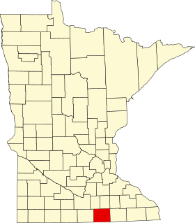 Comté de Freeborn dans l'État du Minnesota | |
| modifier |
|
Le comté de Freeborn est situé dans l’État du Minnesota, aux États-Unis. Il comptait 31 255 habitants en 2010. Son siège est Albert Lea.
Geographie
Sa superficie est de 1 872 km2, dont 1 833 km2 de terres et 39 km2 de surfaces aquatiques.
Lacs
Le comté de Freeborn compte 16 lacs, pour la plupart dans sa partie ouest.
- Albert Lea Lake
- Bear Lake
- Church Lake
- Fountain Lake
- Freeborn Lake
- Geneva Lake
- Goose Lake
- Halls Lake
- Hickory Lake
- Lower Twin Lake
- Pickerel Lake
- School Section Lake
- State Line Lake
- Sugar Lake
- Upper Twin Lake
- White Lake
Grands axes
|
|
Localités
| Villes | Agglomérations | |
|---|---|---|
|
| |
Liens externes
- (en) Site officiel
- (en) Office du tourisme

