Daftar munisipalitas di Rio Grande do Norte

Rio Grande do Norte (bahasa Inggris: Great River of the North)[1] adalah negara bagian yang terletak di Wilayah Timur Laut Brasil. Menurut Sensus 2010 yang dilakukan oleh Institut Geografi dan Statistik Brasil (IBGE), Rio Grande do Norte memiliki populasi 3.168.133 jiwa sepanjang 52.797 kilometer persegi (20.385 sq mi), yang menjadikannya negara bagian terbesar ke-16 berdasarkan jumlah penduduk dan terbesar ke-22 berdasarkan wilayah, dari 26 negara bagian.[2][3][4][5] Wilayah ini adalah rumah bagi kota-kota seperti Natal, Mossoró, dan São Gonçalo do Amarante.
Tanah yang menjadi Rio Grande do Norte adalah donatário untuk João de Barros, Komisioner dari Casa da Índia, yang diberikan oleh João III dari Portugal pada tahun 1535;[6] sebelumnya, Monarki Portugis memiliki tanah tersebut.[7] Orang Perancis, yang memperdagangkan kayu Brasil di wilayah tersebut, mempunyai tanah tersebut hingga Portugis mengusir mereka pada tahun 1598.[6] Belanda mengambil tanah tersebut pada tahun 1634 sebagai milik mereka. bagian dari Brasil Belanda dan memerintah hingga tahun 1654, ketika mereka dikalahkan oleh Portugis.[8] Pada tahun 1701, Rio Grande do Norte bergabung dengan Kapten Pernambuco, dan menjadi provinsi pada tahun 1822 dan negara bagian Brasil pada tahun 1889.[6]
Rio Grande do Norte dibagi menjadi 167 munisipalitas, yang dikelompokkan menjadi empat mesoregion dan 23 microregion. Dari 167 kotamadya, Natal memiliki jumlah penduduk tertinggi, dengan 803.811 jiwa, sedangkan Viçosa, dengan 1.618 penduduk, memiliki jumlah penduduk terendah. Kota terbesar berdasarkan wilayah adalah Mossoró, dengan luas 2.110 kilometer persegi (815 sq mi); yang terkecil adalah Senador Georgino Avelino, dinamai menurut nama mantan Senator dan Gubernur Rio Grande do Norte José Georgino Avelino,[9] yang meliputi area seluas 26 kilometer persegi (10 sq mi).
Munisipalitas
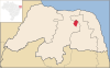
-
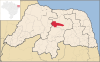
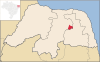
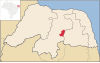
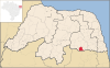
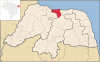
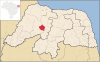
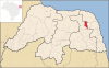
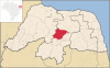
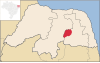
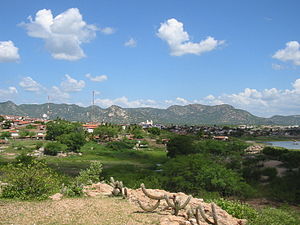 Acari
Acari -
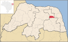
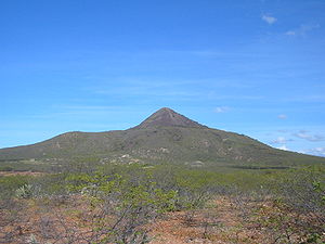 Pico do Cabugi, gunung berapi yang sudah punah di Angicos
 -
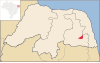
 Sungai Piranhas di Macau
 -
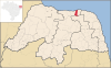
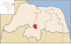
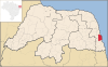
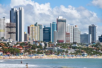 Natal, ibu kota Rio Grande do Norte
 -
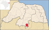
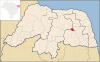
 Parelhas merayakan ulang tahun ke 150 pendiriannya
 -
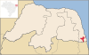
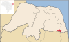
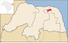
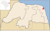
 Mercusuar Calcanhar, mercusuar tradisional terbesar di Brasil,[10] berlokasi di Touros


| Map (coordinates)[11] | Munisipalitas | Luas (kilometer persegi) (mil persegi)[5] |
Populasi[4] | Mesoregion[12] | Microregion[12] |
|---|---|---|---|---|---|
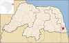
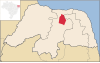
 6°26′8″S 36°38′20″W / 6.43556°S 36.63889°W 6°26′8″S 36°38′20″W / 6.43556°S 36.63889°W
|
Acari | 608.565 (234.967) | 11,035 | Central Potiguar | Seridó Oriental |
 5°29′54″S 36°30′20″W / 5.49833°S 36.50556°W 5°29′54″S 36°30′20″W / 5.49833°S 36.50556°W
|
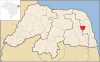
Afonso Bezerra | 576.248 (222.489) | 10,879 | Central Potiguar | Angicos |
 6°12′33″S 38°17′50″W / 6.20917°S 38.29722°W 6°12′33″S 38°17′50″W / 6.20917°S 38.29722°W
|
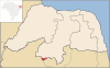
Água Nova | 50.683 (19.569) | 2,984 | Oeste Potiguar | Serra de São Miguel |
 6°24′45″S 38°0′57″W / 6.41250°S 38.01583°W 6°24′45″S 38°0′57″W / 6.41250°S 38.01583°W
|
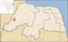
Alexandria | 381.202 (147.182) | 13,475 | Oeste Potiguar | Pau dos Ferros |
 6°9′8″S 37°45′58″W / 6.15222°S 37.76611°W 6°9′8″S 37°45′58″W / 6.15222°S 37.76611°W
|
Almino Afonso | 128.029 (49.432) | 4,880 | Oeste Potiguar | Umarizal |
 5°17′18″S 36°45′44″W / 5.28833°S 36.76222°W 5°17′18″S 36°45′44″W / 5.28833°S 36.76222°W
|
Alto do Rodrigues | 191.311 (73.865) | 12,306 | Oeste Potiguar | Vale do Açu |
 5°39′56″S 36°36′4″W / 5.66556°S 36.60111°W 5°39′56″S 36°36′4″W / 5.66556°S 36.60111°W
|
Angicos | 741.654 (286.353) | 11,553 | Central Potiguar | Angicos |
 6°12′46″S 37°54′20″W / 6.21278°S 37.90556°W 6°12′46″S 37°54′20″W / 6.21278°S 37.90556°W
|
Antônio Martins | 244.620 (94.448) | 6,907 | Oeste Potiguar | Umarizal |
 5°39′51″S 37°47′56″W / 5.66417°S 37.79889°W 5°39′51″S 37°47′56″W / 5.66417°S 37.79889°W
|
Apodi | 1,602.659 (618.787) | 34,777 | Oeste Potiguar | Chapada do Apodi |
 4°57′22″S 37°8′13″W / 4.95611°S 37.13694°W 4°57′22″S 37°8′13″W / 4.95611°S 37.13694°W
|
Areia Branca | 357.580 (138.062) | 25,263 | Oeste Potiguar | Mossoró |
 6°11′40″S 35°9′37″W / 6.19444°S 35.16028°W 6°11′40″S 35°9′37″W / 6.19444°S 35.16028°W
|
Arês | 112.584 (43.469) | 12,931 | Leste Potiguar | Litoral Sul |
 5°34′36″S 36°54′31″W / 5.57667°S 36.90861°W 5°34′36″S 36°54′31″W / 5.57667°S 36.90861°W
|
Assu | 1,269.235 (490.052) | 53,245 | Oeste Potiguar | Vale do Açu |
 6°22′10″S 35°0′28″W / 6.36944°S 35.00778°W 6°22′10″S 35°0′28″W / 6.36944°S 35.00778°W
|
Baía Formosa | 245.510 (94.791) | 8,569 | Leste Potiguar | Litoral Sul |
 5°4′48″S 37°37′0″W / 5.08000°S 37.61667°W 5°4′48″S 37°37′0″W / 5.08000°S 37.61667°W
|
Baraúna | 825.802 (318.842) | 24,187 | Oeste Potiguar | Mossoró |
 5°52′2″S 35°55′35″W / 5.86722°S 35.92639°W 5°52′2″S 35°55′35″W / 5.86722°S 35.92639°W
|
Barcelona | 152.629 (58.930) | 3,957 | Agreste Potiguar | Borborema Potiguar |
 5°41′38″S 35°49′11″W / 5.69389°S 35.81972°W 5°41′38″S 35°49′11″W / 5.69389°S 35.81972°W
|
Bento Fernandes | 301.075 (116.245) | 5,110 | Agreste Potiguar | Baixa Verde |
 6°9′30″S 35°36′2″W / 6.15833°S 35.60056°W 6°9′30″S 35°36′2″W / 6.15833°S 35.60056°W
|
Boa Saúde | 187.211 (72.282) | 9,009 | Agreste Potiguar | Agreste Potiguar |
 5°59′18″S 36°24′47″W / 5.98833°S 36.41306°W 5°59′18″S 36°24′47″W / 5.98833°S 36.41306°W
|
Bodó | 253.513 (97.881) | 2,425 | Central Potiguar | Serra de Santana |
 5°59′2″S 35°34′53″W / 5.98389°S 35.58139°W 5°59′2″S 35°34′53″W / 5.98389°S 35.58139°W
|
Bom Jesus | 122.033 (47.117) | 9,432 | Agreste Potiguar | Agreste Potiguar |
 6°11′27″S 35°21′24″W / 6.19083°S 35.35667°W 6°11′27″S 35°21′24″W / 6.19083°S 35.35667°W
|
Brejinho | 58.528 (22.598) | 11,577 | Agreste Potiguar | Agreste Potiguar |
 5°3′52″S 36°3′21″W / 5.06444°S 36.05583°W 5°3′52″S 36°3′21″W / 5.06444°S 36.05583°W
|
Caiçara do Norte | 189.415 (73.133) | 6,016 | Central Potiguar | Macau |
 5°45′37″S 35°59′54″W / 5.76028°S 35.99833°W 5°45′37″S 35°59′54″W / 5.76028°S 35.99833°W
|
Caiçara do Rio do Vento | 261.191 (100.846) | 3,304 | Central Potiguar | Angicos |
 6°27′30″S 37°5′52″W / 6.45833°S 37.09778°W 6°27′30″S 37°5′52″W / 6.45833°S 37.09778°W
|
Caicó | 1,228.574 (474.352) | 62,727 | Central Potiguar | Seridó Ocidental |
 5°51′50″S 37°18′36″W / 5.86389°S 37.31000°W 5°51′50″S 37°18′36″W / 5.86389°S 37.31000°W
|
Campo Grande | 896.962 (346.317) | 9,289 | Oeste Potiguar | Médio Oeste |
 6°14′29″S 36°10′57″W / 6.24139°S 36.18250°W 6°14′29″S 36°10′57″W / 6.24139°S 36.18250°W
|
Campo Redondo | 213.629 (82.482) | 10,266 | Agreste Potiguar | Borborema Potiguar |
 6°22′48″S 35°7′44″W / 6.38000°S 35.12889°W 6°22′48″S 35°7′44″W / 6.38000°S 35.12889°W
|
Canguaretama | 245.529 (94.799) | 30,900 | Leste Potiguar | Litoral Sul |
 5°47′33″S 37°33′24″W / 5.79250°S 37.55667°W 5°47′33″S 37°33′24″W / 5.79250°S 37.55667°W
|
Caraúbas | 1,095.001 (422.780) | 19,582 | Oeste Potiguar | Chapada do Apodi |
 6°33′20″S 36°35′42″W / 6.55556°S 36.59500°W 6°33′20″S 36°35′42″W / 6.55556°S 36.59500°W
|
Carnaúba dos Dantas | 245.648 (94.845) | 7,429 | Central Potiguar | Seridó Oriental |
 5°20′24″S 36°50′24″W / 5.34000°S 36.84000°W 5°20′24″S 36°50′24″W / 5.34000°S 36.84000°W
|
Carnaubais | 529.835 (204.569) | 9,775 | Oeste Potiguar | Vale do Açu |
 5°38′4″S 35°25′2″W / 5.63444°S 35.41722°W 5°38′4″S 35°25′2″W / 5.63444°S 35.41722°W
|
Ceará-Mirim | 739.686 (285.593) | 67,844 | Leste Potiguar | Macaíba |
 6°2′44″S 36°20′45″W / 6.04556°S 36.34583°W 6°2′44″S 36°20′45″W / 6.04556°S 36.34583°W
|
Cerro Corá | 393.569 (151.957) | 10,916 | Central Potiguar | Serra de Santana |
 6°22′57″S 36°12′53″W / 6.38250°S 36.21472°W 6°22′57″S 36°12′53″W / 6.38250°S 36.21472°W
|
Coronel Ezequiel | 185.752 (71.719) | 5,405 | Agreste Potiguar | Borborema Potiguar |
 6°15′35″S 38°26′37″W / 6.25972°S 38.44361°W 6°15′35″S 38°26′37″W / 6.25972°S 38.44361°W
|
Coronel João Pessoa | 117.140 (45.228) | 4,774 | Oeste Potiguar | Serra de São Miguel |
 6°24′42″S 36°47′23″W / 6.41167°S 36.78972°W 6°24′42″S 36°47′23″W / 6.41167°S 36.78972°W
|
Cruzeta | 295.829 (114.220) | 7,968 | Central Potiguar | Seridó Oriental |
 6°24′42″S 36°47′23″W / 6.41167°S 36.78972°W 6°24′42″S 36°47′23″W / 6.41167°S 36.78972°W
|
Currais Novos | 864.431 (333.757) | 42,668 | Central Potiguar | Seridó Oriental |
 6°5′40″S 38°22′29″W / 6.09444°S 38.37472°W 6°5′40″S 38°22′29″W / 6.09444°S 38.37472°W
|
Doutor Severiano | 108.277 (41.786) | 6,495 | Oeste Potiguar | Serra de São Miguel |
 6°6′38″S 38°18′19″W / 6.11056°S 38.30528°W 6°6′38″S 38°18′19″W / 6.11056°S 38.30528°W
|
Encanto | 125.747 (48.555) | 5,228 | Oeste Potiguar | Serra de São Miguel |
 6°56′42″S 36°43′6″W / 6.94500°S 36.71833°W 6°56′42″S 36°43′6″W / 6.94500°S 36.71833°W
|
Equador | 264.983 (102.310) | 5,822 | Central Potiguar | Seridó Oriental |
 6°19′56″S 35°18′34″W / 6.33222°S 35.30944°W 6°19′56″S 35°18′34″W / 6.33222°S 35.30944°W
|
Espírito Santo | 143.673 (55.472) | 10,480 | Leste Potiguar | Litoral Sul |
 5°42′20″S 35°18′26″W / 5.70556°S 35.30722°W 5°42′20″S 35°18′26″W / 5.70556°S 35.30722°W
|
Extremoz | 125.665 (48.519) | 24,550 | Leste Potiguar | Natal |
 5°36′9″S 37°41′19″W / 5.60250°S 37.68861°W 5°36′9″S 37°41′19″W / 5.60250°S 37.68861°W
|
Felipe Guerra | 268.427 (103.640) | 5,734 | Oeste Potiguar | Chapada do Apodi |
 5°41′50″S 36°31′52″W / 5.69722°S 36.53111°W 5°41′50″S 36°31′52″W / 5.69722°S 36.53111°W
|
Fernando Pedroza | 322.540 (124.533) | 2,850 | Central Potiguar | Angicos |
 6°7′38″S 36°49′5″W / 6.12722°S 36.81806°W 6°7′38″S 36°49′5″W / 6.12722°S 36.81806°W
|
Florânia | 504.022 (194.603) | 9,672 | Central Potiguar | Serra de Santana |
 6°4′42″S 38°7′10″W / 6.07833°S 38.11944°W 6°4′42″S 38°7′10″W / 6.07833°S 38.11944°W
|
Francisco Dantas | 181.593 (70.113) | 2,874 | Oeste Potiguar | Pau dos Ferros |
 6°9′30″S 37°53′23″W / 6.15833°S 37.88972°W 6°9′30″S 37°53′23″W / 6.15833°S 37.88972°W
|
Frutuoso Gomes | 63.278 (24.432) | 4,233 | Oeste Potiguar | Umarizal |
 5°5′26″S 36°16′31″W / 5.09056°S 36.27528°W 5°5′26″S 36°16′31″W / 5.09056°S 36.27528°W
|
Galinhos | 342.442 (132.217) | 2,150 | Central Potiguar | Macau |
 6°15′53″S 35°12′35″W / 6.26472°S 35.20972°W 6°15′53″S 35°12′35″W / 6.26472°S 35.20972°W
|
Goianinha | 192.227 (74.219) | 22,467 | Leste Potiguar | Litoral Sul |
 5°27′32″S 37°31′15″W / 5.45889°S 37.52083°W 5°27′32″S 37°31′15″W / 5.45889°S 37.52083°W
|
Governador Dix-Sept Rosado | 1,129.373 (436.051) | 12,373 | Oeste Potiguar | Chapada do Apodi |
 4°58′47″S 37°9′17″W / 4.97972°S 37.15472°W 4°58′47″S 37°9′17″W / 4.97972°S 37.15472°W
|
Grossos | 126.451 (48.823) | 9,393 | Oeste Potiguar | Mossoró |
 5°6′27″S 36°19′13″W / 5.10750°S 36.32028°W 5°6′27″S 36°19′13″W / 5.10750°S 36.32028°W
|
Guamaré | 259.181 (100.070) | 12,431 | Central Potiguar | Macau |
 5°49′27″S 35°33′10″W / 5.82417°S 35.55278°W 5°49′27″S 35°33′10″W / 5.82417°S 35.55278°W
|
Ielmo Marinho | 305.185 (117.832) | 12,188 | Agreste Potiguar | Agreste Potiguar |
 5°29′54″S 36°51′18″W / 5.49833°S 36.85500°W 5°29′54″S 36°51′18″W / 5.49833°S 36.85500°W
|
Ipanguaçu | 374.239 (144.494) | 13,855 | Oeste Potiguar | Vale do Açu |
 6°48′51″S 37°11′56″W / 6.81417°S 37.19889°W 6°48′51″S 37°11′56″W / 6.81417°S 37.19889°W
|
Ipueira | 127.347 (46.169) | 2,074 | Central Potiguar | Seridó Ocidental |
 5°38′39″S 36°52′17″W / 5.64417°S 36.87139°W 5°38′39″S 36°52′17″W / 5.64417°S 36.87139°W
|
Itajá | 203.623 (78.619) | 6,952 | Oeste Potiguar | Vale do Açu |
 5°50′23″S 37°59′24″W / 5.83972°S 37.99000°W 5°50′23″S 37°59′24″W / 5.83972°S 37.99000°W
|
Itaú | 133.032 (51.364) | 5,568 | Oeste Potiguar | Pau dos Ferros |
 6°25′33″S 36°12′18″W / 6.42583°S 36.20500°W 6°25′33″S 36°12′18″W / 6.42583°S 36.20500°W
|
Jaçanã | 54.558 (21.065) | 7,925 | Agreste Potiguar | Borborema Potiguar |
 5°21′23″S 36°7′41″W / 5.35639°S 36.12806°W 5°21′23″S 36°7′41″W / 5.35639°S 36.12806°W
|
Jandaíra | 435.678 (168.215) | 6,796 | Agreste Potiguar | Baixa Verde |
 6°00′56″S 37°24′32″W / 6.01556°S 37.40889°W 6°00′56″S 37°24′32″W / 6.01556°S 37.40889°W
|
Janduís | 304.899 (117.722) | 5,350 | Oeste Potiguar | Médio Oeste |
 6°27′54″S 35°56′48″W / 6.46500°S 35.94667°W 6°27′54″S 35°56′48″W / 6.46500°S 35.94667°W
|
Japi | 188.990 (72.969) | 5,522 | Agreste Potiguar | Borborema Potiguar |
 5°39′13″S 35°58′8″W / 5.65361°S 35.96889°W 5°39′13″S 35°58′8″W / 5.65361°S 35.96889°W
|
Jardim de Angicos | 254.045 (98.087) | 2,607 | Central Potiguar | Angicos |
 6°22′43″S 37°21′7″W / 6.37861°S 37.35194°W 6°22′43″S 37°21′7″W / 6.37861°S 37.35194°W
|
Jardim de Piranhas | 330.553 (127.627) | 13,511 | Central Potiguar | Seridó Ocidental |
 6°35′4″S 36°46′28″W / 6.58444°S 36.77444°W 6°35′4″S 36°46′28″W / 6.58444°S 36.77444°W
|
Jardim do Seridó | 368.643 (142.333) | 12,115 | Central Potiguar | Seridó Oriental |
 5°32′15″S 35°49′11″W / 5.53750°S 35.81972°W 5°32′15″S 35°49′11″W / 5.53750°S 35.81972°W
|
João Câmara | 714.951 (276.043) | 32,203 | Agreste Potiguar | Baixa Verde |
 6°16′28″S 37°47′46″W / 6.27444°S 37.79611°W 6°16′28″S 37°47′46″W / 6.27444°S 37.79611°W
|
João Dias | 88.173 (34.044) | 2,601 | Oeste Potiguar | Umarizal |
 6°19′0″S 38°16′53″W / 6.31667°S 38.28139°W 6°19′0″S 38°16′53″W / 6.31667°S 38.28139°W
|
José da Penha | 117.634 (45.418) | 5,868 | Oeste Potiguar | Pau dos Ferros |
 6°2′2″S 37°1′13″W / 6.03389°S 37.02028°W 6°2′2″S 37°1′13″W / 6.03389°S 37.02028°W
|
Jucurutu | 933.718 (360.509) | 17,692 | Oeste Potiguar | Vale do Açu |
 6°16′19″S 35°19′37″W / 6.27194°S 35.32694°W 6°16′19″S 35°19′37″W / 6.27194°S 35.32694°W
|
Jundiá | 45.261 (17.475) | 3,585 | Agreste Potiguar | Agreste Potiguar |
 6°26′28″S 35°35′54″W / 6.44111°S 35.59833°W 6°26′28″S 35°35′54″W / 6.44111°S 35.59833°W
|
Lagoa d'Anta | 105.650 (40.791) | 6,227 | Agreste Potiguar | Agreste Potiguar |
 6°8′57″S 35°26′16″W / 6.14917°S 35.43778°W 6°8′57″S 35°26′16″W / 6.14917°S 35.43778°W
|
Lagoa de Pedras | 117.660 (45.429) | 6,992 | Agreste Potiguar | Agreste Potiguar |
 6°0′14″S 35°52′18″W / 6.00389°S 35.87167°W 6°0′14″S 35°52′18″W / 6.00389°S 35.87167°W
|
Lagoa de Velhos | 112.832 (43.564) | 2,632 | Agreste Potiguar | Borborema Potiguar |
 6°7′16″S 35°28′38″W / 6.12111°S 35.47722°W 6°7′16″S 35°28′38″W / 6.12111°S 35.47722°W
|
Lagoa Nova | 176.299 (68.069) | 13,990 | Central Potiguar | Serra de Santana |
 6°7′15″S 35°28′38″W / 6.12083°S 35.47722°W 6°7′15″S 35°28′38″W / 6.12083°S 35.47722°W
|
Lagoa Salgada | 79.515 (30.701) | 7,515 | Agreste Potiguar | Agreste Potiguar |
 5°42′0″S 36°14′41″W / 5.70000°S 36.24472°W 5°42′0″S 36°14′41″W / 5.70000°S 36.24472°W
|
Lajes | 676.417 (261.165) | 10,385 | Central Potiguar | Angicos |
 6°9′1″S 36°7′2″W / 6.15028°S 36.11722°W 6°9′1″S 36°7′2″W / 6.15028°S 36.11722°W
|
Lajes Pintadas | 120.308 (46.451) | 4,614 | Agreste Potiguar | Borborema Potiguar |
 6°7′12″S 37°48′56″W / 6.12000°S 37.81556°W 6°7′12″S 37°48′56″W / 6.12000°S 37.81556°W
|
Lucrécia | 30.935 (11.944) | 3,633 | Oeste Potiguar | Umarizal |
 6°24′50″S 38°23′19″W / 6.41389°S 38.38861°W 6°24′50″S 38°23′19″W / 6.41389°S 38.38861°W
|
Luís Gomes | 166.637 (64.235) | 9,612 | Oeste Potiguar | Serra de São Miguel |
 5°51′30″S 35°21′14″W / 5.85833°S 35.35389°W 5°51′30″S 35°21′14″W / 5.85833°S 35.35389°W
|
Macaíba | 512.487 (197.871) | 69,538 | Leste Potiguar | Macaíba |
 5°6′54″S 36°38′4″W / 5.11500°S 36.63444°W 5°6′54″S 36°38′4″W / 5.11500°S 36.63444°W
|
Macau | 788.022 (304.255) | 28,974 | Central Potiguar | Macau |
 6°24′22″S 38°19′26″W / 6.40611°S 38.32389°W 6°24′22″S 38°19′26″W / 6.40611°S 38.32389°W
|
Major Sales | 31.971 (12.344) | 3,536 | Oeste Potiguar | Serra de São Miguel |
 6°17′39″S 38°10′2″W / 6.29417°S 38.16722°W 6°17′39″S 38°10′2″W / 6.29417°S 38.16722°W
|
Marcelino Vieira | 345.707 (133.477) | 8,265 | Oeste Potiguar | Pau dos Ferros |
 6°5′16″S 37°54′40″W / 6.08778°S 37.91111°W 6°5′16″S 37°54′40″W / 6.08778°S 37.91111°W
|
Martins | 169.446 (65.423) | 8,228 | Oeste Potiguar | Umarizal |
 5°31′2″S 35°15′23″W / 5.51722°S 35.25639°W 5°31′2″S 35°15′23″W / 5.51722°S 35.25639°W
|
Maxaranguape | 131.300 (50.695) | 10,442 | Leste Potiguar | Litoral Nordeste |
 6°4′44″S 37°30′15″W / 6.07889°S 37.50417°W 6°4′44″S 37°30′15″W / 6.07889°S 37.50417°W
|
Messias Targino | 135.094 (52.160) | 4,188 | Oeste Potiguar | Médio Oeste |
 6°29′9″S 35°17′15″W / 6.48583°S 35.28750°W 6°29′9″S 35°17′15″W / 6.48583°S 35.28750°W
|
Montanhas | 82.213 (31.742) | 11,418 | Leste Potiguar | Litoral Sul |
 6°4′4″S 35°19′56″W / 6.06778°S 35.33222°W 6°4′4″S 35°19′56″W / 6.06778°S 35.33222°W
|
Monte Alegre | 199.519 (77.034) | 20,670 | Agreste Potiguar | Agreste Potiguar |
 6°26′29″S 35°46′57″W / 6.44139°S 35.78250°W 6°26′29″S 35°46′57″W / 6.44139°S 35.78250°W
|
Monte das Gameleiras | 71.945 (27.778) | 2,266 | Agreste Potiguar | Borborema Potiguar |
 5°11′15″S 37°20′39″W / 5.18750°S 37.34417°W 5°11′15″S 37°20′39″W / 5.18750°S 37.34417°W
|
Mossoró | 2,110.207 (814.751) | 259,886 | Oeste Potiguar | Mossoró |
 5°47′42″S 35°12′34″W / 5.79500°S 35.20944°W 5°47′42″S 35°12′34″W / 5.79500°S 35.20944°W
|
Natal | 170.298 (65.752) | 803,811 | Leste Potiguar | Natal |
 6°5′28″S 35°12′31″W / 6.09111°S 35.20861°W 6°5′28″S 35°12′31″W / 6.09111°S 35.20861°W
|
Nísia Floresta | 306.051 (118.166) | 23,818 | Leste Potiguar | Macaíba |
 6°28′41″S 35°26′2″W / 6.47806°S 35.43389°W 6°28′41″S 35°26′2″W / 6.47806°S 35.43389°W
|
Nova Cruz | 277.657 (107.203) | 35,541 | Agreste Potiguar | Agreste Potiguar |
 5°57′23″S 37°42′20″W / 5.95639°S 37.70556°W 5°57′23″S 37°42′20″W / 5.95639°S 37.70556°W
|
Olho-d'Água do Borges | 141.170 (54.506) | 4,301 | Oeste Potiguar | Umarizal |
| 6°42′4″S 36°56′44″W / 6.70111°S 36.94556°W
|
Ouro Branco | 253.300 (97.799) | 4,699 | Central Potiguar | Seridó Oriental |
 6°29′11″S 38°18′47″W / 6.48639°S 38.31306°W 6°29′11″S 38°18′47″W / 6.48639°S 38.31306°W
|
Paraná | 81.390 (31.425) | 3,952 | Oeste Potiguar | Pau dos Ferros |
 5°46′28″S 37°6′5″W / 5.77444°S 37.10139°W 5°46′28″S 37°6′5″W / 5.77444°S 37.10139°W
|
Paraú | 410.858 (158.632) | 3,862 | Oeste Potiguar | Médio Oeste |
 5°13′23″S 35°50′18″W / 5.22306°S 35.83833°W 5°13′23″S 35°50′18″W / 5.22306°S 35.83833°W
|
Parazinho | 274.668 (106.057) | 4,845 | Agreste Potiguar | Baixa Verde |
 6°41′16″S 36°39′27″W / 6.68778°S 36.65750°W 6°41′16″S 36°39′27″W / 6.68778°S 36.65750°W
|
Parelhas | 513.052 (198.089) | 20,670 | Central Potiguar | Seridó Ocidental |
 5°54′56″S 35°15′46″W / 5.91556°S 35.26278°W 5°54′56″S 35°15′46″W / 5.91556°S 35.26278°W
|
Parnamirim | 120.202 (46.410) | 202,413 | Leste Potiguar | Natal |
 6°26′8″S 35°38′36″W / 6.43556°S 35.64333°W 6°26′8″S 35°38′36″W / 6.43556°S 35.64333°W
|
Passa e Fica | 42.137 (16.269) | 11,111 | Agreste Potiguar | Agreste Potiguar |
 6°16′44″S 35°22′39″W / 6.27889°S 35.37750°W 6°16′44″S 35°22′39″W / 6.27889°S 35.37750°W
|
Passagem | 41.235 (15.921) | 2,899 | Agreste Potiguar | Agreste Potiguar |
 6°6′36″S 37°18′12″W / 6.11000°S 37.30333°W 6°6′36″S 37°18′12″W / 6.11000°S 37.30333°W
|
Patu | 319.932 (123.526) | 11,964 | Oeste Potiguar | Umarizal |
 6°6′33″S 38°12′16″W / 6.10917°S 38.20444°W 6°6′33″S 38°12′16″W / 6.10917°S 38.20444°W
|
Pau dos Ferros | 259.960 (100.371) | 27,733 | Oeste Potiguar | Pau dos Ferros |
 5°9′1″S 35°52′44″W / 5.15028°S 35.87889°W 5°9′1″S 35°52′44″W / 5.15028°S 35.87889°W
|
Pedra Grande | 221.429 (85.494) | 3,521 | Leste Potiguar | Litoral Nordeste |
 5°34′57″S 36°6′17″W / 5.58250°S 36.10472°W 5°34′57″S 36°6′17″W / 5.58250°S 36.10472°W
|
Pedra Preta | 294.979 (113.891) | 2,583 | Central Potiguar | Angicos |
 5°31′18″S 36°23′17″W / 5.52167°S 36.38806°W 5°31′18″S 36°23′17″W / 5.52167°S 36.38806°W
|
Pedro Avelino | 952.688 (367.833) | 7,168 | Central Potiguar | Angicos |
 6°26′21″S 35°13′17″W / 6.43917°S 35.22139°W 6°26′21″S 35°13′17″W / 6.43917°S 35.22139°W
|
Pedro Velho | 192.707 (74.404) | 14,119 | Leste Potiguar | Litoral Sul |
 5°15′36″S 36°43′20″W / 5.26000°S 36.72222°W 5°15′36″S 36°43′20″W / 5.26000°S 36.72222°W
|
Pendências | 419.141 (161.830) | 13,436 | Oeste Potiguar | Vale do Açu |
 6°16′7″S 38°2′36″W / 6.26861°S 38.04333°W 6°16′7″S 38°2′36″W / 6.26861°S 38.04333°W
|
Pilões | 82.691 (31.927) | 3,453 | Oeste Potiguar | Pau dos Ferros |
 5°37′22″S 35°39′46″W / 5.62278°S 35.66278°W 5°37′22″S 35°39′46″W / 5.62278°S 35.66278°W
|
Poço Branco | 230.730 (89.085) | 13,947 | Agreste Potiguar | Baixa Verde |
 6°1′26″S 37°59′16″W / 6.02389°S 37.98778°W 6°1′26″S 37°59′16″W / 6.02389°S 37.98778°W
|
Portalegre | 110.052 (42.491) | 7,297 | Oeste Potiguar | Pau dos Ferros |
 5°4′4″S 36°46′54″W / 5.06778°S 36.78167°W 5°4′4″S 36°46′54″W / 5.06778°S 36.78167°W
|
Porto do Mangue | 418.636 (161.635) | 5,217 | Oeste Potiguar | Vale do Açu |
 5°28′1″S 35°33′22″W / 5.46694°S 35.55611°W 5°28′1″S 35°33′22″W / 5.46694°S 35.55611°W
|
Pureza | 504.317 (194.717) | 8,432 | Leste Potiguar | Litoral Nordeste |
 6°11′41″S 38°13′33″W / 6.19472°S 38.22583°W 6°11′41″S 38°13′33″W / 6.19472°S 38.22583°W
|
Rafael Fernandes | 78.230 (30.205) | 4,692 | Oeste Potiguar | Pau dos Ferros |
 6°4′32″S 37°43′0″W / 6.07556°S 37.71667°W 6°4′32″S 37°43′0″W / 6.07556°S 37.71667°W
|
Rafael Godeiro | 100.073 (38.638) | 3,070 | Oeste Potiguar | Umarizal |
 5°56′11″S 37°56′47″W / 5.93639°S 37.94639°W 5°56′11″S 37°56′47″W / 5.93639°S 37.94639°W
|
Riacho da Cruz | 127.221 (49.120) | 3,165 | Oeste Potiguar | Pau dos Ferros |
 6°15′48″S 38°18′56″W / 6.26333°S 38.31556°W 6°15′48″S 38°18′56″W / 6.26333°S 38.31556°W
|
Riacho de Santana | 128.104 (49.461) | 4,157 | Oeste Potiguar | Serra de São Miguel |
 5°48′54″S 35°49′30″W / 5.81500°S 35.82500°W 5°48′54″S 35°49′30″W / 5.81500°S 35.82500°W
|
Riachuelo | 262.873 (101.495) | 7,067 | Agreste Potiguar | Agreste Potiguar |
 5°16′22″S 35°22′59″W / 5.27278°S 35.38306°W 5°16′22″S 35°22′59″W / 5.27278°S 35.38306°W
|
Rio do Fogo | 150.282 (58.024) | 10,060 | Leste Potiguar | Litoral Nordeste |
 5°47′17″S 38°3′36″W / 5.78806°S 38.06000°W 5°47′17″S 38°3′36″W / 5.78806°S 38.06000°W
|
Rodolfo Fernandes | 154.840 (59.784) | 4,417 | Oeste Potiguar | Pau dos Ferros |
 5°52′53″S 35°56′5″W / 5.88139°S 35.93472°W 5°52′53″S 35°56′5″W / 5.88139°S 35.93472°W
|
Ruy Barbosa | 125.813 (48.576) | 3,595 | Agreste Potiguar | Borborema Potiguar |
 6°13′46″S 36°1′22″W / 6.22944°S 36.02278°W 6°13′46″S 36°1′22″W / 6.22944°S 36.02278°W
|
Santa Cruz | 624.390 (241.077) | 35,759 | Agreste Potiguar | Borborema Potiguar |
 5°50′23″S 35°41′43″W / 5.83972°S 35.69528°W 5°50′23″S 35°41′43″W / 5.83972°S 35.69528°W
|
Santa Maria | 219.572 (84.777) | 4,762 | Agreste Potiguar | Agreste Potiguar |
 5°57′27″S 36°39′20″W / 5.95750°S 36.65556°W 5°57′27″S 36°39′20″W / 5.95750°S 36.65556°W
|
Santana do Matos | 1,420.313 (548.383) | 13,798 | Central Potiguar | Serra de Santana |
 6°46′14″S 36°44′0″W / 6.77056°S 36.73333°W 6°46′14″S 36°44′0″W / 6.77056°S 36.73333°W
|
Santana do Seridó | 188.402 (72.742) | 2,526 | Central Potiguar | Seridó Oriental |
 6°18′38″S 35°28′44″W / 6.31056°S 35.47889°W 6°18′38″S 35°28′44″W / 6.31056°S 35.47889°W
|
Santo Antônio | 301.052 (116.236) | 22,214 | Agreste Potiguar | Agreste Potiguar |
 5°3′59″S 36°2′17″W / 5.06639°S 36.03806°W 5°3′59″S 36°2′17″W / 5.06639°S 36.03806°W
|
São Bento do Norte | 288.637 (111.443) | 2,974 | Central Potiguar | Macau |
 6°20′30″S 36°5′14″W / 6.34167°S 36.08722°W 6°20′30″S 36°5′14″W / 6.34167°S 36.08722°W
|
São Bento do Trairi | 190.816 (73.674) | 3,909 | Agreste Potiguar | Borborema Potiguar |
 6°22′35″S 37°11′4″W / 6.37639°S 37.18444°W 6°22′35″S 37°11′4″W / 6.37639°S 37.18444°W
|
São Fernando | 404.415 (156.145) | 3,401 | Central Potiguar | Seridó Ocidental |
 5°58′30″S 38°9′6″W / 5.97500°S 38.15167°W 5°58′30″S 38°9′6″W / 5.97500°S 38.15167°W
|
São Francisco do Oeste | 75.550 (29.170) | 3,874 | Oeste Potiguar | Pau dos Ferros |
 5°47′36″S 35°19′46″W / 5.79333°S 35.32944°W 5°47′36″S 35°19′46″W / 5.79333°S 35.32944°W
|
São Gonçalo do Amarante | 251.308 (97.030) | 87,700 | Leste Potiguar | Macaíba |
 6°43′6″S 37°12′2″W / 6.71833°S 37.20056°W 6°43′6″S 37°12′2″W / 6.71833°S 37.20056°W
|
São João do Sabugi | 277.010 (106.954) | 5,914 | Central Potiguar | Seridó Ocidental |
 6°4′29″S 35°14′16″W / 6.07472°S 35.23778°W 6°4′29″S 35°14′16″W / 6.07472°S 35.23778°W
|
São José de Mipibu | 293.877 (113.466) | 39,771 | Leste Potiguar | Macaíba |
 5°47′36″S 35°42′50″W / 5.79333°S 35.71389°W 5°47′36″S 35°42′50″W / 5.79333°S 35.71389°W
|
São José do Campestre | 341.403 (131.816) | 12,359 | Agreste Potiguar | Borborema Potiguar |
 6°26′57″S 36°52′40″W / 6.44917°S 36.87778°W 6°26′57″S 36°52′40″W / 6.44917°S 36.87778°W
|
São José do Seridó | 174.504 (67.376) | 4,231 | Central Potiguar | Seridó Oriental |
 6°12′43″S 38°29′49″W / 6.21194°S 38.49694°W 6°12′43″S 38°29′49″W / 6.21194°S 38.49694°W
|
São Miguel | 171.690 (66.290) | 22,159 | Oeste Potiguar | Serra de São Miguel |
 5°7′29″S 35°38′21″W / 5.12472°S 35.63917°W 5°7′29″S 35°38′21″W / 5.12472°S 35.63917°W
|
São Miguel do Gostoso | 342.445 (132.218) | 8,659 | Leste Potiguar | Litoral Nordeste |
 5°53′42″S 35°45′46″W / 5.89500°S 35.76278°W 5°53′42″S 35°45′46″W / 5.89500°S 35.76278°W
|
São Paulo do Potengi | 240.435 (92.832) | 15,866 | Agreste Potiguar | Agreste Potiguar |
 5°53′53″S 35°38′4″W / 5.89806°S 35.63444°W 5°53′53″S 35°38′4″W / 5.89806°S 35.63444°W
|
São Pedro | 195.238 (75.381) | 6,223 | Agreste Potiguar | Agreste Potiguar |
 5°47′58″S 36°55′14″W / 5.79944°S 36.92056°W 5°47′58″S 36°55′14″W / 5.79944°S 36.92056°W
|
São Rafael | 469.096 (181.118) | 8,106 | Oeste Potiguar | Vale do Açu |
 5°58′21″S 36°4′31″W / 5.97250°S 36.07528°W 5°58′21″S 36°4′31″W / 5.97250°S 36.07528°W
|
São Tomé | 862.577 (333.041) | 10,868 | Agreste Potiguar | Borborema Potiguar |
 6°13′2″S 36°41′4″W / 6.21722°S 36.68444°W 6°13′2″S 36°41′4″W / 6.21722°S 36.68444°W
|
São Vicente | 197.814 (76.376) | 6,030 | Central Potiguar | Serra de Santana |
 6°2′8″S 35°41′34″W / 6.03556°S 35.69278°W 6°2′8″S 35°41′34″W / 6.03556°S 35.69278°W
|
Senador Elói de Souza | 167.592 (64.707) | 5,645 | Agreste Potiguar | Agreste Potiguar |
 6°9′46″S 35°7′21″W / 6.16278°S 35.12250°W 6°9′46″S 35°7′21″W / 6.16278°S 35.12250°W
|
Senador Georgino Avelino | 26.383 (10.186) | 3,924 | Leste Potiguar | Litoral Sul |
 6°6′21″S 35°42′46″W / 6.10583°S 35.71278°W 6°6′21″S 35°42′46″W / 6.10583°S 35.71278°W
|
Serra Caiada | 167.348 (64.613) | 8,774 | Agreste Potiguar | Agreste Potiguar |
 6°25′2″S 35°42′16″W / 6.41722°S 35.70444°W 6°25′2″S 35°42′16″W / 6.41722°S 35.70444°W
|
Serra de São Bento | 96.635 (37.311) | 5,746 | Agreste Potiguar | Borborema Potiguar |
 5°10′12″S 37°1′46″W / 5.17000°S 37.02944°W 5°10′12″S 37°1′46″W / 5.17000°S 37.02944°W
|
Serra do Mel | 616.509 (238.034) | 10,281 | Oeste Potiguar | Mossoró |
 6°39′56″S 37°23′50″W / 6.66556°S 37.39722°W 6°39′56″S 37°23′50″W / 6.66556°S 37.39722°W
|
Serra Negra do Norte | 562.935 (217.349) | 7,770 | Central Potiguar | Seridó Ocidental |
 6°16′34″S 35°29′56″W / 6.27611°S 35.49889°W 6°16′34″S 35°29′56″W / 6.27611°S 35.49889°W
|
Serrinha | 193.352 (74.653) | 6,581 | Agreste Potiguar | Agreste Potiguar |
 6°6′36″S 37°57′23″W / 6.11000°S 37.95639°W 6°6′36″S 37°57′23″W / 6.11000°S 37.95639°W
|
Serrinha dos Pintos | 122.644 (47.353) | 4,538 | Oeste Potiguar | Umarizal |
 5°46′38″S 37°57′28″W / 5.77722°S 37.95778°W 5°46′38″S 37°57′28″W / 5.77722°S 37.95778°W
|
Severiano Melo | 157.833 (60.939) | 5,752 | Oeste Potiguar | Pau dos Ferros |
 6°6′14″S 35°54′40″W / 6.10389°S 35.91111°W 6°6′14″S 35°54′40″W / 6.10389°S 35.91111°W
|
Sítio Novo | 213.470 (82.421) | 5,020 | Agreste Potiguar | Borborema Potiguar |
 5°55′48″S 38°2′42″W / 5.93000°S 38.04500°W 5°55′48″S 38°2′42″W / 5.93000°S 38.04500°W
|
Taboleiro Grande | 124.094 (47.913) | 2,317 | Oeste Potiguar | Pau dos Ferros |
 5°37′18″S 35°35′48″W / 5.62167°S 35.59667°W 5°37′18″S 35°35′48″W / 5.62167°S 35.59667°W
|
Taipu | 352.818 (136.223) | 11,836 | Leste Potiguar | Litoral Nordeste |
 6°11′58″S 35°48′6″W / 6.19944°S 35.80167°W 6°11′58″S 35°48′6″W / 6.19944°S 35.80167°W
|
Tangará | 156.780 (60.533) | 14,175 | Agreste Potiguar | Borborema Potiguar |
 6°27′54″S 38°10′47″W / 6.46500°S 38.17972°W 6°27′54″S 38°10′47″W / 6.46500°S 38.17972°W
|
Tenente Ananias | 223.670 (86.359) | 9,911 | Oeste Potiguar | Pau dos Ferros |
 6°8′53″S 36°43′9″W / 6.14806°S 36.71917°W 6°8′53″S 36°43′9″W / 6.14806°S 36.71917°W
|
Tenente Laurentino Cruz | 74.376 (28.717) | 5,406 | Central Potiguar | Serra de Santana |
 4°50′14″S 37°15′9″W / 4.83722°S 37.25250°W 4°50′14″S 37°15′9″W / 4.83722°S 37.25250°W
|
Tibau | 162.407 (62.705) | 3,687 | Oeste Potiguar | Mossoró |
 6°11′12″S 35°5′31″W / 6.18667°S 35.09194°W 6°11′12″S 35°5′31″W / 6.18667°S 35.09194°W
|
Tibau do Sul | 101.793 (39.302) | 11,402 | Leste Potiguar | Litoral Sul |
 6°27′54″S 37°16′28″W / 6.46500°S 37.27444°W 6°27′54″S 37°16′28″W / 6.46500°S 37.27444°W
|
Timbaúba dos Batistas | 135.450 (52.297) | 2,295 | Central Potiguar | Seridó Ocidental |
 5°11′56″S 35°27′39″W / 5.19889°S 35.46083°W 5°11′56″S 35°27′39″W / 5.19889°S 35.46083°W
|
Touros | 839.351 (324.073) | 31,076 | Leste Potiguar | Litoral Nordeste |
 5°52′1″S 37°11′19″W / 5.86694°S 37.18861°W 5°52′1″S 37°11′19″W / 5.86694°S 37.18861°W
|
Triunfo Potiguar | 268.706 (103.747) | 3,366 | Oeste Potiguar | Médio Oeste |
 5°59′26″S 37°48′52″W / 5.99056°S 37.81444°W 5°59′26″S 37°48′52″W / 5.99056°S 37.81444°W
|
Umarizal | 213.582 (82.464) | 10,669 | Oeste Potiguar | Umarizal |
 5°38′31″S 37°15′28″W / 5.64194°S 37.25778°W 5°38′31″S 37°15′28″W / 5.64194°S 37.25778°W
|
Upanema | 811.806 (313.438) | 12,985 | Oeste Potiguar | Médio Oeste |
 6°20′53″S 35°22′33″W / 6.34806°S 35.37583°W 6°20′53″S 35°22′33″W / 6.34806°S 35.37583°W
|
Várzea | 67.245 (25.963) | 5,227 | Agreste Potiguar | Agreste Potiguar |
 6°19′35″S 38°29′3″W / 6.32639°S 38.48417°W 6°19′35″S 38°29′3″W / 6.32639°S 38.48417°W
|
Venha-Ver | 71.622 (27.653) | 3,821 | Oeste Potiguar | Serra de São Miguel |
 6°2′39″S 35°25′42″W / 6.04417°S 35.42833°W 6°2′39″S 35°25′42″W / 6.04417°S 35.42833°W
|
Vera Cruz | 92.117 (35.566) | 10,725 | Agreste Potiguar | Agreste Potiguar |
 5°59′40″S 37°56′40″W / 5.99444°S 37.94444°W 5°59′40″S 37°56′40″W / 5.99444°S 37.94444°W
|
Viçosa | 37.905 (14.635) | 1,618 | Oeste Potiguar | Pau dos Ferros |
 6°18′52″S 35°4′38″W / 6.31444°S 35.07722°W 6°18′52″S 35°4′38″W / 6.31444°S 35.07722°W
|
Vila Flor | 47.656 (18.340) | 2,872 | Leste Potiguar | Litoral Sul |
Lihat juga
Referensi
- ^ Smith, Benjamin Eli (1918). The Century cyclopedia of names: a pronouncing and etymological dictionary of names in geography, biography, mythology, history, ethnology, art, archaeology, fiction, etc., etc. 6. The Century Company. hlm. 857.
- ^ "Censo 2010: população do Brasil é de 190.732.694 pessoas" [Census 2010: Brazil's population is 190,732,694 people] (dalam bahasa Portugis). Brazilian Institute of Geography and Statistics. Diarsipkan dari versi asli tanggal 18 January 2012. Diakses tanggal 26 November 2011.
- ^ "Área Territorial Oficial" [Official Territorial Area] (dalam bahasa Portugis). Brazilian Institute of Geography and Statistics. Diarsipkan dari versi asli tanggal June 27, 2012. Diakses tanggal 26 November 2011.
- ^ a b "Censo 2010– Rio Grande do Norte" [Census 2010– Rio Grande do Norte] (PDF) (dalam bahasa Portugis). Brazilian Institute of Geography and Statistics. 29 November 2010. Diarsipkan dari versi asli (PDF) tanggal 14 June 2011. Diakses tanggal 26 November 2011.
- ^ a b "Divisão Territorial do Brasil" [Territorial Divisions of Brazil] (Zip file) (dalam bahasa Portugis). Brazilian Institute of Geography and Statistics. 1 July 2008. Diakses tanggal 26 November 2011.
- ^ a b c "História" [History] (dalam bahasa Portugis). State Government of Rio Grande do Norte. Diarsipkan dari versi asli tanggal 22 March 2012. Diakses tanggal 10 March 2012.
- ^ Olson, James Stuart; Shadle, Robert (1991). Historical Dictionary of European Imperialism. Greenwood Publishing Group. hlm. 527. ISBN 978-0-313-26257-9.
- ^ "Paraíba & Rio Grande do Norte" (PDF). Lonely Planet. Diarsipkan dari versi asli (PDF) tanggal 2 October 2012. Diakses tanggal 10 March 2012.
- ^ "Senador Georgino Avelino" (dalam bahasa Portugis). Portal Oficial De Turismo do Rio Grande do Norte. Diarsipkan dari versi asli tanggal 2 April 2015. Diakses tanggal 6 March 2015.
- ^ "São Miguel do Gostoso entra na onda do kitesurf" [São Miguel do Gostoso enters the wave of the kite]. Paraná Online (dalam bahasa Portugis). 23 August 2008. Diarsipkan dari versi asli tanggal 4 March 2016. Diakses tanggal 16 March 2012.
- ^ "Rio Grande do Norte" (dalam bahasa Portugis). Empresa Brasileira de Pesquisa Agropecuária. Diarsipkan dari versi asli tanggal 28 March 2013. Diakses tanggal 18 February 2012.
- ^ a b "DTB_2016_v2.zip" (Zip file) (dalam bahasa Portugis). Brazilian Institute of Geography and Statistics. Diakses tanggal 22 April 2020. DTB_BRASIL_MUNICIPIO.xls within zip file.
Templat:Munisipalitas di Rio Grande do Norte
Templat:Daftar unggulan