Écueillé
| Gemeente in Frankrijk | |||
|---|---|---|---|
 | |||
 | |||
| Situering | |||
| Regio | Centre-Val de Loire | ||
| Departement | Indre (36) | ||
| Arrondissement | Châteauroux | ||
| Kanton | Valençay | ||
| Coördinaten | 47° 5′ NB, 1° 21′ OL | ||
| Algemeen | |||
| Oppervlakte | 34,9 km² | ||
| Inwoners (1 januari 2022) |
1.189[1] (34 inw./km²) | ||
| Hoogte | 119 - 187 m | ||
| Overig | |||
| Postcode | 36240 | ||
| INSEE-code | 36069 | ||
| Website | Officiële website | ||
| Detailkaart | |||
 | |||
| Foto's | |||
| |||
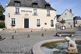
| Gemeentehuis | |||

| |||
| Gezicht op Écueillé | |||
| |||
Écueillé is een gemeente in het Franse departement Indre (regio Centre-Val de Loire). De plaats maakt deel uit van het arrondissement Châteauroux. Écueillé telde op 1 januari 2022 1.189[1] inwoners.
Geografie
De oppervlakte van Écueillé bedroeg op 1 januari 2022 34,9 vierkante kilometer; de bevolkingsdichtheid was toen 34,1 inwoners per km².

Verkeer en vervoer
In de gemeente ligt het gesloten spoorwegstation Écueillé.
Demografie
Onderstaande figuur toont het verloop van het inwonertal (bron: INSEE-tellingen).

Externe links
Zie de categorie Écueillé van Wikimedia Commons voor mediabestanden over dit onderwerp.