Richmond-Fremont Line
Kaart van het BART-netwerk op weekdagen en zaterdag overdag. De oranje lijn stelt de Richmond-Fremont Line voor. De Richmond-Fremont Line is een van de vijf metrolijnen van het Bay Area Rapid Transit -netwerk (BART) in de San Francisco Bay Area . De lijn gaat van Richmond in Contra Costa County naar Fremont in Alameda County en is daarmee de enige lijn die uitsluitend de regio East Bay aandoet en niet oversteekt naar San Francisco . De Richmond-Fremont-Line loopt door de steden El Cerrito , Berkeley , Oakland , San Leandro , Hayward en Union City en heeft in totaal 19 stations.
De metrolijn wordt steeds met oranje aangeduid, maar het is ongebruikelijk om BART-metrolijnen bij hun kaartkleur te noemen.
Het was de eerste BART-lijn met een regelmatige dienstregeling; ze opende op 11 september 1972. In 2014 werd begonnen om de lijn samen met de Fremont-Daly City Line vanaf Fremont naar het zuiden door te trekken tot Warm Springs. Deze verlenging kwam begin 2017 gereed en sindsdien wordt gewerkt aan een verdere verlenging tot San Jose .
Stations
Station
Overstappunt
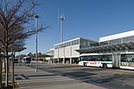
Foto *
Type
Geopend
Ligging
County
Richmond
350 ! maaiveld
19730129 ! 29 januari 1973
375612 ! 37° 56′ 13″ NB, 122° 21′ 11″ WL Contra Costa
El Cerrito del Norte
360 ! viaductstation
19730129 ! 29 januari 1973
375531 ! 37° 55′ 31″ NB, 122° 19′ 1″ WL Contra Costa
El Cerrito Plaza
370 ! viaductstation
19730129 ! 29 januari 1973
375410 ! 37° 54′ 10″ NB, 122° 17′ 56″ WL Contra Costa
North Berkeley
380 ! kuip
19730129 ! 29 januari 1973
375226 ! 37° 52′ 26″ NB, 122° 16′ 59″ WL Alameda
Downtown Berkeley
390 ! ondiep gelegen zuilenstation
19730129 ! 29 januari 1973
375242 ! 37° 52′ 11″ NB, 122° 16′ 5″ WL Alameda
Ashby
400 ! kuip
19730129 ! 29 januari 1973
375040 ! 37° 51′ 11″ NB, 122° 16′ 12″ WL Alameda
MacArthur
410 ! talud
19720911 ! 11 september 1972
375040 ! 37° 49′ 42″ NB, 122° 16′ 1″ WL Alameda
19th Street Oakland
420 ! ondiep gelegen zuilenstation
19720911 ! 11 september 1972
374828 ! 37° 48′ 28″ NB, 122° 16′ 8″ WL Alameda
12th Street/Oakland City Center
430 ! ondiep gelegen zuilenstation
19720911 ! 11 september 1972
374813 ! 37° 48′ 13″ NB, 122° 16′ 19″ WL Alameda
Lake Merrit
1250 ! ondiep gelegen zuilenstation
19720911 ! 11 september 1972
374752 ! 37° 47′ 52″ NB, 122° 16′ 1″ WL Alameda
Fruitvale
1260 ! viaductstation
19720911 ! 11 september 1972
374629 ! 37° 46′ 29″ NB, 122° 13′ 26″ WL Alameda
Oakland Coliseum
1270 ! viaductstation
19720911 ! 11 september 1972
374513 ! 37° 45′ 13″ NB, 122° 11′ 49″ WL Alameda
San Leandro
1280 ! viaductstation
19720911 ! 11 september 1972
374318 ! 37° 43′ 18″ NB, 122° 09′ 40″ WL Alameda
Bay Fair
1290 ! viaductstation
19720911 ! 11 september 1972
374149 ! 37° 41′ 49″ NB, 122° 07′ 37″ WL Alameda
Hayward
1300 ! viaductstation
19720911 ! 11 september 1972
374011 ! 37° 40′ 11″ NB, 122° 05′ 13″ WL Alameda
South Hayward
1310 ! maaiveld
19720911 ! 11 september 1972
373804 ! 37° 38′ 4″ NB, 122° 03′ 25″ WL Alameda
Union City
1320 ! talud
19720911 ! 11 september 1972
373527 ! 37° 35′ 27″ NB, 122° 01′ 2″ WL Alameda
Fremont
1330 ! talud
19720911 ! 11 september 1972
373327 ! 37° 33′ 27″ NB, 121° 58′ 37″ WL Alameda
Irvington
1340 !
maaiveld
20260000 ! verwacht 2026
374206 ! 37° 31′ 58″ NB, 121° 57′ 13″ WL Alameda
Warm Springs/South Fremont
1350 ! maaiveld
20170325 ! 25 maart 2017
373010 ! 37° 30′ 11″ NB, 121° 56′ 24″ WL Alameda
Milpitas
1360 ! uitgraving
20200613 ! 13 juni 2020
372437 ! 37° 24′ 37″ NB, 121° 53′ 28″ WL Santa Clara
Berryessa/North San José
1370 ! viaductstation
20200613 ! 13 juni 2020
372206 ! 37° 22′ 6″ NB, 121° 52′ 29″ WL Santa Clara
* De sorteerwaarde van de foto is de ligging langs de lijn
The article is a derivative under the Creative Commons Attribution-ShareAlike License .
A link to the original article can be found here and attribution parties here
By using this site, you agree to the Terms of Use . Gpedia ® is a registered trademark of the Cyberajah Pty Ltd