Chémery-les-Deux
| Chémery-les-Deux | |
|---|---|
|
| |
 | |
 | |
| Verwaltung | |
| Land |
|
| Region |
|
| Département | Moselle (57) |
| Arrondissement | Forbach-Boulay-Moselle |
| Kanton | Bouzonville |
| Kommunalverband | Bouzonvillois-Trois Frontières |
| Maire | Maurice Ochem (2014-2020)[1] |
| Code Insee |
57136 |
| Boschtlaitzahl |
57320 |
| Aiwohner | |
| Aiwohner | 592 |
| Flech | 10,03 km2 |
| Bevelkerungsdicht | 42,77 Iiw./km2 |
| Lach | |
| Koordinate | 49° 17′ 58″ N, 6° 26′ 38″ E / 49.299444444444°N,6.4438888888889°EKoordinate: 49° 17′ 58″ N, 6° 26′ 38″ E / 49.299444444444°N,6.4438888888889°E |
| Hech | 233 m |
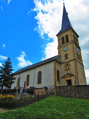
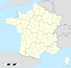
Chémery-les-Deux (daitsch Schemmerich) ìsch e franzesische Gemää im Département Moselle in de Rechion Grand Est (bis 2015 Rechion Lothringe).
D Gemää gheat zum Kanton Bouzonville im Arrondissement Forbach-Boulay-Moselle.
Verwaltung
De Maire vun Chémery-les-Deux isch de Maurice Ochem. Chémery-les-Deux gheat zum Kommunalvaband Bouzonvillois-Trois Frontières.
Bevelkerungsentwicklung
| Johr | 1968 | 1975 | 1982 | 1990 | 1999 | 2008 |
| Aiwohner | 310 | 317 | 405 | 395 | 381 | 444 |
Dialekt
De lothringisch Dialekt vun Chémery-les-Deux gheat zum Moselfränkisch.
Weblinks
Fußnote
- ↑ (franzesisch) Liste des maires au 25 avril 2014 (data.gouv.fr)
Alzing | Anzeling | Berviller-en-Moselle | Bibiche | Bouzonville | Brettnach | Château-Rouge | Chémery-les-Deux | Colmen | Creutzwald | Dalem | Dalstein | Ébersviller | Falck | Filstroff | Freistroff | Guerstling | Hargarten-aux-Mines | Heining-lès-Bouzonville | Hestroff | Menskirch | Merten | Neunkirchen-lès-Bouzonville | Oberdorff | Rémelfang | Rémering | Saint-François-Lacroix | Schwerdorff | Tromborn | Vaudreching | Villing | Vœlfling-lès-Bouzonville
