Anacostia River
| Anacostia River | |
|---|---|
 Anacostia River adjacent to the United States National Arboretum in Washington, D.C. | |
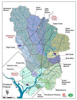 Map of the Anacostia River watershed | |
| Location | |
| Country | United States |
| State | Maryland and Washington, D.C. |
| Physical characteristics | |
| Source | |
| - location | Bladensburg, Maryland |
| - coordinates | 38°56′33″N 76°56′38″W / 38.94250°N 76.94389°W |
| Mouth | Potomac River |
| - location | Washington, D.C. |
| - coordinates | 38°51′13″N 77°01′13″W / 38.85361°N 77.02028°W |
| - elevation | −3 ft (−0.91 m)[1] |
| Length | 8.4 mi (13.5 km) |
| Basin size | 176 sq mi (460 km2) |
| Discharge | |
| - location | mouth |
| - average | 216.93 cu ft/s (6.143 m3/s) (estimate)[2] |
| Basin features | |
| Tributaries | |
| - left | Northeast Branch |
| - right | Northwest Branch |
The Anacostia River is a river in the Mid-Atlantic States of the United States. It flows from Prince George's County, Maryland, to Washington, D.C. The river is very polluted. Sewage water is dumped into the river.[3]
References
- ↑ U.S. Geological Survey Geographic Names Information System: Anacostia River
- ↑ United States Environmental Protection Agency. "Watershed Report: Anacostia River". WATERS GeoViewer. Archived from the original on 2021-07-09. Retrieved 2021-07-08.
- ↑ Murray, Rianna; Wilson, Sacoby (April 29, 2015). "Should We Put Our Feet in the Water? Use of a Survey to Assess Recreational Exposures to Contaminants in the Anacostia River". Environmental Health Insights. 9 (Suppl 2): 19–27. doi:10.4137/EHI.S19594. PMC 4476373. PMID 26124665.