Cleveland County, North Carolina
Cleveland County | |
|---|---|
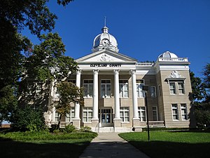 The west side of the old Cleveland County Courthouse, Shelby | |
| Motto(s): "Live, Work and Play in Cleveland County" | |
 Location within the U.S. state of North Carolina | |
 North Carolina's location within the U.S. | |
| Coordinates: 35°20′05″N 81°33′26″W / 35.33463°N 81.557114°W | |
| Country | |
| State | |
| Founded | 1841 |
| Named for | Benjamin Cleveland |
| Seat | Shelby |
| Largest community | Shelby |
| Area | |
| • Total | 468.18 sq mi (1,212.6 km2) |
| • Land | 464.25 sq mi (1,202.4 km2) |
| • Water | 3.93 sq mi (10.2 km2) 0.84% |
| Population (2020) | |
| • Total | 99,519 |
| • Density | 214.37/sq mi (82.77/km2) |
| Time zone | UTC−5 (Eastern) |
| • Summer (DST) | UTC−4 (EDT) |
| Congressional district | 10th |
| Website | www |
Cleveland County is a county on the southern border of the U.S. state of North Carolina. As of the 2020 census, the population was 99,519.[1] Its county seat is Shelby.[2]
History
The county was made in 1841 from parts of Lincoln and Rutherford counties.
Bordering counties
These counties are bordered to Cleveland County:
- Burke County – north
- Lincoln County – northeast
- Gaston County – east
- York County, South Carolina – southeast
- Cherokee County, South Carolina – south
- Rutherford County – west
Communities
These communities are in Cleveland County:
Cities
- Kings Mountain (small section is a part of Gaston County)
- Shelby
Towns
- Belwood
- Boiling Springs
- Casar
- Earl
- Fallston
- Grover
- Kingstown
- Lattimore
- Lawndale
- Mooresboro
- Patterson Springs
- Polkville
- Waco
Census-designated place
- Light Oak
References
- ↑ "QuickFacts: Cleveland County, North Carolina". United States Census Bureau. Retrieved January 17, 2024.
- ↑ National Association of Counties. "NACo County Explorer". Retrieved January 17, 2024.
Other websites
Wikimedia Commons has media related to Cleveland County, North Carolina.

