Comanche County, Oklahoma
Comanche County | |
|---|---|
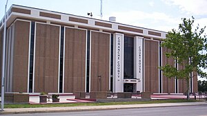
 Comanche County Courthouse | |
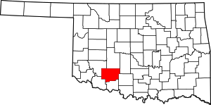
 Location within the U.S. state of Oklahoma | |
 Oklahoma's location within the U.S. | |
| Coordinates: 34°40′N 98°28′W / 34.66°N 98.46°W | |
| Country | |
| State | |
| Founded | July 8, 1901 |
| Seat | Lawton |
| Largest city | Lawton |
| Area | |
| • Total | 1,084 sq mi (2,810 km2) |
| • Land | 1,069 sq mi (2,770 km2) |
| • Water | 14 sq mi (40 km2) 1.3% |
| Population (2020) | |
| • Total | 121,125 |
| • Density | 110/sq mi (43/km2) |
| Time zone | UTC−6 (Central) |
| • Summer (DST) | UTC−5 (CDT) |
| Congressional district | 4th |
| Website | www |
Comanche County is a county in the U.S. state of Oklahoma. As of 2020, 121,125 people lived there.[1] Its county seat is Lawton.
Geography
The county has a total area of 1,064 square miles.
References
- ↑ "QuickFacts: Comanche County, Oklahoma". United States Census Bureau. Retrieved January 19, 2024.
