Dahme-Spreewald
Dahme-Spreewald | |
|---|---|
 | |
| Country | Germany |
| State | Brandenburg |
| Capital | Lübben (Spreewald) |
| Area | |
| • Total | 2,261 km2 (873 sq mi) |
| Population (31 December 2022)[1] | |
| • Total | 178,967 |
| • Density | 79/km2 (210/sq mi) |
| Time zone | UTC+01:00 (CET) |
| • Summer (DST) | UTC+02:00 (CEST) |
| Vehicle registration | LDS |
| Website | dahme-spreewald.de |
Dahme-Spreewald is a district in Brandenburg, Germany.
History
The Spreewald region has always been a centre of Sorbian culture.
When the state of Brandenburg was newly founded in 1990, the districts of Lübben, Luckau and Königs Wusterhausen were formed. In 1993 the three districts were merged.
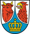
Coat of arms

|
The coat of arms displays:
|
Towns and municipalities
| Amt-free towns | Ämter | |
|---|---|---|
|
1. Golßener Land
2. Lieberose/Oberspreewald
|
3. Schenkenländchen
4. Unterspreewald
|
| 1seat of the Amt; 2town | ||
Other websites
- Official website Archived 2020-05-10 at the Wayback Machine (in German)
- Spreewald touristical website (in German)
- Spreewald Biosphere Reserve (in German)
Preview of references
- ↑ "Bevölkerungsentwicklung und Bevölkerungsstandim Land Brandenburg Dezember 2022" (PDF). Amt für Statistik Berlin-Brandenburg (in German). June 2023.

