Jackson County, Iowa
Jackson County | |
|---|---|
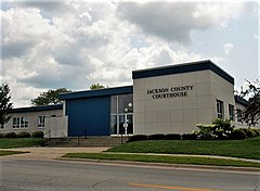 Jackson County Courthouse | |
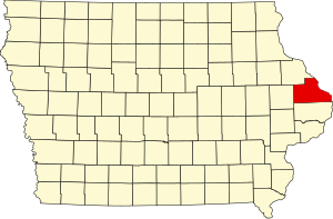 Location within the U.S. state of Iowa | |
 Iowa's location within the U.S. | |
| Coordinates: 42°10′13″N 90°34′30″W / 42.170277777778°N 90.575°W | |
| Country | |
| State | |
| Founded | December 21, 1837 |
| Named for | Andrew Jackson |
| Seat | Maquoketa |
| Largest city | Maquoketa |
| Area | |
| • Total | 650 sq mi (1,700 km2) |
| • Land | 584 sq mi (1,510 km2) |
| • Water | 69 sq mi (180 km2) 10.63% |
| Population | |
| • Total | 19,485 |
| • Density | 30/sq mi (12/km2) |
| Time zone | UTC−6 (Central) |
| • Summer (DST) | UTC−5 (CDT) |
| Website | jacksoncounty |
Jackson County is a county in the U.S. state of Iowa. As of the 2020 census, the population was 19,485.[1] The county seat is Maquoketa.[2] The county was founded on December 21, 1837 and named after U.S. President Andrew Jackson.[3]
Geography
The county has a total area of 650 square miles (1,700 km2).
Bordering counties
- Dubuque County (north)
- Jo Daviess County, Illinois (northeast)
- Carroll County, Illinois (east)
- Clinton County (south)
- Jones County (west)
Communities
Cities
Unincorporated communities
- Canton‡
- Cottonville
- Garryowen
- Green Island
- Nashville
- Otter Creek
- South Garry Owen
Ghost towns
- Alma
- Amoy
- America
- Bridgeport
- Brookfield
- Buckhorn
- Canton
- Carrollport
- Centerville
- Charleston
- Charkstown
- Cobb
- Coloma
- Copper Creek
- Cottonville
- Crabb
- Crabb's Mill
- Crabbtown
- Deventersville
- Duggan
- Duke
- Emeline
- Fremont
- Fulton
- Gordon's Ferry
- Hickory Grove
- Higginsport
- Hugo
- Hurstville
- Fairfield
- Farmers Creek
- Franklin
- Iron Hill
- East Iron Hills
- Isabel
- Lainsville
- Lowell
- Millrock
- Mount Algor
- Nashville
- New Castle
- New Rochester
- North Maquoketa
- Otter Creek
- Ozark
- Pass
- Prairie Springs
- Rolley
- Silsbee
- Smiths Ferry
- Springfield
- Spruce Mills
- Sterling
- Sullivan
- Summer Hill
- Sylva
- Tetes des Morts
- Union Center
- Van Buren
- Wagonersburgh
- Waterford
- Wickliffe
Townships
Jackson County is divided into 18 townships:
- Bellevue
- Brandon
- Butler
- Fairfield
- Farmers Creek
- Iowa
- Jackson
- Maquoketa
- Monmouth
- Otter Creek
- Perry
- Prairie Springs
- Richland
- South Fork
- Tete Des Morts
- Union
- Van Buren
- Washington
References
- ↑ 1.0 1.1 "QuickFacts: Jackson County, Iowa". United States Census Bureau. Retrieved August 9, 2023.
- ↑ "Find a County". National Association of Counties. Archived from the original on May 31, 2011. Retrieved 2011-06-07.
- ↑ Gannett, Henry (1905). The Origin of Certain Place Names in the United States. Govt. Print. Off. p. 167.
Other websites
Wikimedia Commons has media related to Jackson County, Iowa.
- Official Jackson County Government Website
- Jackson County Economic Development Council's website Archived 2005-11-24 at the Wayback Machine
- Jackson County Government Overview Webpages Archived 2005-11-24 at the Wayback Machine
- Jackson County Historical Society
| International | |
|---|---|
| National | |
| Other | |