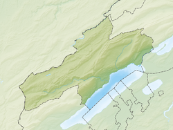
Marin-Epagnier
Marin-Epagnier | |
|---|---|
| Coordinates: 47°01′N 7°01′E / 47.017°N 7.017°E | |
| Country | Switzerland |
| Canton | Neuchâtel |
| District | Neuchâtel |
| Area | |
| • Total | 3.26 km2 (1.26 sq mi) |
| Elevation | 450 m (1,480 ft) |
| Population (December 2007) | |
| • Total | 4,087 |
| • Density | 1,300/km2 (3,200/sq mi) |
| Time zone | UTC+01:00 (Central European Time) |
| • Summer (DST) | UTC+02:00 (Central European Summer Time) |
| Postal code(s) | 2074 |
| SFOS number | 6457 |
| Surrounded by | Cudrefin (VD), Gampelen (BE), Ins (BE), Saint-Blaise, Thielle-Wavre |
| Website | www SFSO statistics |
Marin-Epagnier was a municipality in the district of Neuchâtel in the Swiss canton of Neuchâtel. In 1888, the formerly independent municipality merged with Epagnier and Marin to form Marin-Epagnier. On 1 January 2009, the former municipalities of Marin-Epagnier and Thielle-Wavre joined together and became the new municipality of La Tène.[1]
It lies at the northeastern tip of Lake Neuchâtel close to Biel, at the boundary between French- and German-speaking regions, and at a knot of highways.
The Iron Age archaeological site of La Tène is within Marin-Epagnier's communal boundaries. (See also La Tène culture.) La Tène is a village at the eastern end of the Lake Neuchâtel (Lac de Neuchâtel), a lake in Switzerland. La Tène has a sandy beach, unique in Switzerland.
References
- ↑ Amtliches Gemeindeverzeichnis der Schweiz published by the Swiss Federal Statistical Office (in German) accessed 14 January 2010
Other websites


