Muotathal
Muotathal | |
|---|---|
 | |
 Coat of arms | |
 Muotathal  Muotathal | |
| Coordinates: 46°58′N 8°45′E / 46.967°N 8.750°E | |
| Country | Switzerland |
| Canton | Schwyz |
| District | Schwyz |
| Area | |
| • Total | 172.15 km2 (66.47 sq mi) |
| Elevation (Church Muotathal) | 626 m (2,054 ft) |
| Population (31 December 2018)[2] | |
| • Total | 3,526 |
| • Density | 20/km2 (53/sq mi) |
| Demonym | German: Muotathaler/-in |
| Time zone | UTC+01:00 (Central European Time) |
| • Summer (DST) | UTC+02:00 (Central European Summer Time) |
| Postal code(s) | 6436 |
| SFOS number | 1367 |
| Localities | Muotathal, Ried, Schachen, Wil, Hinterthal, Chrüz, Pragel, Bisisthal, Glattalp, Toralp, Charetalp, Goldplangg |
| Surrounded by | Bürglen (UR), Glarus (GL), Glarus Süd (GL), Illgau, Innerthal, Morschach, Oberiberg, Riemenstalden, Spiringen (UR), Schwyz, Unteriberg, Unterschächen (UR) |
| Website | www SFSO statistics |
Muotathal is a village and a municipality in Schwyz District in the canton of Schwyz in Switzerland. The eponymous valley, the Muotatal, is formed by the Muota, which joins Lake Lucerne at Brunnen.
Geography


The village is in the valley of the river Muota, the Muotatal, with which it shares the name. The municipality is in a series of valleys on the eastern edge of the canton, on the borders with the cantons of Uri and Glarus. It is the 10th largest municipality by area in Switzerland.
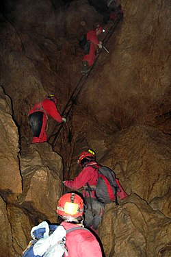
The municipality includes the entry site of the Hölloch, which at over 200 km is the longest cave in Switzerland, and the second-longest in Europe.
Localities
- Villages
- Muotathal
- Schachen
- Wil
- Hinterthal
- Bisisthal
- Hamlet
- Ried
- Alps
- Glattalp
- Toralp
- Charetalp
- Goldplangg
References
- ↑ 1.0 1.1 "Arealstatistik Standard - Gemeinden nach 4 Hauptbereichen". Federal Statistical Office. Retrieved 13 January 2019.
- ↑ "Ständige Wohnbevölkerung nach Staatsangehörigkeitskategorie Geschlecht und Gemeinde; Provisorische Jahresergebnisse; 2018". Federal Statistical Office. 9 April 2019. Retrieved 11 April 2019.
Other websites
![]() Media related to Muotathal at Wikimedia Commons
Media related to Muotathal at Wikimedia Commons
- Official website (in German)
- Muotathal in German, French and Italian in the online Historical Dictionary of Switzerland.