Saitama Prefecture
Saitama
埼玉県 | |
|---|---|
| Japanese transcription(s) | |
| • Romaji | Saitama-ken |
 Flag  Symbol | |
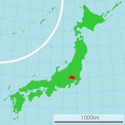 Location of Saitama in Japan | |
| Coordinates: 35°51′25″N 139°38′57″E / 35.85694°N 139.64917°E | |
| Country | |
| Region | Kantō |
| Island | Honshū |
| Capital | Saitama |
| ISO 3166 code | JP-11 |
| Website | www |
Saitama Prefecture (埼玉県, Saitama-ken) is a prefecture in the Kantō region of Japan on the island of Honshu.[1] The capital is the city of Saitama.[2]
History
Saitama Prefecture was formerly part of the old Musashi Province.[3]
Geography

Saitama is in the Kantō region. The prefecture shares borders with Chiba Prefecture, Ibaraki Prefecture, Gunma Prefecture, Nagano Prefecture, Tochigi Prefecture, Yamanashi Prefecture and Tokyo.
Cities
- Saitama
- Kawaguchi
- Hatogaya
- Shiki
- Kasukabe
- Soka
- Kumagaya
- Higashi-Matsuyama
- Gyoda
- Kuki
- Hasuda
- Okegawa
- Kounosu
- Ageo
- Toda
- Fujimi
- Kawagoe
National Parks
National Parks are established in about 33% of the total land area of the prefecture.[4]
Shrines and Temples
Hikawa jinja is the chief Shinto shrine (ichinomiya) in the prefecture. [5]
Friendship Cities
- Mexico Estado (2 Oct.1979)
- China Shanxi (27 Oct. 1982)
- Australia Queensland (27 Oct. 1984)
- United States of America Ohio (22 Oct. 1990)
- Deutschland Brandenburg (26 Aug. 1998)
Related pages
- Provinces of Japan
- Prefectures of Japan
- List of regions of Japan
- List of islands of Japan
- Urawa Red Diamonds
- Omiya Ardija
References
- ↑ Nussbaum, Louis-Frédéric. (2005). "Saitama prefecture" in Japan Encyclopedia, p. 808; "Kantō" at p. 479.
- ↑ Saitama City Profile, overview. Retrieved 2012-3-15.
- ↑ Nussbaum, "Provinces and prefectures" at p. 780.
- ↑ Japan Ministry of the Environment, "General overview of area figures for Natural Parks by prefecture". Retrieved 2012-3-13.
- ↑ "Nationwide List of Ichinomiya," p. 2 Archived 2013-05-17 at the Wayback Machine. Retrieved 2012-3-14.
Other websites
![]() Media related to Saitama prefecture at Wikimedia Commons
Media related to Saitama prefecture at Wikimedia Commons
