Sinai Peninsula
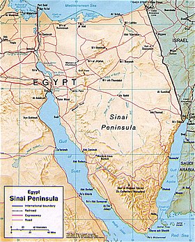
The Sinai Peninsula or Sinai (Arabic: سيناء Sīnā), is a triangular peninsula in Egypt. It is about 60,000 km2 (23,000 sq mi) in area. It is between the Mediterranean Sea to the north and the Red Sea to the south. It is the only part of Egyptian territory located in Asia. This is because the Sinai is known as a land bridge between the two continents of Africa and Asia. There are approximately 500,000 people living there. Egyptians refer to it as the "Land of Fayrouz", based on the Ancient Egyptian "Dumafkat".

There have been several battles in the region. The Sinai has been under the rule by Egyptian governments, including the Ayyubids, the Mamluks, the Muhammad Ali Dynasty, and the modern Egyptian republic. It was also controlled by the Ottoman Empire, and the United Kingdom from 1882 to 1956. Israel invaded and took over Sinai during the 1956 Suez Crisis (known in Egypt as the Tripartite Aggression) and during the 1967 Six Day War. On October 6, 1973, Egypt began the October War to allow the Sinai to be a free nation.
In 1982, after the Israel-Egypt Peace Treaty of 1979, Israel left Sinai. Since Israel's departure, the region became a tourist destination. This was because of its natural setting, their coral reefs, and biblical history. Mount Sinai is a sacred place in Abrahamic religion.
Other websites
- Guide to Sinai, covering background information on history, flora, fauna, desert, bedouin, safaris and geology of Sinai
- Sinai Local Magazine Archived 2021-06-10 at the Wayback Machine
- Sinai in ancient Egypt
- Broadcasting videos from Sinai Archived 2008-03-13 at the Wayback Machine
- Images of the Sinai Desert Archived 2012-03-07 at the Wayback Machine
Books
- Gardner, Ann "At Home in South Sinai" Nomadic Peoples 2000. Vol. 4,Iss. 2; pp. 48–67. Detailed account of Bedouin women
- H. J. L. Beadnell (May 1926). "Central Sinai". Geographical Journal. 67 (5): 385–398. doi:10.2307/1782203. JSTOR 1782203.
- C. W. Wilson (1873). "Recent Surveys in Sinai and Palestine". Journal of the Royal Geographical Society of London. 43: 206–240. doi:10.2307/1798627. JSTOR 1798627.
- Teague, Matthew; Moyer, Matt (March 2009). "The Sinai's Separate Peace". National Geographic Magazine. Washington, DC: National Geographic Society. 215 (3): 99–121. ISSN 0027-9358. Archived from the original on December 11, 2009. Retrieved January 7, 2010.
29°30′N 33°50′E / 29.500°N 33.833°E
| International | |
|---|---|
| National | |
| Other | |